Aeta, Agta and Dumagat, are collective terms for several indigenous Filipinos who live in various parts of Luzon island in the Philippines. They are also known as the "Philippines Negrito"; and they are included in the wider Negrito grouping of Southeast Asia, with whom they share superficial common physical characteristics such as: dark skin tones; short statures; frizzy to curly-hair; and a higher frequency of naturally lighter hair colour (blondism) relative to the general population. They are thought to be among the earliest inhabitants of the Philippines — preceding the Austronesian migrations. Regardless, the modern Aeta populations have significant Austronesian admixture, and speak Austronesian languages.
Young Aeta girl from Mariveles, Bataan, in 1901
An Aeta man in Santa Ana, Pampanga
Aetas as illustrated in Carta Hydrographica y Chorographica de las Yslas Filipinas, 1734. The caption in Spanish describes them as "wild men of the mountains".
The genetic relationship of Philippines Negritos (Aeta, Agta): (A) Neighbor-joining tree constructed from Nei’s standard genetic distance. (B) Maximum-likelihood tree generated using Treemix. This tree shows that following the split from Europeans, the Papuans/Melanesians, split from Andamanese, Malaysian, and Philippine Negritos, which all appear basal to other Southeast and East Asian populations, in that branching order.
Filipinos are citizens or people identified with the country of the Philippines. The majority of Filipinos today are predominantly Catholic and come from various Austronesian peoples, all typically speaking Filipino, English, or other Philippine languages. Despite formerly being subject to Spanish colonialism, only around 2–4% of Filipinos are fluent in Spanish. Currently, there are more than 185 ethnolinguistic groups in the Philippines each with its own language, identity, culture, tradition, and history.
The Negritos are descendants of one of the earliest groups of modern humans to reach the Philippines
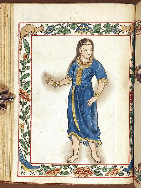
Binukot from Visayas, c. 1590 Boxer Codex
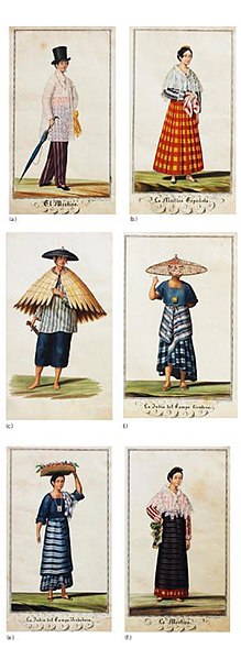
Tipos del País works by Justiniano Asuncion
Economic Life in Spanish Colonial Philippines, with Native and Sangley Chinese traders