Agua Dulce, California
Videos
Agua Dulce is a census-designated place in Los Angeles County, California, United States. It lies at an elevation of 2,526 feet (770 m), northeast of Santa Clarita. The community had a population of 3,342 at the 2010 census and covers a geographic area of about 23 square miles (59 km2). Agua Dulce is on the Pacific Crest Trail. The ZIP code is 91390, and the area code is 661.

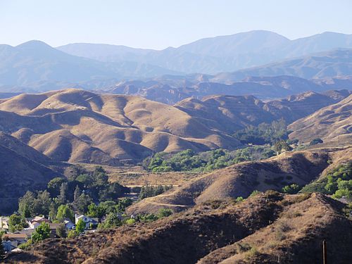
Agua Dulce as seen from Vasquez Rocks

Vasquez Rocks
Sierra Pelona Ridge
Videos
The Sierra Pelona, also known as the Sierra Pelona Ridge or the Sierra Pelona Mountains, is a mountain ridge in the Transverse Ranges in Southern California. Located in northwest Los Angeles County, the ridge is bordered on the north by the San Andreas fault and lies within and is surrounded by the Angeles National Forest.
View from Santa Clarita

Aerial view of the Sierra Pelona Mountains and San Andreas Fault

Burnt Peak is the tallest mountain in the Sierra Pelona Mountains.