Agulhas Plateau
Videos
Photos
The Agulhas Plateau is an oceanic plateau located in the south-western Indian Ocean about 500 km (310 mi) south of South Africa. It is a remainder of a large igneous province (LIP), the Southeast African LIP, that formed 140 to 95 million years ago (Ma) at or near the triple junction where Gondwana broke-up into Antarctica, South America, and Africa. The plateau formed 100 to 94 Ma together with Northeast Georgia Rise and Maud Rise when the region passed over the Bouvet hotspot.

The Agulhas Plateau is limited by the Agulhas Passage to the north; by the Agulhas Basin to the west; and by the Transkei Basin to the north-east.
Indian Ocean
Videos
Photos
The Indian Ocean is the third-largest of the world's five oceanic divisions, covering 70,560,000 km2 (27,240,000 sq mi) or approx. 20% of the water on Earth's surface. It is bounded by Asia to the north, Africa to the west and Australia to the east. To the south it is bounded by the Southern Ocean, or Antarctica, depending on the definition in use. Along its core, the Indian Ocean has large marginal, or regional seas, such as the Andaman Sea, the Arabian Sea, the Bay of Bengal, and the Laccadive Sea.

The ocean-floor of the Indian Ocean is divided by spreading ridges and crisscrossed by aseismic structures

A composite satellite image centred on the Indian Ocean

During summer, warm continental masses draw moist air from the Indian Ocean hence producing heavy rainfall. The process is reversed during winter, resulting in dry conditions.
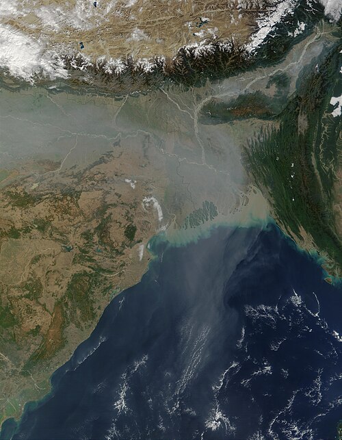
Air pollution in South Asia spread over the Bay of Bengal and beyond.