Amadalavalasa is a town in Srikakulam district of the Indian state of Andhra Pradesh. It is a municipality and also the mandal headquarters of Amadalavalasa mandal. The town is spread over an area of 19.65 km2 (7.59 sq mi), which is under the jurisdiction of Visakhapatnam Metropolitan Region Development Authority. Srikakulam Road railway station is situated at Amadalavalasa.
Megalithic Dolmen (said to be world's large single capstone as a dolmen with 36 ft in length and 14 ft in width and 2 ft thickness) of early Iron Age at Dannanapeta near Amadalavalsa
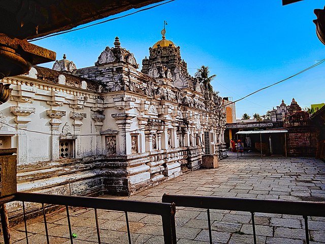
Danthapuri remnants
Prehistoric Rock shelters at Chittivalasa village near Amudalavalasa
Srikakulam Road Railway Station, Amadalavalasa Town
Srikakulam district is one of the twenty-six districts of the Indian state of Andhra Pradesh, located in the Uttarandhra region of the state, with its headquarters located at Srikakulam. It is one of the six districts, located in the extreme northeastern direction of the state. It was formerly known as Chicacole, and was under Ganjam district till 1936 April 1, then merged under Vizagapatam district. Srikakulam district forms the core area of Kalinga where most of its historical capitals like Kalinganagari, pithunda, Dantapuram are located.
Image: 700 CE Mukhalingeswara Temples Group, Kalinga architecture, Mukhalingam, Andhra Pradesh 84
Image: 2nd century BCE to 8th century CE Salihundam Buddhist site, Andhra Pradesh 54
Image: Ancient Buddhist site, Kalingapatnam Andhra Pradesh 12
Image: 11th century Kurmanatha Swamy Temple, Srikurmam Andhra Pradesh 02