Aramoana is a small coastal settlement 27 kilometres (17 mi) north of Dunedin on the South Island of New Zealand. The settlement's permanent population in the 2001 Census was 261. Supplementing this are seasonal visitors from the city who occupy cribs. The name Aramoana is Māori for "pathway of the sea".
Looking east across the mouth of Otago Harbour; Aramoana settlement to the lower right
Aerial view to the east across the entrance to Otago Harbour, Aramoana is just below the centre of the picture, with the mudflats and mole clearly visible.
Endangered New Zealand sea lions resting at the end of Aramoana spit, the site of the Aramoana Pilot's Wharf.
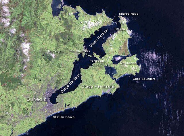
Otago Harbour is the natural harbour of Dunedin, New Zealand, consisting of a long, much-indented stretch of generally navigable water separating the Otago Peninsula from the mainland. They join at its southwest end, 21 km (13 mi) from the harbour mouth. It is home to Dunedin's two port facilities, Port Chalmers and at Dunedin's wharf. The harbour has been of significant economic importance for approximately 700 years, as a sheltered harbour and fishery, then deep water port.
Otago Harbour
NASA satellite photo of Otago Harbour and Peninsula.
Otago Harbour mouth.
Otakou, the centre of fishing and trade on the harbour for centuries.