The Arcadia quadrangle is one of a series of 30 quadrangle maps of Mars used by the United States Geological Survey (USGS) Astrogeology Research Program. The quadrangle is located in the north-central portion of Mars’ western hemisphere and covers 240° to 300° east longitude and 30° to 65° north latitude. The quadrangle uses a Lambert conformal conic projection at a nominal scale of 1:5,000,000 (1:5M). The Arcadia quadrangle is also referred to as MC-3. The name comes from a mountainous region in southern Greece. It was adopted by IAU, in 1958.
Image of the Arcadia quadrangle (MC-3). The southern part contains the large shield volcano Alba Patera and the highly faulted Tempe Terra province, which includes many small volcanoes.
Graben near Alba Patera, as seen by THEMIS. Graben and catenae, collapse features, both caused by faults. When the crust is stretched, faults form and material falls into voids created by the stretching. Uranius Tholus (upper) and Ceraunius Tholus (largest) volcanoes are visible in wide context view, below and to the right of Alba Patera.
Forces from different directions caused this complex of grabens to form. Picture taken by THEMIS.
Mareotis Fossae Region, as seen by HiRISE
Tempe Terra is a heavily cratered highland region in the northern hemisphere of the planet Mars. Located at the northeastern edge of the Tharsis volcanic province, Tempe Terra is notable for its high degree of crustal fracturing and deformation. The region also contains many small shield volcanoes, lava flows, and other volcanic structures.
Hanging valley, as seen by HiRISE under HiWish program This may have been a waterfall at one time.
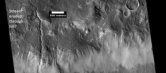
Channels, as seen by HiRISE under HiWish program. Stream appears to have eroded through a hill.
Stream meander and cutoff, as seen by HiRISE under HiWish program.
A variety of gullies originating at different levels are visible in this HiRISE image that was taken under the HiWish program.