Atherton Tableland
Videos
Photos
The Atherton Tableland is a fertile plateau, which is part of the Great Dividing Range in Queensland, Australia. It has very deep, rich basaltic soils and the main industry is agriculture. The principal river flowing across the plateau is the Barron River, which was dammed to form the irrigation reservoir named Lake Tinaroo. Unlike many other rural areas, the Tablelands is experiencing a significant growth in population.

View over the Atherton Tableland from McHugh Lookout

Atherton Tablelands, 2006
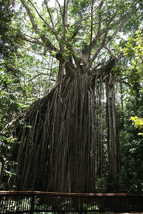
Curtain Fig Tree, Atherton Tableland

Country road to the Cathedral Fig Tree in the Atherton Tablelands
Great Dividing Range
Videos
Photos
The Great Dividing Range, also known as the East Australian Cordillera or the Eastern Highlands, is a cordillera system in eastern Australia consisting of an expansive collection of mountain ranges, plateaus and rolling hills. It runs roughly parallel to the east coast of Australia and forms the fifth-longest land-based mountain chain in the world, and the longest entirely within a single country. It is mainland Australia's most substantial topographic feature and serves as the definitive watershed for the river systems in eastern Australia, hence the name.

Great Dividing Range

The Great Dividing Range consists of a complex of mountain ranges, plateaus, upland areas and escarpments.

The Monaro Plains (top right) are drier than the verdant western upslopes (bottom left) as they lie in a rain shadow. (View of the Snowy Mountains region)

Great Dividing Range sign on the Kings Highway between Braidwood and Bungendore, New South Wales