Auckland waterfront
Videos
The Auckland waterfront is a city-side stretch of the southern Waitematā Harbour coastline in Auckland, New Zealand. Previously mostly dominated by Ports of Auckland uses, from the 2000s on it is beco

The Auckland waterfront.

The Auckland waterfront in 1912, with steam ferries at the ferry quay.

Shipbuilding and other marine companies abound on the Western Reclamation, next to industrial uses.
Auckland CBD
Videos
The Auckland Central Business District, or Auckland city centre, is the geographical and economic heart of the Auckland metropolitan area. It is the area in which Auckland was established in 1840, by
Auckland waterfront
…east. However, in most usage, 'Auckland waterfront' only refers to those parts freely accessible to the public (such as around the Viaduct Basin and the Auckland CBD), and thus at the moment excludes much of the Western Reclamation and almost the whole of the Ports of Auckland area to the east. While Auckland City…

Auckland CBD as seen from Mount Victoria, Devonport, 2026

The Auckland waterfront with Māori waka and the original St Paul's Church building above Point Britomart, painted in 1852.

The Dilworth Building, one of the few remaining stately older buildings along Queen Street
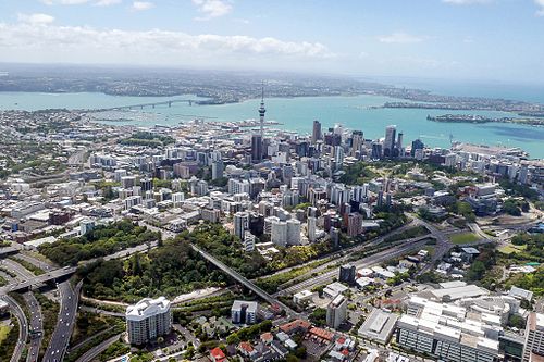
Aerial view of the CBD, CMJ is just to the left and the very bottom