Beaver Lake is a man-made reservoir in the Ozark Mountains of Northwest Arkansas and is formed by a dam across the White River. Beaver Lake has some 487 miles (784 km) of shoreline. With towering limestone bluffs, natural caves, and a wide variety of trees and flowering shrubs, it is a popular tourist destination. Beaver Lake is the source of drinking water in Northwest Arkansas, which is managed, treated and sold by Beaver Water District, serving more than 450,000 customers. One out of 7 people in Arkansas get their drinking water from Beaver Lake.
Beaver Lake (Arkansas)
Beaver Dam and its spillway and powerhouse.
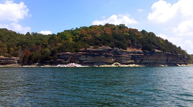
View of Beaver Lake as seen from Prairie Creek, Arkansas.
The Ozarks, also known as the Ozark Mountains, Ozark Highlands or Ozark Plateau, is a physiographic region in the U.S. states of Missouri, Arkansas, Oklahoma and the extreme southeastern corner of Kansas. The Ozarks cover a significant portion of northern Arkansas and most of the southern half of Missouri, extending from Interstate 40 in central Arkansas to Interstate 70 in central Missouri.
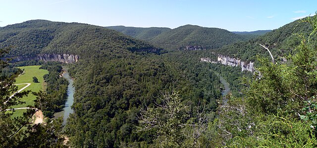
View of the Ozarks from the Buffalo National River, Newton County, Arkansas
Image: Ozark Overview
A rural Ozarks scene. Phelps County, Missouri
The Saint Francois Mountains, viewed here from Knob Lick Mountain, are the exposed geologic core of the Ozarks.