Bighorn Basin
Videos
The Bighorn Basin is a plateau region and intermontane basin, approximately 100 miles (160 km) wide, in north-central Wyoming in the United States. It is bounded by the Absaroka Range on the west, the Pryor Mountains on the north, the Bighorn Mountains on the east, and the Owl Creek Mountains and Bridger Mountains on the south. It is drained to the north by tributaries of the Bighorn River, which enters the basin from the south, through a gap between the Owl Creek and Bridger Mountains, as the Wind River, and becomes the Bighorn as it enters the basin. The region is semi-arid, receiving only 6–10 in (15–25 cm) of rain annually.

Folds and geological structures of the northern Bighorn Basin. Astronaut photo from ISS, 2021.

Power lines crossing the Bighorn Basin's plains
Cody, Wyoming
Videos
Cody is a city in and the county seat of Park County, Wyoming, United States. It is named after Buffalo Bill Cody for his part in the founding of Cody in 1896.

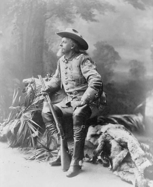
Buffalo Bill Cody, 1903

Near Cody, Wyoming

Buffalo Bill - The Scout statue by Gertrude Vanderbilt Whitney commemorates Buffalo Bill