The Black Rock Desert is a semi-arid region of lava beds and playa, or alkali flats, situated in the Black Rock Desert–High Rock Canyon Emigrant Trails National Conservation Area, a silt playa 100 miles (160 km) north of Reno, Nevada that encompasses more than 300,000 acres (120,000 ha) of land and contains more than 120 miles (200 km) of historic trails. It is in the northern Nevada section of the Great Basin with a lakebed that is a dry remnant of Pleistocene Lake Lahontan.
Black Rock Point with mirage
Calico Hills, Humboldt County, Nevada
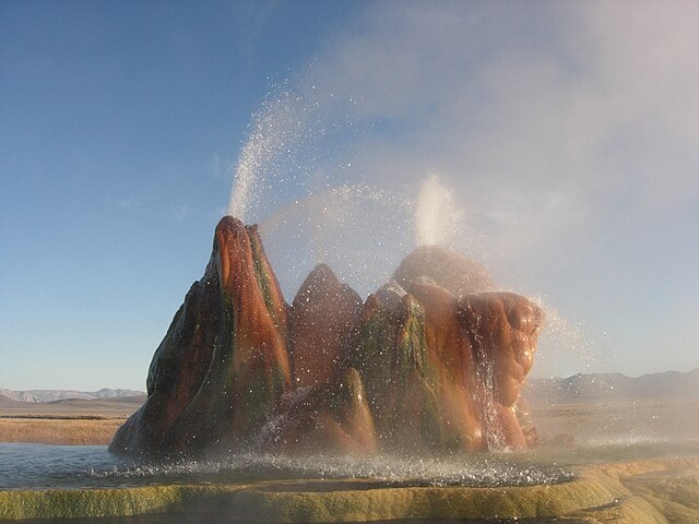
The continuous Fly Geyser of Fly Ranch is on private land and began in 1916 when water well drilling accidentally penetrated a geothermal source.
CSXT Space Shot, May 17, 2004
The Great Basin Desert is part of the Great Basin between the Sierra Nevada and the Wasatch Range. The desert is a geographical region that largely overlaps the Great Basin shrub steppe defined by the World Wildlife Fund, and the Central Basin and Range ecoregion defined by the U.S. Environmental Protection Agency and United States Geological Survey. It is a temperate desert with hot, dry summers and snowy winters. The desert spans large portions of Nevada and Utah, and extends into eastern California. The desert is one of the four biologically defined deserts in North America, in addition to the Mojave, Sonoran, and Chihuahuan Deserts.
Central Basin and Range from space (central-west Nevada region, view due-south)
Valley bottom at Ash Meadows National Wildlife Refuge
Sagebrush in the Virgin Mountains, Nevada
Pinyon-Juniper woodland in Elko County, Nevada


