The Bolaven Plateau is an elevated region in southern Laos. Most of the plateau is located within Champasak Province of Laos, though the edges of the plateau are also located in Salavan, Sekong and Attapeu Provinces. It is located between the Annamite Range, along which runs Laos' eastern border with Vietnam, and the Mekong River to the west, at about 15°N 106°E. The plateau's elevation ranges approximately from 1,000 to 1,350 metres above sea level. The plateau is crossed by several rivers and has many scenic waterfalls. The name Bolaven makes reference to the Laven ethnic group which has historically dominated the region. However, domestic migrations by the Lao ethnic group has resulted in widespread interethnic marriage, thus modifying the ethnic composition of the region.
Tad Fane waterfall, situated in the Bolaven Plateau. The water drops about 120 m.
Tad Lo, Bolaven Plateau, Laos
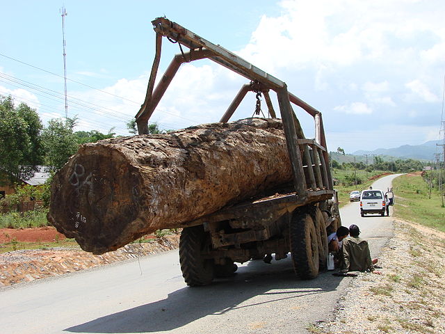
Logging truck on the Bolaven Plateau, southern Laos. June 2009
Coffee processing on the Bolaven Plateau
Laos, officially the Lao People's Democratic Republic, is the only landlocked country in Southeast Asia. At the heart of the Indochinese Peninsula, Laos is bordered by Myanmar and China to the northwest, Vietnam to the east, Cambodia to the southeast, and Thailand to the west and southwest. Its capital and largest city is Vientiane.
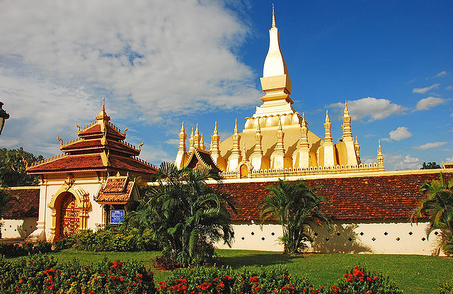
Pha That Luang in Vientiane is the national symbol of Laos.
Fa Ngum, founder of the Lan Xang Kingdom
Ruins of Muang Khoun, former capital of Xiangkhouang province, destroyed by the American bombing of Laos in the late 1960s
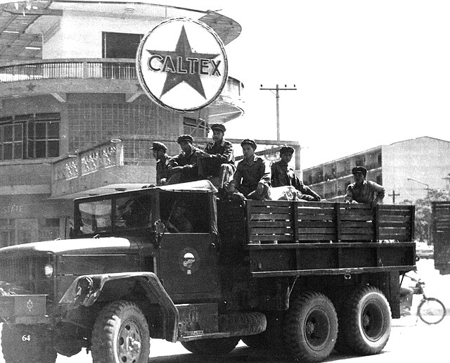
Pathet Lao soldiers in Vientiane, 1972