Bosporus
Videos
The Bosporus or Bosphorus Strait is a natural strait and an internationally significant waterway located in Istanbul, Turkey. The Bosporus connects the Black Sea to the Sea of Marmara and forms one of the continental boundaries between Asia and Europe. It also divides Turkey by separating Anatolia from Thrace. It is the world's narrowest strait used for international navigation.
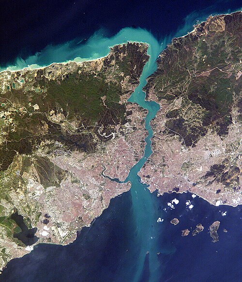
Aerial view of the Bosporus taken from its northern end near the Black Sea (bottom), looking south (top) toward the Marmara Sea, with the city center of Istanbul visible along the strait's hilly banks

The Bosphorus, with the Castles of Europe & Asia. 19th-century engraving by Thomas Allom. The castles are Rumelihisarı and Anadoluhisarı, respectively. The original is a watercolor available in the online collection of the Victoria and Albert Museum.

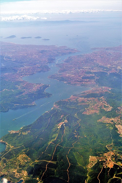
Modern (2012) view of the European side of Istanbul from the southern entrance to the Bosporus
International waters
Videos
The terms international waters or transboundary waters apply where any of the following types of bodies of water transcend international boundaries: oceans, large marine ecosystems, enclosed or semi-enclosed regional seas and estuaries, rivers, lakes, groundwater systems (aquifers), and wetlands.

Komárno in Slovakia is an inland port on the Danube River which is an important international waterway.
The Atlantic Ocean has the busiest ocean trade routes in the world.