Camboglanna was a Roman fort. It was the twelfth fort on Hadrian's Wall counting from the east, between Banna (Birdoswald) almost 7 miles (11 km) to the east and Uxelodunum (Stanwix), 9 miles to the west. It was on a high bluff commanding the Cambeck Valley. It guarded an important approach to the Wall and also watched the east bank of the Cambeck against raiders from the Bewcastle area. The site was drastically levelled in 1791 when the gardens of Castlesteads House were laid over it. The name "Camboglanna" is believed to mean "Crook Bank", or "Bent Valley" because it overlooks a bend in the river Irthing; the name is Brythonic, made of cambo- "curved, bent, crooked" and glanna "steep bank, stream/river side, valley with a stream".
Camboglanna Lidar image
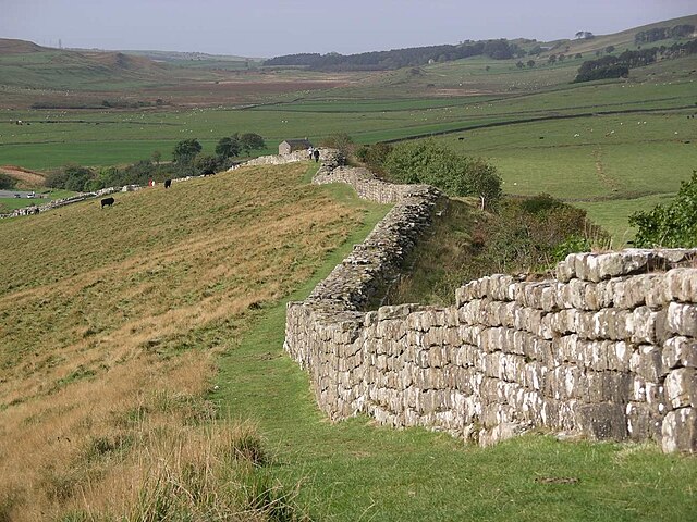
Hadrian's Wall is a former defensive fortification of the Roman province of Britannia, begun in AD 122 in the reign of the Emperor Hadrian. Running from Wallsend on the River Tyne in the east to Bowness-on-Solway in the west of what is now northern England, it was a stone wall with large ditches in front of it and behind it that crossed the whole width of the island. Soldiers were garrisoned along the line of the wall in large forts, smaller milecastles, and intervening turrets. In addition to the wall's defensive military role, its gates may have been customs posts.
A view of Hadrian's Wall showing its length and height. The upright stones on top of it are modern, to deter people from walking on it.
Sections of Hadrian's Wall still remain, particularly in its hilly central sector. Little remains in lowland regions, where it was used as a source of stone for new buildings.
Hadrian's Wall facing east towards Crag Lough. The rocky outcrop is the Whin Sill, of volcanic origin.
Bronze head of Hadrian, who commissioned the wall's construction, found in 1834 in the River Thames in London, around 280 miles (450 km) south of Hadrian's Wall