The Caribbean Plate is a mostly oceanic tectonic plate underlying Central America and the Caribbean Sea off the northern coast of South America.
Bathymetry of the northeast corner of the Caribbean Plate showing the major faults and plate boundaries; view looking south-west. The main bathymetric features of this area include: the Lesser Antilles Volcanic Arc; the old inactive volcanic arc of the Greater Antilles (Virgin Islands, Puerto Rico, and Hispaniola); the Muertos Trough; and the Puerto Rico Trench formed at the plate boundary zone between the Caribbean and obliquely subducting North American Plates. Vertical exaggeration is 5:1.
Plate tectonics is the scientific theory that Earth's lithosphere comprises a number of large tectonic plates, which have been slowly moving since about 3.4 billion years ago. The model builds on the concept of continental drift, an idea developed during the first decades of the 20th century. Plate tectonics came to be accepted by geoscientists after seafloor spreading was validated in the mid-to-late 1960s.
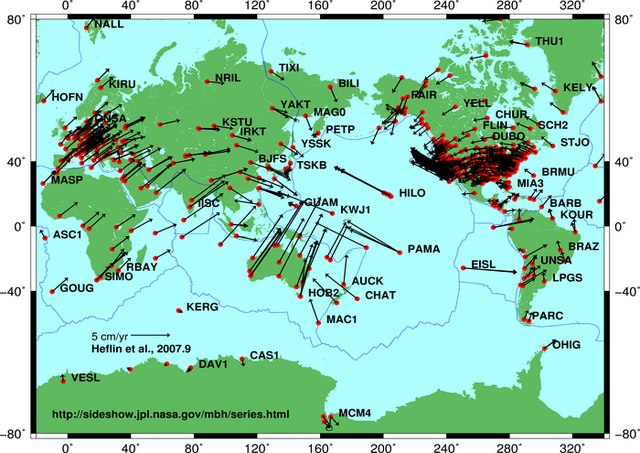
Plate motion based on Global Positioning System (GPS) satellite data from NASA JPL. Each red dot is a measuring point and vectors show direction and magnitude of motion.
Alfred Wegener in Greenland in the winter of 1912–13.


