Charles Morse Stotz
Videos
Charles Morse Stotz was an American architect, architectural historian, and preservationist. He is known for his extensive study of the architectural history of Pittsburgh and Western Pennsylvania. He

Fort Pitt (Pennsylvania)
Videos
Fort Pitt was a fort built by British forces between 1759 and 1761 during the French and Indian War at the confluence of the Monongahela and Allegheny rivers, where the Ohio River is formed in western

A Plan of the New Fort at Pitts-Burgh drawn by cartographer John Rocque in 1765

Artist's interpretation of Fort Pitt in 1759 with the Allegheny (left) and Monongahela (right) rivers. At their confluence is the Ohio River, seen at the bottom.
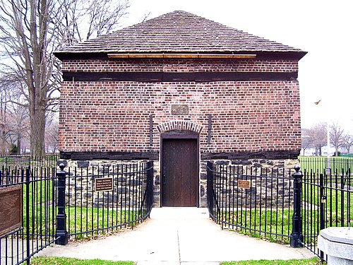
Fort Pitt Blockhouse, constructed in 1764

A view of the Fort Pitt Museum from Mount Washington; its structure is a recreation of a bastion of Ft. Pitt.