The Clarence River is a river situated in the Northern Rivers district of New South Wales, Australia. It rises on the eastern slopes of the Great Dividing Range, in the Border Ranges west of Bonalbo, near Rivertree at the junction of Koreelah Creek and Maryland River, on the watershed that marks the border between New South Wales and Queensland. It flows generally south, south east and north east, and is joined by twenty-four tributaries including Tooloom Creek and the Mann, Nymboida, Cataract, Orara, Coldstream, Timbarra, and Esk rivers. It descends 256 metres (840 ft) over the course of its 394-kilometre (245 mi) length and empties into the Coral Sea in the South Pacific Ocean, between Iluka and Yamba.

The Grafton Bridge across the Clarence River.

The Bruxner Highway crossing the Clarence River at Tabulam.

The Grafton Bridge over the Clarence River showing Bascule span lifted to let shipping through. (Postcard from about 1932; The "Southern Cross" aeroplane has been added to the photograph.)

The Clarence River, as it flows past Susan Island Nature Reserve, near Grafton.
Tabulam
Videos
Tabulam is a rural village in the far north-east of New South Wales, Australia, 800 kilometres from the state capital, Sydney. Tabulam is located on the Bruxner Highway between Tenterfield and Casino and on the Clarence River. According to the 2016 census, there were 470 people living in Tabulam. The main village is administered by Kyogle Council, while the section of Tabulam west of the Clarence River is part of Tenterfield Shire.
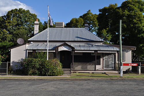
Tabulam Post Office, Court Street