The Columbia Mountains are a group of mountain ranges along the Upper Columbia River in British Columbia, Montana, Idaho and Washington. The mountain range covers 135,952 km². The range is bounded by the Rocky Mountain Trench on the east, and the Kootenai River on the south; their western boundary is the edge of the Interior Plateau. Seventy-five percent of the range is located in Canada and the remaining twenty-five percent in the United States; American geographic classifications place the Columbia Mountains as part of the Rocky Mountains complex, but this designation does not apply in Canada. Mount Sir Sandford is the highest mountain in the range, reaching 3,519 metres (11,545 ft).
Mount Sir Sandford from the Gothics Glacier
Monashee Mountains, on the right of Kinbasket Lake. The Monashees are a major subrange of Columbia Mountains.
Rogers Pass
Valhalla Provincial Park
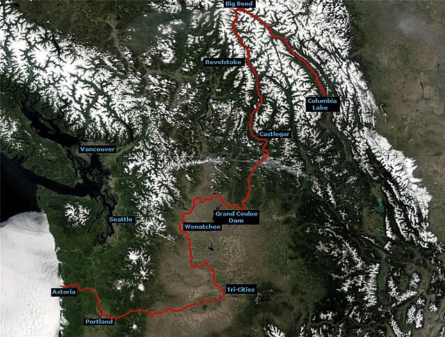
The Columbia River is the largest river in the Pacific Northwest region of North America. The river forms in the Rocky Mountains of British Columbia, Canada. It flows northwest and then south into the U.S. state of Washington, then turns west to form most of the border between Washington and the state of Oregon before emptying into the Pacific Ocean. The river is 1,243 miles long, and its largest tributary is the Snake River. Its drainage basin is roughly the size of France and extends into seven states of the United States and one Canadian province. The fourth-largest river in the United States by volume, the Columbia has the greatest flow of any river entering the Pacific outside of Asia, and the 36th greatest discharge of any river in the world.
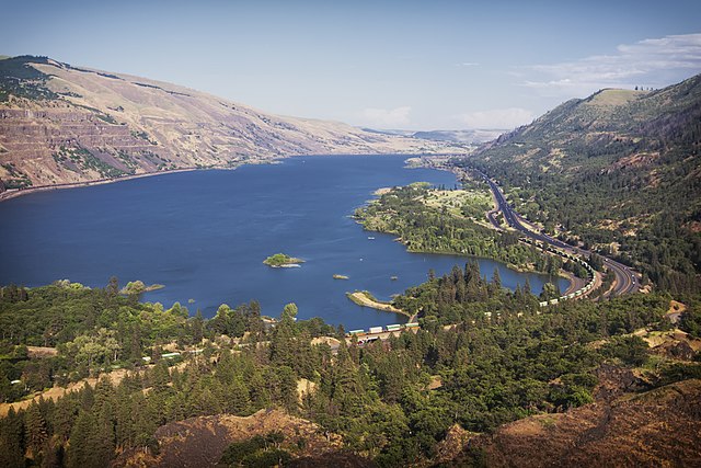
Columbia River from Rowena Crest with Interstate 84 on the right
Course of the Columbia River
The Columbia River Gorge facing east toward Beacon Rock
Drumheller Channels, part of the Channeled Scablands formed by the Missoula Floods


