Continental Divide of the Americas
The Continental Divide of the Americas is the principal, and largely mountainous, hydrological divide of the Americas. The Continental Divide extends from the Bering Strait to the Strait of Magellan, and separates the watersheds that drain into the Pacific Ocean from those river systems that drain into the Atlantic and Arctic Ocean, including those that drain into the Gulf of Mexico, the Caribbean Sea, and Hudson Bay.
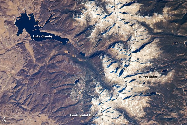
The Continental Divide in the Front Range of the Rocky Mountains of north central Colorado, taken from the International Space Station in October 2008
Grays Peak, at 4,352 m (14,278 ft), is the highest point of the Continental Divide in North America.
The Parting of the Waters in the Teton Wilderness, where one fork flows into the Pacific Ocean and the other flows into the Atlantic Ocean
The Continental Divide Trail often remains above the treeline and on the Divide, providing unobstructed views along its route.
A drainage divide, water divide, ridgeline, watershed, water parting or height of land is elevated terrain that separates neighboring drainage basins. On rugged land, the divide lies along topographical ridges, and may be in the form of a single range of hills or mountains, known as a dividing range. On flat terrain, especially where the ground is marshy, the divide may be difficult to discern.
A minor drainage divide south of Buckeye, Arizona. Both branches flow to the Gila River.


