Coria was a fort and town 2.5 miles (4.0 km) south of Hadrian's Wall, in the Roman province of Britannia. It was strategically located on the junction of a major Roman north–south road with the River Tyne and the Roman Stanegate road, which was also the first frontier line which ran east–west between Coria and Luguvalium. Corbridge Roman Site is in the village of Corbridge in the county of Northumberland.
Ruins of Corbridge’s Roman granaries
The Stanegate, Corbridge Roman Site
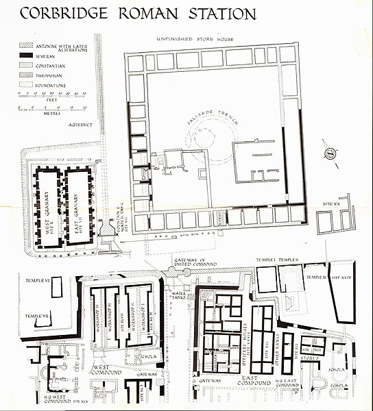
Plan of Coria showing the various stages of building; the twin granaries are at left
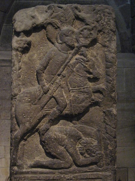
Tombstone of Flavinus, a Roman Standard Bearer, on display in Hexham Abbey, where it was found reused
Hadrian's Wall is a former defensive fortification of the Roman province of Britannia, begun in AD 122 in the reign of the Emperor Hadrian. Running from Wallsend on the River Tyne in the east to Bowness-on-Solway in the west of what is now northern England, it was a stone wall with large ditches in front of it and behind it that crossed the whole width of the island. Soldiers were garrisoned along the line of the wall in large forts, smaller milecastles, and intervening turrets. In addition to the wall's defensive military role, its gates may have been customs posts.
A view of Hadrian's Wall showing its length and height. The upright stones on top of it are modern, to deter people from walking on it.
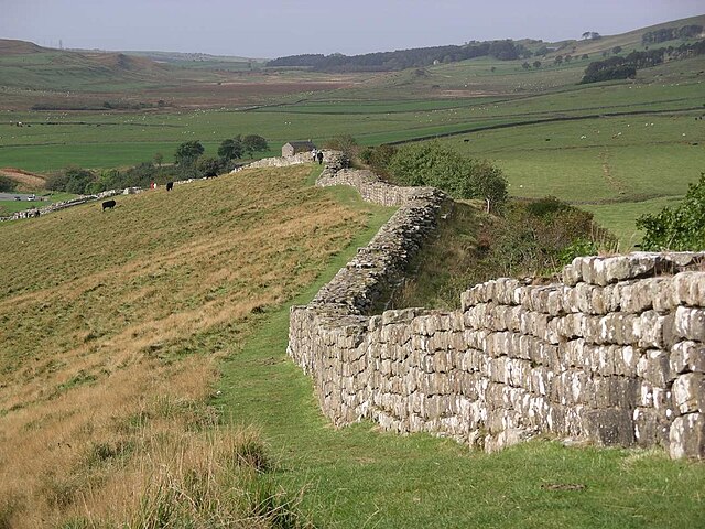
Sections of Hadrian's Wall still remain, particularly in its hilly central sector. Little remains in lowland regions, where it was used as a source of stone for new buildings.
Hadrian's Wall facing east towards Crag Lough. The rocky outcrop is the Whin Sill, of volcanic origin.
Bronze head of Hadrian, who commissioned the wall's construction, found in 1834 in the River Thames in London, around 280 miles (450 km) south of Hadrian's Wall