The Crooked River is a tributary, 125 miles (201 km) long, of the Deschutes River in the U.S. state of Oregon. The river begins at the confluence of the South Fork Crooked River and Beaver Creek. Of the two tributaries, the South Fork Crooked River is the larger and is sometimes considered part of the Crooked River proper. A variant name of the South Fork Crooked River is simply "Crooked River". The Deschutes River flows north into the Columbia River.
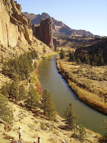
The Crooked River in Smith Rock State Park
Upper river near Post
Lower Crooked Wild and Scenic River Recreation Area
Crooked River Railroad Bridge spanning the canyon at Peter Skene Ogden State Scenic Viewpoint along U.S. Route 97
The Deschutes River in central Oregon is a major tributary of the Columbia River. The river provides much of the drainage on the eastern side of the Cascade Range in Oregon, gathering many of the tributaries that descend from the drier, eastern flank of the mountains. The Deschutes provided an important route to and from the Columbia for Native Americans for thousands of years, and then in the 19th century for pioneers on the Oregon Trail. The river flows mostly through rugged and arid country, and its valley provides a cultural heart for central Oregon. Today the river supplies water for irrigation and is popular in the summer for whitewater rafting and fishing.
The Deschutes River near its mouth on the Columbia. Pioneers camped on the bluff to the left.
The river as it passes Sunriver, near Benham Falls
The Deschutes in winter at its confluence with the Columbia