The Deschutes River in central Oregon is a major tributary of the Columbia River. The river provides much of the drainage on the eastern side of the Cascade Range in Oregon, gathering many of the tributaries that descend from the drier, eastern flank of the mountains. The Deschutes provided an important route to and from the Columbia for Native Americans for thousands of years, and then in the 19th century for pioneers on the Oregon Trail. The river flows mostly through rugged and arid country, and its valley provides a cultural heart for central Oregon. Today the river supplies water for irrigation and is popular in the summer for whitewater rafting and fishing.
The Deschutes River near its mouth on the Columbia. Pioneers camped on the bluff to the left.
The river as it passes Sunriver, near Benham Falls
The Deschutes in winter at its confluence with the Columbia
Oregon is a state in the Pacific Northwest region of the United States. Oregon is a part of the Western United States, with the Columbia River delineating much of Oregon's northern boundary with Washington, while the Snake River delineates much of its eastern boundary with Idaho. The 42° north parallel delineates the southern boundary with California and Nevada. The western boundary is formed by the Pacific Ocean.
Oregon border welcome sign at Denio, Nevada
Paul Shoaway of the Umatilla tribe, 1899
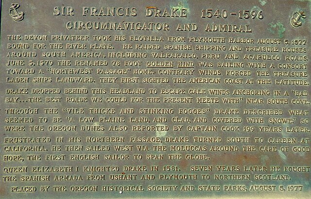
Monument near Coos Bay, Oregon, of Francis Drake's first North American Encounter. Plaque by Oregon State Parks and Oregon Historical Society.
Fort Astoria, as established by John Jacob Astor in 1813