Denali Highway is a lightly traveled, mostly gravel highway in the U.S. state of Alaska. It leads from Paxson on the Richardson Highway to Cantwell on the Parks Highway. Opened in 1957, it was the first road access to Denali National Park. Since 1971, primary park access has been via the Parks Highway, which incorporated a section of the Denali Highway from Cantwell to the present-day park entrance. The Denali Highway is 135 miles (217 km) in length.
The Denali Highway as seen in summer.
White Spruce taiga along the Denali Highway, with the Alaska Mountain Range in the Background
At 4,086 feet (1,245 m), MacClaren summit is the highest point on the highway.
Portions of the road are built directly on top of glacial eskers.
The Richardson Highway is a highway in the U.S. state of Alaska, running 368 miles (562 km) and connecting Valdez to Fairbanks. It is marked as Alaska Route 4 from Valdez to Delta Junction and as Alaska Route 2 from there to Fairbanks. It also connects segments of Alaska Route 1 between the Glenn Highway and the Tok Cut-Off. The Richardson Highway was the first major road built in Alaska.
The "first car" to travel from Valdez to Eagle, 1913
Interchange with the Fairbanks end of Badger Road, a loop road serving suburban parts of the North Pole area. The interchange was constructed in the early 2000s, after an approximately three-decade history of serious accidents at the previous at-grade intersection.
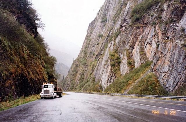
The highway in Keystone Canyon, just north of Valdez
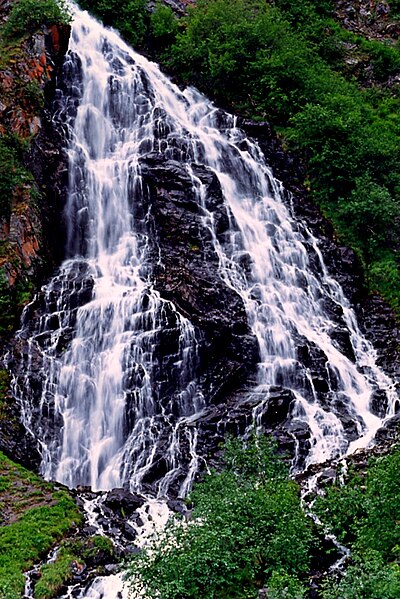
Horsetail falls, one of many waterfalls visible as the highway traverses Keystone Canyon