Detroit River
Videos
The Detroit River flows west and south for 24 nautical miles from Lake St. Clair to Lake Erie as a strait in the Great Lakes system. The river divides the metropolitan areas of Detroit, Michigan, and Windsor, Ontario—an area collectively referred to as Detroit–Windsor—and forms part of the border between Canada and the United States. The Ambassador Bridge, the Detroit–Windsor Tunnel, and the Michigan Central Railway Tunnel connect the cities.

Southern end as it enters Lake Erie with Canada in the foreground and the U.S. in the background
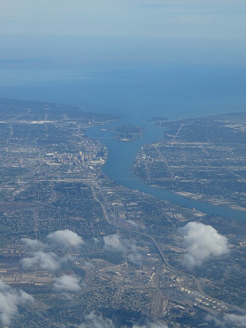
Aerial view of the Detroit River looking north
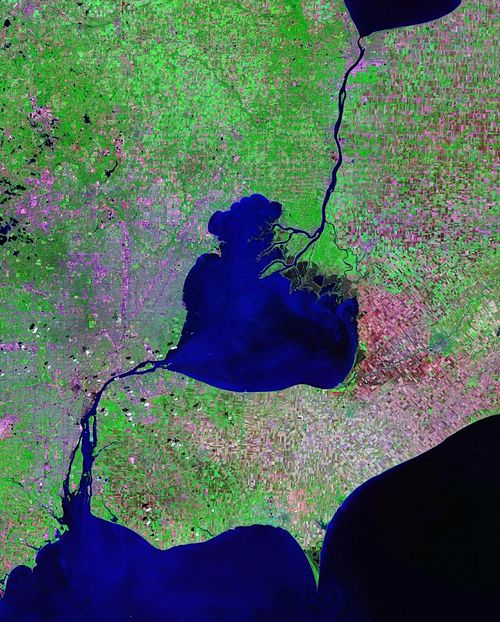
Satellite photo showing Lake Saint Clair (center) with the Detroit River connecting it to Lake Erie (to the south) and the St. Clair River connecting it to Lake Huron (to the north).

Aerial view of a classification yard and two train ferries, 1943
Ontario
Videos
Ontario is the southernmost province of Canada. Located in Central Canada, Ontario is the country's most populous province. As of the 2021 Canadian census, it is home to 38.5 percent of the country's population, and is the second-largest province by total area. Ontario is Canada's fourth-largest jurisdiction in total area of all the Canadian provinces and territories. It is home to the nation's capital, Ottawa, and its most populous city, Toronto, which is Ontario's provincial capital.

Typical landscape of the Canadian Shield at Queen Elizabeth II Wildlands Provincial Park, located in Central Ontario.

Cold northwesterly wind over the Great Lakes creating lake-effect snow. Lake-effect snow most frequently occurs in the snowbelt regions of the province.

A monument in Hamilton commemorating the United Empire Loyalists, a group of settlers who fled the United States during or after the American Revolution

Depiction of the Battle of Queenston Heights, during the War of 1812. Upper Canada was an active theatre of operation during the conflict.