Doggerland
Videos
Page
Doggerland was an area of land in Northern Europe, now submerged beneath the North Sea, that connected Britain to continental Europe. It was repeatedly exposed at various times during the Pleistocene epoch due to the lowering of sea levels during glacial periods. It was last flooded by rising sea levels around 6500–6200 BCE. The flooded land is known as the Dogger Littoral. Geological surveys have suggested that it stretched from what is now the east coast of Great Britain to what is now the Netherlands, the western coast of Germany and the Danish peninsula of Jutland. It was probably a rich habitat with human habitation in the Mesolithic period, although rising sea levels gradually reduced it to low-lying islands before its final submergence, possibly following a tsunami caused by the Storegga Slide. Doggerland was named after the Dogger Bank, which in turn was named after 17th-century Dutch fishing boats called doggers.
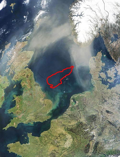
The red line marks Dogger Bank, which is most likely a moraine formed in the Pleistocene.

A Woolly mammoth skull discovered by fishermen in the North Sea, at the Celtic and Prehistoric Museum, Ireland
North Sea
Videos
Page
The North Sea lies between Great Britain, Denmark, Norway, Germany, the Netherlands, Belgium and France. An epeiric sea on the European continental shelf, it connects to the Atlantic Ocean through the English Channel in the south and the Norwegian Sea in the north. It is more than 970 kilometres (600 mi) long and 580 kilometres (360 mi) wide, covering 570,000 square kilometres (220,000 sq mi).

North Sea

The German North Sea coast

The Afsluitdijk (Closure-dike) is a major dam in the Netherlands

Zuid-Beveland, North Sea flood of 1953