Drainage system (geomorphology)
In geomorphology, drainage systems, also known as river systems, are the patterns formed by the streams, rivers, and lakes in a particular drainage basin. They are governed by the topography of land, whether a particular region is dominated by hard or soft rocks, and the gradient of the land. Geomorphologists and hydrologists often view streams as part of drainage basins. This is the topographic region from which a stream receives runoff, throughflow, and its saturated equivalent, groundwater flow. The number, size, and shape of the drainage basins varies and the larger and more detailed the topographic map, the more information is available.
Dendritic drainage: the Yarlung Tsangpo River, Tibet, seen from space: snow cover has melted in the valley system.
Dendritic drainage patterns
Parallel drainage pattern
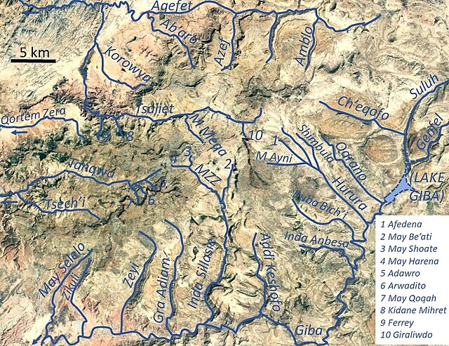
The radial drainage network of Dogu’a Tembien in Ethiopia
Geomorphology is the scientific study of the origin and evolution of topographic and bathymetric features generated by physical, chemical or biological processes operating at or near Earth's surface. Geomorphologists seek to understand why landscapes look the way they do, to understand landform and terrain history and dynamics and to predict changes through a combination of field observations, physical experiments and numerical modeling. Geomorphologists work within disciplines such as physical geography, geology, geodesy, engineering geology, archaeology, climatology, and geotechnical engineering. This broad base of interests contributes to many research styles and interests within the field.
Badlands incised into shale at the foot of the North Caineville Plateau, Utah, within the pass carved by the Fremont River and known as the Blue Gate. GK Gilbert studied the landscapes of this area in great detail, forming the observational foundation for many of his studies on geomorphology.
Surface of Earth, showing higher elevations in red.
Waves and water chemistry lead to structural failure in exposed rocks
"Cono de Arita" at the dry lake Salar de Arizaro on the Atacama Plateau, in northwestern Argentina. The cone itself is a volcanic edifice, representing complex interaction of intrusive igneous rocks with the surrounding salt.


