Edwards Plateau
Videos
The Edwards Plateau is a geographic region forming the crossroads of Central, South, and West Texas, United States. It is named in honor of Haden Edwards. It is bounded by the Balcones Fault to the so

Edwards Plateau terrain as seen from US 277 between Del Rio and Sonora

Enchanted Rock near Fredericksburg by Hermann Lungkwitz, 1864, oil on canvas

San Saba River near Sloan, San Saba County (9 May 2014)

Wildflowers on ranchland, State Highway 965, Llano County (13 April 2012)
Llano Estacado
Videos
The Llano Estacado, sometimes translated into English as the Staked Plains, is a region in the Southwestern United States encompassing parts of eastern New Mexico and northwestern Texas. One of the la
Edwards Plateau
…West Texas, United States. It is named in honor of Haden Edwards. It is bounded by the Balcones Fault to the south and east; the Llano Uplift and the Llano Estacado to the north; and the Pecos River and Chihuahuan Desert to the west. San Angelo, Austin, San Antonio, and Del Rio roughly outline the area. The plateau…
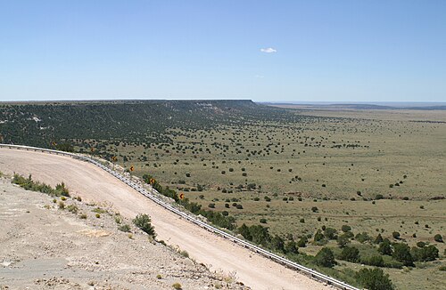
Northwest escarpment of the Llano Estacado

Shaded relief image of the Llano Estacado. The escarpments marking the eastern edge of the Llano are visible, running roughly in a north–south line through the middle of the Panhandle. The western edge is on the New Mexico side of the border, with the Texas–New Mexico border running considerably closer to the western edge of the Llano than to the eastern.

The northern edge of the Llano Estacado in New Mexico

Lubbock, Texas, the largest city on the Llano