Fiordland
Videos
Photos
Fiordland is a geographical region of New Zealand in the south-western corner of the South Island, comprising the westernmost third of Southland. Most of Fiordland is dominated by the steep sides of the snow-capped Southern Alps, deep lakes, and its steep, glacier-carved and now ocean-flooded western valleys. The name "Fiordland" comes from a variant spelling of the Scandinavian word for this type of steep valley, "fjord". The area of Fiordland is dominated by, and very roughly coterminous with, Fiordland National Park, New Zealand's largest National Park.

Fiordland's landscape is characterised by deep fiords along the coast...

...and U-shaped valleys carved by glaciers

Fraser Beach on the eastern shore of Lake Manapouri

Mountains reach over 2500m in the northern parts of Fiordland
New Zealand
Videos
Photos
New Zealand is an island country in the southwestern Pacific Ocean. It consists of two main landmasses—the North Island and the South Island —and over 700 smaller islands. It is the sixth-largest island country by area and lies east of Australia across the Tasman Sea and south of the islands of New Caledonia, Fiji, and Tonga. The country's varied topography and sharp mountain peaks, including the Southern Alps, owe much to tectonic uplift and volcanic eruptions. New Zealand's capital city is Wellington, and its most populous city is Auckland.
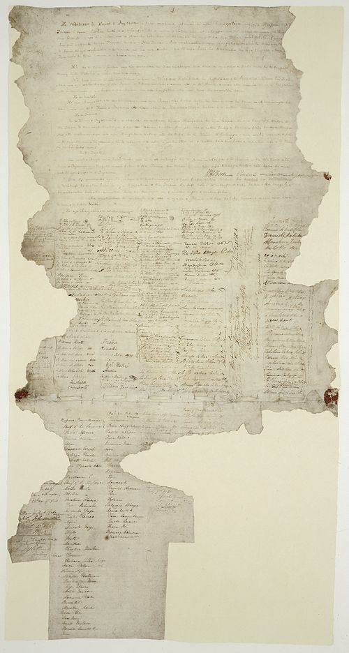
The Waitangi sheet from the Treaty of Waitangi

A meeting of European and Māori residents of Hawke's Bay Province. Engraving, 1863.
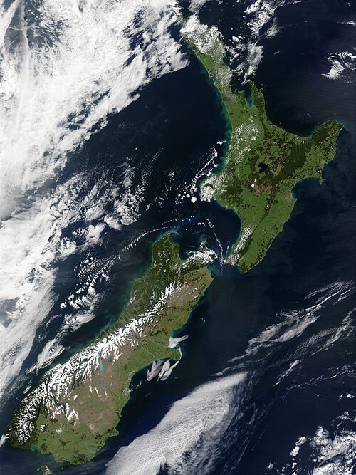
The snow-capped Southern Alps dominate the South Island, while the North Island's Northland Peninsula stretches towards the subtropics.

Aoraki / Mount Cook is the highest point in New Zealand, at 3,724 metres.