Fort Hall Indian Reservation
The Fort Hall Reservation is a Native American reservation of the federally recognized Shoshone-Bannock Tribes in the U.S. state of Idaho. This is one of five federally recognized tribes in the state. The reservation is located in southeastern Idaho on the Snake River Plain about 20 miles (32 km) north and west of Pocatello. It comprises 814.874 sq mi (2,110.51 km2) of land area in four counties: Bingham, Power, Bannock, and Caribou. To the east is the 60-mile-long (97 km) Portneuf Range; both Mount Putnam and South Putnam Mountain are located on the Fort Hall Reservation.
Translator George LaVatta and Chief Tendoi at the Fort Hall Reservation circa 1923
Houses in the town of Fort Hall, with Mount Putnam in the background
Grain elevator on the Fort Hall Indian Reservation
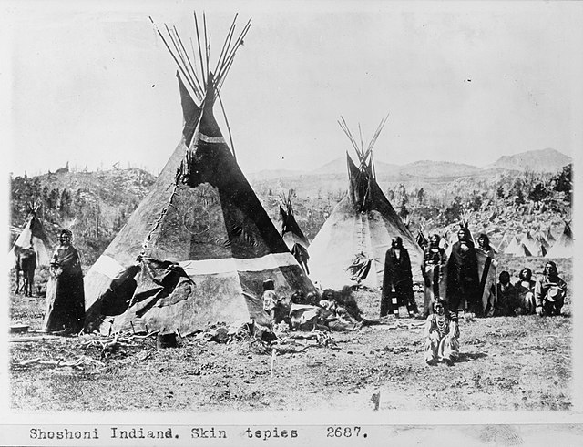
The Shoshone or Shoshoni are a Native American tribe with four large cultural/linguistic divisions:Eastern Shoshone: Wyoming
Northern Shoshone: southern Idaho
Western Shoshone: Nevada, northern Utah
Goshute: western Utah, eastern Nevada
Rabbit-Tail or Moragootch (information varies).
A Shoshone encampment in the Wind River Mountains of Wyoming, photographed by W. H. Jackson, 1870
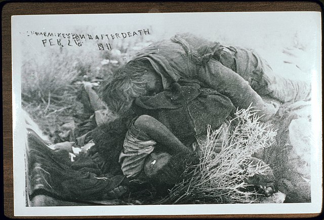
Reported picture of Mike Daggett February 26, 1911
Sheriff Charles Ferrel with the surviving members of Mike Daggett's family (Daggett's daughter Heney (Louise, 17), and two of his grandchildren, Cleveland (Mosho, 8), and Hattie (Harriet Mosho, 4))