Texarkana metropolitan area
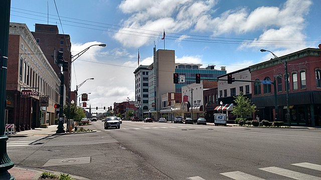
The Texarkana metropolitan statistical area, as defined by the United States Office of Management and Budget, is a two-county region anchored by the twin cities of Texarkana and Texarkana, encompassing the surrounding communities in Bowie County and Miller County, Arkansas. As of the 2016 census, the MSA had a population of 150,098. Texarkana is a subset of the broader Ark-La-Tex region. Texarkana was founded in 1873 on the junction of two railroads; the name is a portmanteau of TEXas, ARKansas, nearby LouisiANA. One tradition tells of a Red River steamboat named The Texarkana, c. 1860. Another story mentions a storekeeper named Swindle in Red Land, Louisiana who concocted a drink called "Texarkana Bitters". A third account states that a railroad surveyor, coined the name. Local lore suggests that, before Texas's annexation by the US, lawlessness ruled in the area that at times was claimed by various nations. In 1876, Texas, was granted a charter under an act of the Texas legislature, a Texarkana, post office operated from 1886 to 1892.
Congressman Morris Sheppard secured a postal order changing the name to "Texarkana, Arkansas-Texas". The Texarkana metropolitan area was first defined in 1960. Known as the Texarkana, TX–Texarkana, AR Standard Metropolitan Statistical Area, it consisted of Bowie County and Miller County, Arkansas. In 1963, the area was renamed the Texarkana, TX–AR Standard Metropolitan Statistical Area, only to return to its original name in 1971. Little River County, was added to the SMSA in 1973. In 1983, the official name was shortened to the Texarkana, TX–Texarkana, AR Metropolitan Statistical Area, still in use; that same year, Little River County was removed from the MSA. The two-county MSA had a population of 137,486 in 2000; as of the census of 2000, there were 137,486 people, 72,695 households, 55,524 families residing within the MSA. The racial makeup of the MSA was 53.5% White, 43.3% African American, 0.6% Native American, 0.4% Asian, <0.1% Pacific Islander, 0.9% from other races, 1.2% from two or more races.
Hispanic or Latino of any race were 3.6% of the population. The median income for a household in the MSA was $31,976, the median income for a family was $38,887. Males had a median income of $32,482 versus $21,408 for females; the per capita income for the MSA was $16,901. Texarkana began as a railroad and lumber center, developed in the 20th century as a regional agricultural processing, retail and service center. Red River Army Depot and Lone Star Army Ammunition Plant were the largest regional employers from the 1940s through the 1970s. Paper mills near Ashdown and Atlanta, as well as other industrial facilities, brought new jobs to the area in the 1970s. Today the Texarkana area is a diversified economy whose pattern of employment categorized by industry is similar to the entire state of Arkansas. Texarkana consists of two separate municipal designations: Texarkana, the county seat of Miller County, Arkansas Texarkana, located in Bowie County, TexasState Line Avenue follows the Texas-Arkansas state line throughout much of Texarkana.
The two "sides" of Texarkana are separate only from a political standpoint. Thousands of locals live in one state and work in the other. Owing to its divided political nature, Texarkana has two sets of city officials. Texarkana is located at the intersection of Interstate 30 and Interstate 49, it is situated halfway between Dallas and Little Rock, Arkansas. Texarkana Regional Airport is located inside the northeastern city limits and is included in the National Plan of Integrated Airport Systems for 2011–2015, which categorized it as a primary commercial service airport; the airport covers an area of 964 acres at an elevation of 390 feet above mean sea level and it has two runways with asphalt surfaces: Runway 4/22 is 6,601 by 144 feet Runway 13/31 is 5,200 by 100 feet Major routes in Texarkana include: Interstate 30 Interstate 49 U. S. Route 59 U. S. Route 67 U. S. Route 71 U. S. Route 82 Loop As of October 2015, new interchanges had been completed at the junctions of I-30/US 59, I-30/I-49. Interstate 49 had been extended south to Shreveport with its northern extension planned into Kansas City along the U.
S. Route 71 corridor. Multiple projects were under construction to relieve the strain on local roadways, including continuous access roads and the expansion of area highways and bridges. Rail service in Texarkana is provided by: Amtrak's Texas Eagle, which stops at Texarkana Union Station Kansas City Southern Railway Texas Northeastern Railroad Union Pacific Railroad Notable historical buildings in Texarkana include the post office and federal building that straddle the state line, the Ace of Clubs House, The Perot Theater, Texarkana Regional Museum; the Aces of Clubs House is shaped like a club on a playing card and inspired by a winning poker hand. The Texarkana Symphony Orchestra was established in 2005, providing the community with several professional concerts of classical music every year. In 2007, the Texarkana Youth Symphony Orchestra was established, presenting spring and winter concerts. Texarkana College, a community college whose origins date to 1927, enrolls more than four thousand annually.
In 1971, East Texas State University began offering classes at the campus, an institution that became Texas A&M University–Texarkana. Texas A&M University-Texarkana has constructed a large campus at Bringle Lake. His
Ozarks
The Ozarks called the Ozark Mountains or Ozark Plateau, is a physiographic region in the U. S. states of Missouri, Arkansas and extreme southeastern Kansas. The Ozarks cover a significant portion of northern Arkansas and most of the southern half of Missouri, extending from Interstate 40 in Arkansas to the Interstate 70 in central Missouri. There are two mountain ranges within the Ozarks: the Boston Mountains of Arkansas and the St. Francois Mountains of Missouri. Buffalo Lookout, the highest point in the Ozarks, is located in the Boston Mountains. Geologically, the area is a broad dome with the exposed core in the ancient St. Francois Mountains, some of the oldest rocks in North America; the Ozarks cover nearly 47,000 square miles, making it the most extensive highland region between the Appalachians and Rockies. Together with the Ouachita Mountains, the area is known as the U. S. Interior Highlands; the Salem Plateau, named after Salem, makes up the largest geologic area of the Ozarks. The second largest is the Springfield Plateau, named after Springfield, nicknamed the “Queen City of the Ozarks”.
On the northern Ozark border are the cities of Columbia, Missouri. Significant cities in Arkansas include Fayetteville. Near the Missouri-Arkansas border is Branson, Missouri, a tourist destination and popularizer of Ozark culture. Ozarks is a toponym believed to be derived as an English-language adaptation of the French abbreviation aux Arcs. In the decades prior to the French and Indian War, aux Arkansas referred to the trading post at Arkansas Post, located in wooded Arkansas Delta lowland area above the confluence of the Arkansas River with the Mississippi River. "Arkansas" seems to be the French version of what the Illinois tribe called the Quapaw, who lived in eastern Arkansas in the area of the trading post. The term came to refer to all Ozark Plateau drainage into the Arkansas and Missouri Rivers. An alternative origin for the name "Ozark" relates. In the 17th and early 18th centuries, French cartographers mapped the Arkansas and Mississippi Rivers; the large, top most arc or bend in this part of the Arkansas River was referred to as being aux arcs—the top or northernmost arc in the whole of the lower Arkansas.
Travelers arriving by boat would disembark at this top bend of the river to explore the Ozarks. Other possible derivations include aux arcs meaning " of the arches," in reference to the dozens of natural bridges formed by erosion and collapsed caves in the Ozark region; these include Clifty Hollow Natural Bridge in Missouri, Alum Cove in the Ozark – St. Francis National Forest, it is suggested aux arcs is an abbreviation of aux arcs-en-ciel, French for "toward the rainbows," which are a common sight in the mountainous regions. After the Louisiana Purchase in 1803, American travelers in the region referred to various features of the upland areas using the term Ozark, such as Ozark Mountains and Ozark forests. By the early 20th century, the Ozarks had become a generic and used term; the Ozarks consist of five physiographic subregions: the Boston Mountains of north Arkansas and Cookson Hills of east Oklahoma. Karst features such as springs, losing streams and caves are common in the limestones of the Springfield Plateau and abundant in the dolostone bedrock of the Salem Plateau and Boston Mountains.
Missouri is known as "The Cave State" with over 6000 recorded caves. The Ozark Plateaus aquifer system affects groundwater movement in all areas except the igneous core of the St. Francois Mountains. Geographic features include limestone and dolomite glades, which are rocky, desert-like area on hilltops. Kept open by periodic fires that limit growth of grasses and forbs in shallow soil, glades are home to collared lizards, scorpions and other species more typical of the desert southwest; the Boston Mountains contain the highest elevations of the Ozarks with peaks over 2,500 feet and form some of the greatest relief of any formation between the Appalachian and Rocky Mountains. The Ouachita Mountains to the south rise a few hundred feet higher, but are not geographically associated with the Ozarks; the Boston Mountains portion of the Ozarks extends north of the Arkansas River Valley 20 to 35 miles and is 200 miles and are bordered by the Springfield and Salem Plateau to the north of the White River.
Summits can reach elevations of just over 2,560 feet with valleys 500 to 1,550 feet deep. Turner Ward Knob is the highest named peak. Located in western Newton County, its elevation is 2,463 feet. Nearby, five unnamed peaks have elevations at or above 2,560 feet. Drainage is to the White River, with the exception of the Illinois River, although there is considerab
Talihina, Oklahoma
Talihina is a town in Le Flore County, United States, its name originating from two Choctaw words and hena, meaning iron road. Iron road is reference to the railroad, it is part of the Fort Smith, Arkansas–Oklahoma Metropolitan Statistical Area. The population was 1,114 at the 2010 census, a loss of 8.0 percent from 1,211 at the 2000 census. Talihina received its name in 1886–1887 when the St. Louis and San Francisco Railway built a line through the Choctaw Nation in Indian Territory; the railroad opened the surrounding area to ship cattle and cotton to Eastern markets and facilitated growth of the town. When Talihina incorporated in 1905, the town claimed a population of 400. Two major hospitals, the Choctaw-Chickasaw Tuberculosis Sanatorium and the Eastern Oklahoma State Tuberculosis Sanatorium, were built here between 1915 and 1921. By 1920, the population had grown to 690. Tourism and recreation have been a major economic stimulus since the 1920s. Six lakes have been built in the Kiamichi Valley, attracting campers.
Talimena State Park and Old Military Road historic site are 7 miles northeast of Talihina. This is the western end of Talimena Scenic Drive, which runs to Mena and attracts many people to view the fall foliage; the Choctaw Nation Health Center was constructed in Talihina in 1999. Talihina is located at 34°45′6″N 95°2′28″W, it is in the Kiamichi Valley between the Kiamichi and Winding Stair Mountains, about 39 miles southwest of Poteau, the Le Flore County seat. According to the United States Census Bureau, the town has a total area of 0.8 square miles, all of it land. As of the census of 2000, there were 1,211 people, 463 households, 292 families residing in the town; the population density was 1,445.4 people per square mile. There were 548 housing units at an average density of 654.1 per square mile. The racial makeup of the town was 54.75% White, 1.07% African American, 37.16% Native American, 0.08% Asian, 0.17% from other races, 6.77% from two or more races. Hispanic or Latino of any race were 1.16% of the population.
There were 463 households out of which 30.5% had children under the age of 18 living with them, 40.8% were married couples living together, 16.0% had a female householder with no husband present, 36.9% were non-families. 33.3% of all households were made up of individuals and 17.7% had someone living alone, 65 years of age or older. The average household size was 2.50 and the average family size was 3.21. In the town, the population was spread out with 29.4% under the age of 18, 8.1% from 18 to 24, 22.0% from 25 to 44, 20.4% from 45 to 64, 20.1% who were 65 years of age or older. The median age was 38 years. For every 100 females, there were 88.9 males. For every 100 females age 18 and over, there were 83.5 males. The median income for a household in the town was $20,875, the median income for a family was $25,761. Males had a median income of $19,688 versus $17,216 for females; the per capita income for the town was $10,405. About 23.7% of families and 29.2% of the population were below the poverty line, including 42.7% of those under age 18 and 13.1% of those age 65 or over.
Choctaw Nation Health Services Authority Kerr Arboretum and Botanical Area Talimena Scenic Drive Choctaw Museum and Gift Shop Cedar Lake Pres. Kennedy Monument Three Sticks Monument Ouachita National Forest Hale Scout Reservation Bob Neighbors, the only Major League Baseball player to be killed in the Korean War, was born in Talihina. Sean Marsee was a Talihina high-school athlete who has become a national icon against the use of chewing tobacco. Lane Adams, who plays for the Major League Baseball Atlanta Braves, was born in Talihina. JD McPherson Rockabilly singer, songwriter & musician was raised just outside the Talihina city limits; the song Talihina Sky by Kings of Leon was featured as a hidden track on the band's 2003 debut album and Young Manhood. The three brothers and cousin who comprise the band Kings of Leon have roots in Talihina, along with Nashville, Tennessee. "Talihina Sky" became the name of their DVD documentary, about their upbringing, featuring the annual Followill Talihina reunion.
Http://www.talihinacc.com Talihina Public Library Talihina Main Street Choctaw Nation Health Services Authority Oklahoma Digital Maps: Digital Collections of Oklahoma and Indian Territory
United States Census Bureau
The United States Census Bureau is a principal agency of the U. S. Federal Statistical System, responsible for producing data about the American people and economy; the Census Bureau is part of the U. S. Department of Commerce and its director is appointed by the President of the United States; the Census Bureau's primary mission is conducting the U. S. Census every ten years, which allocates the seats of the U. S. House of Representatives to the states based on their population; the Bureau's various censuses and surveys help allocate over $400 billion in federal funds every year and it helps states, local communities, businesses make informed decisions. The information provided by the census informs decisions on where to build and maintain schools, transportation infrastructure, police and fire departments. In addition to the decennial census, the Census Bureau continually conducts dozens of other censuses and surveys, including the American Community Survey, the U. S. Economic Census, the Current Population Survey.
Furthermore and foreign trade indicators released by the federal government contain data produced by the Census Bureau. Article One of the United States Constitution directs the population be enumerated at least once every ten years and the resulting counts used to set the number of members from each state in the House of Representatives and, by extension, in the Electoral College; the Census Bureau now conducts a full population count every 10 years in years ending with a zero and uses the term "decennial" to describe the operation. Between censuses, the Census Bureau makes population projections. In addition, Census data directly affects how more than $400 billion per year in federal and state funding is allocated to communities for neighborhood improvements, public health, education and more; the Census Bureau is mandated with fulfilling these obligations: the collecting of statistics about the nation, its people, economy. The Census Bureau's legal authority is codified in Title 13 of the United States Code.
The Census Bureau conducts surveys on behalf of various federal government and local government agencies on topics such as employment, health, consumer expenditures, housing. Within the bureau, these are known as "demographic surveys" and are conducted perpetually between and during decennial population counts; the Census Bureau conducts economic surveys of manufacturing, retail and other establishments and of domestic governments. Between 1790 and 1840, the census was taken by marshals of the judicial districts; the Census Act of 1840 established a central office. Several acts followed that revised and authorized new censuses at the 10-year intervals. In 1902, the temporary Census Office was moved under the Department of Interior, in 1903 it was renamed the Census Bureau under the new Department of Commerce and Labor; the department was intended to consolidate overlapping statistical agencies, but Census Bureau officials were hindered by their subordinate role in the department. An act in 1920 changed the date and authorized manufacturing censuses every two years and agriculture censuses every 10 years.
In 1929, a bill was passed mandating the House of Representatives be reapportioned based on the results of the 1930 Census. In 1954, various acts were codified into Title 13 of the US Code. By law, the Census Bureau must count everyone and submit state population totals to the U. S. President by December 31 of any year ending in a zero. States within the Union receive the results in the spring of the following year; the United States Census Bureau defines four statistical regions, with nine divisions. The Census Bureau regions are "widely used...for data collection and analysis". The Census Bureau definition is pervasive. Regional divisions used by the United States Census Bureau: Region 1: Northeast Division 1: New England Division 2: Mid-Atlantic Region 2: Midwest Division 3: East North Central Division 4: West North Central Region 3: South Division 5: South Atlantic Division 6: East South Central Division 7: West South Central Region 4: West Division 8: Mountain Division 9: Pacific Many federal, state and tribal governments use census data to: Decide the location of new housing and public facilities, Examine the demographic characteristics of communities and the US, Plan transportation systems and roadways, Determine quotas and creation of police and fire precincts, Create localized areas for elections, utilities, etc.
Gathers population information every 10 years The United States Census Bureau is committed to confidentiality, guarantees non-disclosure of any addresses or personal information related to individuals or establishments. Title 13 of the U. S. Code establishes penalties for the disclosure of this information. All Census employees must sign an affidavit of non-disclosure prior to employment; the Bureau cannot share responses, addresses or personal information with anyone including United States or foreign government
Van Buren, Arkansas
Van Buren is the second largest city in the Fort Smith, Arkansas-Oklahoma Metropolitan Statistical Area and the county seat of Crawford County, United States. The city is located directly northeast of Fort Smith at the Interstate 40 - Interstate 540 junction; the city was incorporated in 1845 and as of the 2010 census had a population of 22,791, ranking it as the state's 22nd largest city, behind Searcy. The area was settled by David Boyd and Thomas Martin in 1818. After Arkansas became a territory in 1819 Daniel and Thomas Phillips constructed a lumber yard in the community to serve as a fuel depot for traffic along the Arkansas River. In 1831 a post office was constructed at the time known as Phillips Landing; this post office was named after the newly appointed Secretary of Martin Van Buren. John Drennen, along with his partner David Thompson, purchased the area for US$11,000, they moved their business of supplying firewood for steamboats to this new location on higher ground. The courthouse was constructed on a lot of land donated by Drennen on the condition that Van Buren become the county seat.
The Drennen Reserve is one of the town's existing historical sites from the 1830s. Van Buren was incorporated on January 4, 1845. On December 28, 1862, Union and Confederate forces clashed in and around Van Buren resulting in a defeat for Major-General T. C. Hindman, driving him south across the river with minimal casualties. Federal forces captured 100 prisoners, as stated in an official report by U. S. Major-General Samuel R. Curtis. On April 21, 1996, at 11:12 p.m. a category F3 tornado hit the Fort Smith/Van Buren area causing extensive damage. The tornado, which spawned in Oklahoma and crossed into west Fort Smith near the confluence of the Arkansas and Poteau rivers, killed two, injured 89 and caused $300 million in damage; the fatalities were small children from Fort Smith. At its worst, the tornado was one half mile across. After leaving the downtown area of Fort Smith, it traveled northeast through industrial and residential sections of north Fort Smith crossed the Arkansas River again into the Mount Vista area on the west side of Van Buren and damaged a residential area where no fatalities occurred, although this area was populated at the time.
The total distance it traveled on the ground was 7 miles. In total, there were around 1,800 homes damaged, the majority of. Van Buren is located in the southwest corner of Crawford County at 35°26′40″N 94°20′48″W; the Arkansas–Oklahoma state line is 2 miles to the west. The Arkansas River forms the southern boundary of the city, separating it from Fort Smith of Sebastian County. Lee Creek flows through the western side of the city into the Arkansas River. According to the United States Census Bureau, Van Buren has a total area of 16.5 square miles, of which 15.4 square miles is land and 1.0 square mile, or 6.34%, is water. Van Buren lies within a humid subtropical climate area; the city lies on the eastern edge of the region known as Tornado Alley. Average temperatures range from 36°F in January, to as high an average of 81 °F in July with temperatures reaching the high 90s and low 100s in August; the average annual temperature is 60 °F. Average precipitation is about 41 total inches, with only six inches being snow.
July and August are the hottest months of the year, with an average high of 93 °F and an average low of 71.5 °F. Temperatures above 100 °F are not uncommon. December and January are the coldest months with an average high of 50.5 °F and an average low of 30 °F. Highs below 32 °F occur on average five times a year, with 0.2 nights per year dropping below 0 °F. The city's highest temperature was 113 °F, recorded in 1936; the lowest temperature recorded was −15 °F, in 1899. As of the census of 2000, there were 18,986 people, 6,947 households, 5,182 families residing in the city; the population density was 1,260.7 people per square mile. There were 7,427 housing units at an average density of 493.2 per square mile. The racial makeup of the city was 87.37% White, 1.64% Black or African American, 1.96% Native American, 2.82% Asian, 3.17% from other races, 3.03% from two or more races. 6.04% of the population were Hispanic or Latino of any race. There are 6,947 households, of which 40.4% have children under the age of 18 living with them, 56.2% were married couples living together, 14.7% had a female householder with no husband present, 25.4% are classified as non-families by the United States Census Bureau.
Of 6,947 households, 362 are unmarried partner households: 304 heterosexual, 12 same-sex male, 46 same-sex female households. 21.7% of all households were made up of individuals and 8.2% had someone living alone, 65 years of age or older. The average household size was 2.67 and the average family size was 3.12. In the city, the population was spread out with 29.6% under the age of 18, 9.0% from 18 to 24, 30.7% from 25 to 44, 20.1% from 45 to 64, 10.6% who were 65 years of age or older. The median age was 33 years. For every 100 females, there were 92.0 males. For every 100 females age 18 and over, there were 86.8 males. The median income for a household in the city was $33,608, the median income for a family was $37,198. Males had a median income of $28,798 versus $21,201 for females; the per capita income for the city was $14,948. About 13.5% of families and 16.7% of the population were below the poverty line, including 24.4% of those under age 18 and 13.0% of those age 65 or over. Van Buren is home to many large corporations within the state and employs a great deal of the
Sallisaw, Oklahoma
Sallisaw is a city and county seat of Sequoyah County. The population was 8,880 at an 11.2 percent increase from 7,891 at the 2000 census. Sallisaw is part of the Fort Arkansas -- Oklahoma Metropolitan Statistical Area. French explorers and traders had travelled through this part of North America in the 17th Century, were the people who attached the name Sallisaw to several geographic features. In the 1840s and 1850s, Sallisaw had been the name of one of the 22 Arkansas River steamboat landings between Fort Smith and Fort Gibson. Modern Sallisaw's beginning as a permanent community began in 1887–1888, when Argyle Quesenbury, a white man, Will Watie Wheeler, a collateral relative of noted Cherokee leader Stand Watie, laid out lots for a town. Several post offices had existed in the area nearby before there was a named community; the site of present-day Sallisaw fell within the boundaries of the Cherokee Nation after the tribe was forced to emigrate from its former home in the Southeastern U. S.
It had a post office called Childer's Station from 1873 to 1888, when the name was changed to Sallisaw. Another community fifteen miles north bore the name Sallisaw for a period until 1888, when the name of the post office there was changed to Mays, but it closed in 1896. Will Watie Wheeler established several businesses in the town during the 1890s; these included a cotton gin, saw mill, grist mill and lumberyard. In 1896, he opened the Coffin Shop, which became the Wheeler Funeral Home; the latter was still doing business in Sallisaw in the twenty-first century. The Kansas & Arkansas Valley Railway built an east–west line from Van Buren, Arkansas to Sallisaw in 1888–1890; the Kansas City, Pittsburgh & Gulf Railroad (later named the Kansas City Southern Railroad built a north-south line through Sallisaw in 1895–96, where the two intersected. Other early businesses included the Economy Store and McDonald Mercantile Company, operated by William Henry McDonald, who owned a bank. Mr. and Mrs. C. F. Ivey established a long-standing drug store.
By 1900, Sallisaw recorded a population of 965, which increased to 2,255 in 1920. During this time, the community's economy fell with the price of cotton. After 1920, lumber and its byproducts began playing a major role in the town's economy, along with coal and petroleum products; the local newspaper, Sequoyah County Times, began publication in 1932. It was founded by Wheeler Mayo, son of an earlier Sallisaw businessman, his wife; as of 2005, the paper was still owned by the Mayo family. The name Sallisaw was taken from the French word salaison; the French, who hunted in the area long before the town was founded, called Sallisaw Creek Salaiseau because hunters salted bison meat there. English naturalist Thomas Nuttall recorded the name as Salaiseau, in his journal during his exploration of the area in 1819. Sallisaw is located at 35°27′29″N 94°47′40″W. According to the United States Census Bureau, the city has a total area of 12.9 square miles, of which 12.7 square miles is land and 0.2 square miles is water.
The city lies within the Green Country region of eastern Oklahoma, known for its rolling green hills. It has three highways running through it: U. S. 59, or Kerr Boulevard, U. S. 64, or Cherokee Avenue, the city's main street, I-40. It is located in the central area of the county, 14 miles from Muldrow, 11 miles from Vian, 19 miles from Roland, 22 miles from Fort Smith, Arkansas. According to the Encyclopedia of Oklahoma History and Culture, nearby geographic features include Wildhorse Mountain to the south, Badger Mountain to the northwest, Lone Pine Mountain to the northeast; as of the census of 2000, there were 7,989 people, 3,206 households, 2,151 families residing in the city. The population density was 629.0 inhabitants per square mile. There were 3,556 housing units at an average density of 280.0 per square mile. The racial makeup of the city was 68.29% White, 1.35% African American, 20.30% Native American, 0.29% Asian, 0.03% Pacific Islander, 1.11% from other races, 8.62% from two or more races.
Hispanic or Latino of any race were 2.25% of the population. There were 3,206 households out of which 31.9% had children under the age of 18 living with them, 47.1% were married couples living together, 15.3% had a female householder with no husband present, 32.9% were non-families. 29.6% of all households were made up of individuals and 13.9% had someone living alone, 65 years of age or older. The average household size was 2.42 and the average family size was 2.99. In the city, the population was spread out with 26.6% under the age of 18, 9.9% from 18 to 24, 25.0% from 25 to 44, 21.8% from 45 to 64, 16.7% who were 65 years of age or older. The median age was 36 years. For every 100 females, there were 89.9 males. For every 100 females age 18 and over, there were 82.9 males. The median income for a household in the city was $24,821, the median income for a family was $31,572. Males had a median income of $26,793 versus $19,775 for females; the per capita income for the city was $13,231. About 18.5% of families and 23.3% of the population were below the poverty line, including 30.6% of those under age 18 and 15.9% of those age 65 or over.
The local economy was based on cotton farming during the town's early years. During the 1920s, the focus of the economy shifted to the production of lumber and natural gas. A prison camp was establis
Vian, Oklahoma
Vian is a town in Sequoyah County, United States. It is part of Arkansas-Oklahoma Metropolitan Statistical Area; the population was 1,466 at the 2010 census, a 7.6 percent gain from 1,362 at the 2000 census. It was named for Little Vian Creeks. Nearby tourist attractions include Lake Tenkiller, Lake Robert S. Kerr and Sequoyah National Wildlife Refuge. Vian began as a trading post where the primary goods were meat-related, between Big Vian and Little Vian Creeks in the Cherokee Nation; when a post office was established in 1886, the first postmaster, Mahala Thompson, wanted to name the town Round Mountain, but the name was in use and was thus rejected. The post office was therefore named Vian for the two creeks, which get their name from the French word for meat. After the St. Louis, Iron Mountain and Southern Railway laid tracks through the town in 1888, it became an important shipping point for cotton produced in the surrounding farmland. Before Vian was incorporated and shown on maps as a town in 1903, the Vian Town Hall was founded in 1902, as seen on the plaque in the photo.
It was the original county seat of Sequoyah County. Vian was a more bustling town than what it is today. A theater and many other venues existed there, its downfall was seen most keenly. In 2013, one of Vian's oldest buildings burned to the ground due to a fire in a neighboring café. In May 2017, the city government of Vian was put on the national stage due to alleged corruption. A city police officer pulled over city councilman E. O. Smith's son, Joshua Smith, discovered he was driving on a suspended license, a repeat offense. After performing an arrest, the officer was threatened with termination by City Attorney Larry Vickers. Mayor Dennis Fletcher ordered Smith's release; the officer and police chief were both replaced. Vian is located at 35°29′52″N 94°58′15″W, it is 11 miles west of Sallisaw. According to the United States Census Bureau, the town has a total area of 0.8 square miles, all land. As of the census of 2000, there were 1,362 people, 503 households, 339 families residing in the town.
The population density was 1,702.3 people per square mile. There were 558 housing units at an average density of 697.4 per square mile. The racial makeup of the town was 51.54% White, 6.98% African American, 26.51% Native American, 0.07% Asian, 0.22% from other races, 14.68% from two or more races. Hispanic or Latino of any race were 2.13% of the population. There were 503 households out of which 35.4% had children under the age of 18 living with them, 44.3% were married couples living together, 17.9% had a female householder with no husband present, 32.6% were non-families. 30.2% of all households were made up of individuals and 14.9% had someone living alone, 65 years of age or older. The average household size was 2.49 and the average family size was 3.10. In the town, the population was spread out with 28.6% under the age of 18, 7.2% from 18 to 24, 25.5% from 25 to 44, 19.9% from 45 to 64, 18.9% who were 65 years of age or older. The median age was 36 years. For every 100 females, there were 83.1 males.
For every 100 females age 18 and over, there were 76.9 males. The median income for a household in the town was $18,264, the median income for a family was $24,167. Males had a median income of $26,731 versus $16,806 for females; the per capita income for the town was $10,471. About 28.2% of families and 35.6% of the population were below the poverty line, including 42.2% of those under age 18 and 33.5% of those age 65 or over. Franklin Gritts - Cherokee painter Captain Frederick F. Henry, United States Army, Korean War Medal of Honor recipient Kenyatta Wright - NFL linebacker Buffalo Bills, New York Jets Richard Jordan - NFL linebacker Kansas City Chiefs, Detroit Lions Heath Wright and Greg Cook - Two of the founding members of the band Ricochet Bobby Ussery - Hall of Fame Jockey