Fraser Canyon
Videos
Photos
The Fraser Canyon is a major landform of the Fraser River where it descends rapidly through narrow rock gorges in the Coast Mountains en route from the Interior Plateau of British Columbia to the Fraser Valley. Colloquially, the term "Fraser Canyon" is often used to include the Thompson Canyon from Lytton to Ashcroft, since they form the same highway route which most people are familiar with, although it is actually reckoned to begin above Williams Lake at Soda Creek Canyon near the town of the same name.

View of Fraser Canyon near Fountain, British Columbia
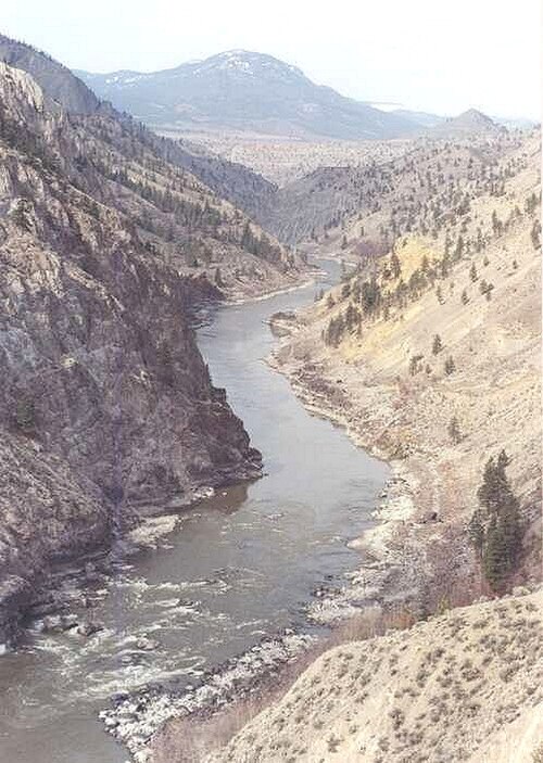
View of Fraser Canyon looking upstream from Fountain, British Columbia.
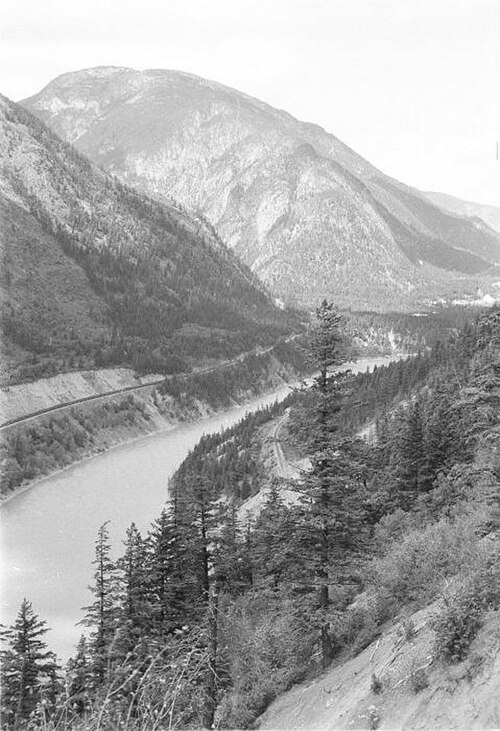
View of Fraser Canyon in the area of the Kwioek Creek (the valley coming in at left)

View of Hells Gate looking downstream, c.1955
Fraser River
Videos
Photos
The Fraser River is the longest river within British Columbia, Canada, rising at Fraser Pass near Blackrock Mountain in the Rocky Mountains and flowing for 1,375 kilometres (854 mi), into the Strait of Georgia just south of the City of Vancouver. The river's annual discharge at its mouth is 112 cubic kilometres (27 cu mi) or 3,550 cubic metres per second (125,000 cu ft/s), and each year it discharges about 20 million tons of sediment into the ocean.

The Fraser River, from the grounds of Westminster Abbey, above Hatzic in Mission, British Columbia, looking upstream (E)

The Descent of the Fraser River, 1808, by C.W. Jefferys

Fraser River in Lillooet

Source of Fraser River at Fraser Pass