Galdhøpiggen is the highest mountain in Norway, Scandinavia, and Northern Europe. The 2,469-metre-tall (8,100 ft) mountain is located in Lom Municipality in Innlandet county, Norway. It is in the Jotunheimen mountains within Jotunheimen National Park. The mountain sits about 25 kilometres (16 mi) southwest of the village of Fossbergom and about 45 kilometres (28 mi) northeast of the village of Øvre Årdal. The mountain is surrounded by several other notable mountains including Keilhaus topp to the east; Store Styggehøe to the southeast; Svellnosbreahesten, Midtre Tverråtinden, and Store Tverråtinden to the south; Storjuvtinden and Skardstinden to the west; Veslpiggen, Storgrovtinden, and Storgrovhøe to the northwest; and Galdhøi and Juvvasshøi to the northeast.
Galdhøpiggen viewed from the west (Fannaråki)
The cabin on top of Galdhøpiggen
A close-up view of the mountain
The view from the top (scroll left/right to see the view)
Norway is a country located in Northern Europe in the northern and western parts of the Scandinavian Peninsula. The majority of the country borders water, including the Skagerrak inlet to the south, the North Sea to the southwest, the North Atlantic Ocean to the west, and the Barents Sea to the north. It has a land border with Sweden to the east; to the northeast it has a shorter border with Finland and an even shorter border with Russia.
Satellite image of southern Norway, higher areas shown in red. Sognefjord and Hardangerfjord are visible in the west, and Oslofjord is seen in the southeast. Trondheimsfjord (some white clouds) is in the north, with Hitra and Frøya islands at the mouth.
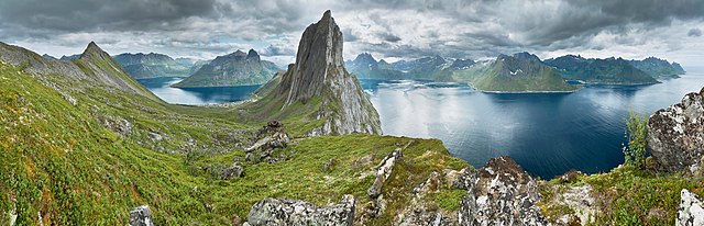
View from a ridge between Segla and Hesten, Senja, Norway
Waterfalls are common along the western part of the mountain chain, here represented by The Seven Sisters in Geiranger
Landscape with grainfield in Tønsberg, southeastern Norway.