The Gall–Peters projection is a rectangular, equal-area map projection. Like all equal-area projections, it distorts most shapes. It is a cylindrical equal-area projection with latitudes 45° north and south as the regions on the map that have no distortion. The projection is named after James Gall and Arno Peters.
Mural at a school depicting the Gall–Peters projection, with continents coloured.
In cartography, an equivalent, authalic, or equal-area projection is a map projection that preserves relative area measure between any and all map regions. Equivalent projections are widely used for thematic maps showing scenario distribution such as population, farmland distribution, forested areas, and so forth, because an equal-area map does not change apparent density of the phenomenon being mapped.
The equal-area Mollweide projection
Lambert azimuthal equal-area projection of the world centered on 0° N 0° E.
Albers projection of the world with standard parallels 20° N and 50° N.
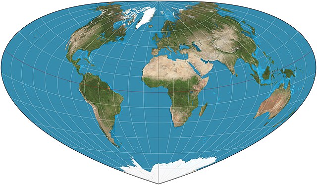
Bottomley projection of the world with standard parallel at 30° N.