Geographically, the country of Iran is located in West Asia and borders the Caspian Sea, Persian Gulf, and Gulf of Oman. Topographically, it is predominantly located on the Persian Plateau. Its mountains have impacted both the political and the economic history of the country for several centuries. The mountains enclose several broad basins, on which major agricultural and urban settlements are located. Until the 20th century, when major highways and railroads were constructed through the mountains to connect the population centers, these basins tended to be relatively isolated from one another.
Iran at night
Mount Damavand. Photo by Klaus Thymann, 2014.
Iranian provinces' contribution to GDP. Tehran host 45% of Iran's industries.
Satellite view of southern Pakistan, Iran and the Gulf of Oman
The Gulf of Oman or Sea of Oman, also known as Gulf of Makran or Sea of Makran, is a gulf in the Indian Ocean that connects the Arabian Sea with the Strait of Hormuz, which then runs to the Persian Gulf. It borders Iran and Pakistan on the north, Oman on the south, and the United Arab Emirates on the west.
Satellite view of Iran, Pakistan and the Gulf of Oman.
Khor Fakkan, a city in the Emirate of Sharjah, has one of the major container ports in the eastern seaboard of the United Arab Emirates.
U.S. Navy, French Navy, and Italian Navy aircraft carriers conduct operations in the U.S. 5th Fleet area of responsibility in the Gulf of Oman.
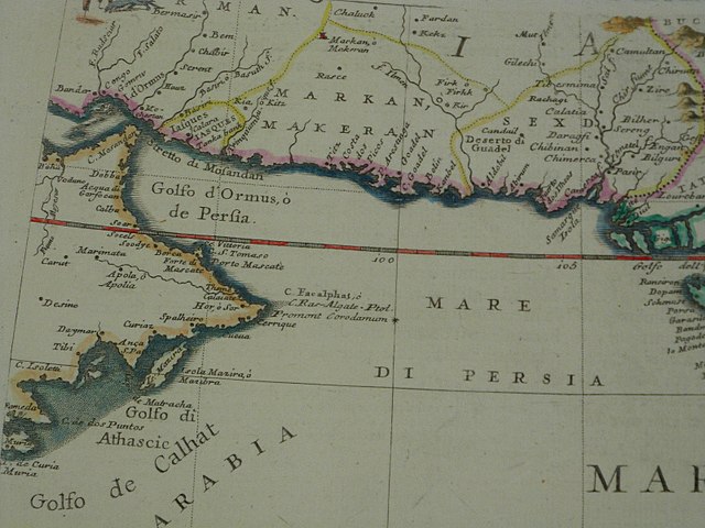
The western part of the Indian Ocean, by Vincenzo Maria Coronelli, 1693 from his system of global gores the Makran coast