Geography of New Zealand
Videos
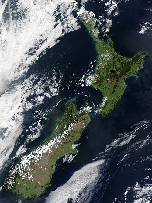
New Zealand is an island country located in the southwestern Pacific Ocean, near the centre of the water hemisphere. It consists of a large number of islands, estimated around 700, mainly remnants of a larger landmass now beneath the sea. The land masses by size are the South Island and the North Island, separated by the Cook Strait. The third-largest is Stewart Island / Rakiura, located 30 kilometres off the tip of the South Island across Foveaux Strait. Other islands are significantly smaller in area. The three largest islands stretch 1,600 kilometres across latitudes 35° to 47° south. New Zealand is the sixth-largest island country in the world, with a land size of 268,680 km2 (103,740 sq mi).


Strong winds in the Cook Strait produce high waves which erode the shore, as shown in this image

The Forty-Fours viewed from the north; the leftmost islet is the easternmost point of New Zealand.

The scalloped bays indenting Lake Taupō's northern and western coasts are typical of large volcanic caldera margins. The caldera they surround was formed during the huge Oruanui eruption.
New Zealand
Videos
New Zealand is an island country in the southwestern Pacific Ocean. It consists of two main landmasses—the North Island and the South Island —and over 700 smaller islands. It is the sixth-largest island country by area and lies east of Australia across the Tasman Sea and south of the islands of New Caledonia, Fiji, and Tonga. The country's varied topography and sharp mountain peaks, including the Southern Alps, owe much to tectonic uplift and volcanic eruptions. New Zealand's capital city is Wellington, and its most populous city is Auckland.
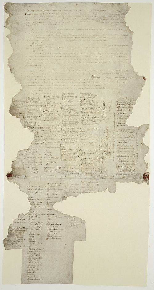

A meeting of European and Māori residents of Hawke's Bay Province. Engraving, 1863.
The snow-capped Southern Alps dominate the South Island, while the North Island's Northland Peninsula stretches towards the subtropics.

Aoraki / Mount Cook is the highest point in New Zealand, at 3,724 metres.