1.
Geology (journal)
–
Geology is a publication of the Geological Society of America. The GSA claims that it is the most widely read journal in the field of earth science. It is published monthly, with each issue containing 20 or more articles, one of the goals of the journal is to provide a forum for shorter articles and less focus on pure academic research type articles. List of scientific journals List of scientific journals in earth and atmospheric sciences Official website Archives Table of contents for current edition
2.
Geological map
–
A geologic map or geological map is a special-purpose map made to show geological features. Rock units or geologic strata are shown by color or symbols to indicate where they are exposed at the surface, stratigraphic contour lines may be used to illustrate the surface of a selected stratum illustrating the subsurface topographic trends of the strata. Isopach maps detail the variations in thickness of stratigraphic units and it is not always possible to properly show this when the strata are extremely fractured, mixed, in some discontinuities, or where they are otherwise disturbed. Rock units are represented by colors. Instead of colors, certain symbols can be used, different geologic mapping agencies and authorities have different standards for the colors and symbols to be used for rocks of differing types and ages. Geologists take two major types of measurements, orientations of planes and orientations of lines. Orientations of planes are often measured as a strike and dip, while orientations of lines are measured as a trend. The angle that the bed makes with the horizontal, along the dip direction, is next to the dip line. In the azimuthal system, strike and dip are often given as strike/dip, trend and plunge are used for linear features, and their symbol is a single arrow on the map. The arrow is oriented in the direction of the linear feature and at the end of the arrow. Trend and plunge are often notated as PLUNGE → TREND, the oldest preserved geologic map is the Turin papyrus, which shows the location of building stone and gold deposits in Egypt. The earliest geologic map of the era is the 1771 Map of Part of Auvergne, or figures of, The Current of Lava in which Prisms, Balls. To be used with Mr. Demarests theories of this hard basalt, pasumot and Daily, Geological Engineers of the King. This map is based on Nicolas Desmarests 1768 detailed study of the geology and eruptive history of the Auvergne volcanoes and he identified both landmarks as features of extinct volcanoes. The 1798 report was incorporated in the 1771 Royal Academy of Science compendium, the first geological map of the U. S. was produced in 1809 by William Maclure. In 1807, Maclure undertook the task of making a geological survey of the United States. He traversed and mapped nearly every state in the Union, during the rigorous two-year period of his survey, he crossed and recrossed the Allegheny Mountains some 50 times. Maclures map shows the distribution of five classes of rock in what are now only the states of the present-day US
3.
Lithology
–
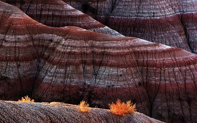
It may be either a detailed description of these characteristics or be a summary of the gross physical character of a rock. It is the basis of subdividing rock sequences into individual lithostratigraphic units for the purposes of mapping, in certain applications, such as site investigations, lithology is described using a standard terminology such as in the European geotechnical standard Eurocode 7. The naming of a lithology is based on the rock type, the three major rock types are sedimentary, igneous, metamorphic. Sedimentary rocks are classified by whether they are siliciclastic or carbonate. Siliciclastic sedimentary rocks are then subcategorized based on their size distribution and the relative proportions of quartz, feldspar. Carbonate rocks are classified with the Dunham or Folk classification schemes according to the constituents of the carbonate rock, the name of an igneous rock requires information on crystal size and mineralogy. This classification can often be performed with a QAPF diagram, metamorphic rock naming can be based on texture, protolith, metamorphic facies, and/or the locations in which they are found. Naming based on texture and a pelite protolith can be used to slate and phyllite. Texture-based names are schist and gneiss and these textures, from slate to gneiss, define a continually-increasing extent of metamorphism. Metamorphic facies are defined by the fields in which particular minerals form. In igneous and metamorphic rocks, grain size is a measure of the sizes of the crystals in the rock. In igneous rock, this is used to determine the rate at which the material cooled, large crystals typically indicate intrusive igneous rock, as metamorphic reactions progress, the grains in metamorphic rocks can often be broken down into smaller grains. In clastic sedimentary rocks, grain size is the diameter of the grains and/or clasts that constitute the rock and these are used to determine which rock naming system to use. In the case of sandstones and conglomerates, which cover a range of grain sizes. Examples are pebble conglomerate and fine quartz arenite, in rocks in which mineral grains are large enough to be identified using a hand lens, the visible mineralogy is included as part of the description. The mineralogical composition of a rock is one of the ways in which it is classified. In general, igneous rocks can be categorized by increasing silica content as ultramafic, mafic, intermediate, or felsic, the fabric of a rock describes the spatial and geometric configuration of all the elements that make it up. In sedimentary rocks the main fabric is normally bedding and the scale
4.
Ancient Greek
–
Ancient Greek includes the forms of Greek used in ancient Greece and the ancient world from around the 9th century BC to the 6th century AD. It is often divided into the Archaic period, Classical period. It is antedated in the second millennium BC by Mycenaean Greek, the language of the Hellenistic phase is known as Koine. Koine is regarded as a historical stage of its own, although in its earliest form it closely resembled Attic Greek. Prior to the Koine period, Greek of the classic and earlier periods included several regional dialects, Ancient Greek was the language of Homer and of fifth-century Athenian historians, playwrights, and philosophers. It has contributed many words to English vocabulary and has been a subject of study in educational institutions of the Western world since the Renaissance. This article primarily contains information about the Epic and Classical phases of the language, Ancient Greek was a pluricentric language, divided into many dialects. The main dialect groups are Attic and Ionic, Aeolic, Arcadocypriot, some dialects are found in standardized literary forms used in literature, while others are attested only in inscriptions. There are also several historical forms, homeric Greek is a literary form of Archaic Greek used in the epic poems, the Iliad and Odyssey, and in later poems by other authors. Homeric Greek had significant differences in grammar and pronunciation from Classical Attic, the origins, early form and development of the Hellenic language family are not well understood because of a lack of contemporaneous evidence. Several theories exist about what Hellenic dialect groups may have existed between the divergence of early Greek-like speech from the common Proto-Indo-European language and the Classical period and they have the same general outline, but differ in some of the detail. The invasion would not be Dorian unless the invaders had some relationship to the historical Dorians. The invasion is known to have displaced population to the later Attic-Ionic regions, the Greeks of this period believed there were three major divisions of all Greek people—Dorians, Aeolians, and Ionians, each with their own defining and distinctive dialects. Often non-west is called East Greek, Arcadocypriot apparently descended more closely from the Mycenaean Greek of the Bronze Age. Boeotian had come under a strong Northwest Greek influence, and can in some respects be considered a transitional dialect, thessalian likewise had come under Northwest Greek influence, though to a lesser degree. Most of the dialect sub-groups listed above had further subdivisions, generally equivalent to a city-state and its surrounding territory, Doric notably had several intermediate divisions as well, into Island Doric, Southern Peloponnesus Doric, and Northern Peloponnesus Doric. The Lesbian dialect was Aeolic Greek and this dialect slowly replaced most of the older dialects, although Doric dialect has survived in the Tsakonian language, which is spoken in the region of modern Sparta. Doric has also passed down its aorist terminations into most verbs of Demotic Greek, by about the 6th century AD, the Koine had slowly metamorphosized into Medieval Greek
5.
Earth science
–
Earth science or geoscience is a widely embraced term for the fields of science related to the planet Earth. Earth science can be considered to be a branch of planetary science, there are both reductionist and holistic approaches to Earth sciences. The Earth sciences can include the study of geology, the lithosphere, and the structure of the Earths interior, as well as the atmosphere, hydrosphere. Typically, Earth scientists use tools from geography, chronology, physics, chemistry, biology, Geology describes the rocky parts of the Earths crust and its historic development. Major subdisciplines are mineralogy and petrology, geochemistry, geomorphology, paleontology, stratigraphy, structural geology, engineering geology, geophysics and geodesy investigate the shape of the Earth, its reaction to forces and its magnetic and gravity fields. Geophysicists explore the Earths core and mantle as well as the tectonic and seismic activity of the lithosphere, geophysics is commonly used to supplement the work of geologists in developing a comprehensive understanding of crustal geology, particularly in mineral and petroleum exploration. Soil science covers the outermost layer of the Earths crust that is subject to soil formation processes, major subdisciplines include edaphology and pedology. Ecology covers the interactions between the biota, with their natural environment and this field of study differentiates the study of the Earth, from the study of other planets in the Solar System, the Earth being the only planet teeming with life. Hydrology is a study revolved around the movement, distribution, and quality of the water and involves all the components of the cycle on the earth. Sub-disciplines of hydrology include hydrometeorology, surface hydrology, hydrogeology, watershed science, forest hydrology. Glaciology covers the icy parts of the Earth, atmospheric sciences cover the gaseous parts of the Earth between the surface and the exosphere. Major subdisciplines include meteorology, climatology, atmospheric chemistry, and atmospheric physics, plate tectonics, mountain ranges, volcanoes, and earthquakes are geological phenomena that can be explained in terms of physical and chemical processes in the Earths crust. Beneath the Earths crust lies the mantle which is heated by the decay of heavy elements. The mantle is not quite solid and consists of magma which is in a state of semi-perpetual convection and this convection process causes the lithospheric plates to move, albeit slowly. The resulting process is known as plate tectonics, plate tectonics might be thought of as the process by which the Earth is resurfaced. As the result of spreading, new crust and lithosphere is created by the flow of magma from the mantle to the near surface, through fissures. Through subduction, oceanic crust and lithosphere returns to the convecting mantle, volcanoes result primarily from the melting of subducted crust material. Crust material that is forced into the asthenosphere melts, and some portion of the material becomes light enough to rise to the surface—giving birth to volcanoes
6.
Rock (geology)
–
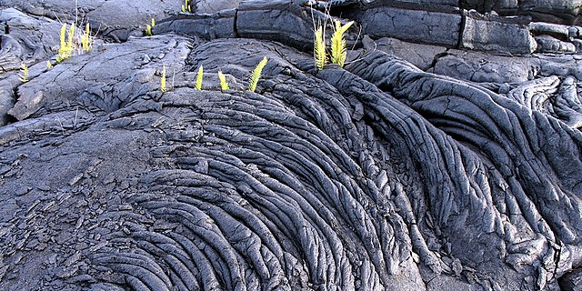
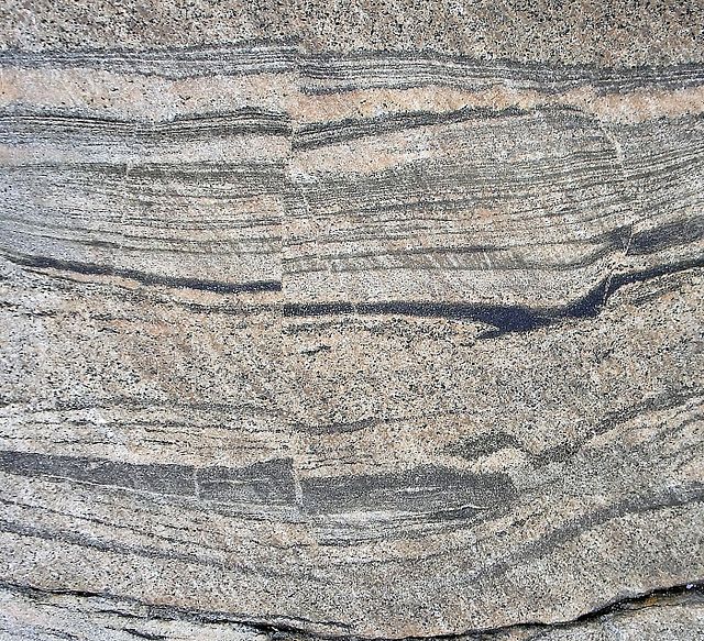
Rock or stone is a natural substance, a solid aggregate of one or more minerals or mineraloids. For example, granite, a rock, is a combination of the minerals quartz, feldspar. The Earths outer solid layer, the lithosphere, is made of rock, rock has been used by mankind throughout history. The minerals and metals found in rocks have been essential to human civilization, three major groups of rocks are defined, igneous, sedimentary, and metamorphic. The scientific study of rocks is called petrology, which is a component of geology. At a granular level, rocks are composed of grains of minerals, the aggregate minerals forming the rock are held together by chemical bonds. The types and abundance of minerals in a rock are determined by the manner in which the rock was formed, many rocks contain silica, a compound of silicon and oxygen that forms 74. 3% of the Earths crust. This material forms crystals with other compounds in the rock, the proportion of silica in rocks and minerals is a major factor in determining their name and properties. Rocks are geologically classified according to such as mineral and chemical composition, permeability, the texture of the constituent particles. These physical properties are the end result of the processes that formed the rocks, over the course of time, rocks can transform from one type into another, as described by the geological model called the rock cycle. These events produce three general classes of rock, igneous, sedimentary, and metamorphic, the three classes of rocks are subdivided into many groups. However, there are no hard and fast boundaries between allied rocks, hence the definitions adopted in establishing rock nomenclature merely correspond to more or less arbitrary selected points in a continuously graduated series. Igneous rock forms through the cooling and solidification of magma or lava and this magma can be derived from partial melts of pre-existing rocks in either a planets mantle or crust. Typically, the melting of rocks is caused by one or more of three processes, an increase in temperature, a decrease in pressure, or a change in composition, igneous rocks are divided into two main categories, plutonic rock and volcanic. Plutonic or intrusive rocks result when magma cools and crystallizes slowly within the Earths crust, a common example of this type is granite. Volcanic or extrusive rocks result from magma reaching the surface either as lava or fragmental ejecta, the chemical abundance and the rate of cooling of magma typically forms a sequence known as Bowens reaction series. Most major igneous rocks are found along this scale, about 64. 7% of the Earths crust by volume consists of igneous rocks, making it the most plentiful category. Of these, 66% are basalts and gabbros, 16% are granite, only 0. 6% are syenites and 0. 3% peridotites and dunites
7.
Terrestrial planet
–
A terrestrial planet, telluric planet, or rocky planet is a planet that is composed primarily of silicate rocks or metals. Within the Solar System, the planets are the inner planets closest to the Sun, i. e. Mercury, Venus, Earth. The terms terrestrial planet and telluric planet are derived from Latin words for Earth, as these planets are, in terms of composition, Earth-like. All terrestrial planets may have the basic type of structure, such as a central metallic core, mostly iron. The Moon is similar, but has a smaller iron core. Io and Europa are also satellites that have internal structures similar to that of terrestrial planets, terrestrial planets can have canyons, craters, mountains, volcanoes, and other surface structures, depending on the presence of water and tectonic activity. The Solar System has four planets, Mercury, Venus, Earth. Only one terrestrial planet, Earth, is known to have an active hydrosphere, during the formation of the Solar System, there were probably many more terrestrial planetesimals, but most merged with or were ejected by the four terrestrial planets. The Earths Moon has a density of 3.4 g·cm−3 and Jupiters satellites, Io,3.528 and Europa,3.013 g·cm−3, the uncompressed density of a terrestrial planet is the average density its materials would have at zero pressure. A greater uncompressed density indicates greater metal content, uncompressed density differs from the true average density because compression within planet cores increases their density, the average density depends on planet size as well as composition. The uncompressed density of terrestrial planets trends towards lower values as the distance from the Sun increases, the rocky minor planet Vesta orbiting outside of Mars is less dense than Mars still, at 3.4 g·cm−3. It is unknown whether extrasolar terrestrial planets in general will also follow this trend, most of the planets discovered outside the Solar System are giant planets, because they are more easily detectable. But since 2005, hundreds of terrestrial extrasolar planets have been found. Most of these are super-Earths, i. e. planets with masses between Earths and Neptunes, super-Earths may be gas planets or terrestrial, depending on their mass and other parameters. During the early 1990s, the first extrasolar planets were discovered orbiting the pulsar PSR B1257+12, with masses of 0.02,4.3 and it was later found to be a gas giant. In 2005, the first planets around stars that may be terrestrial were found, Gliese 876 d, has a mass 7 to 9 times that of Earth. It orbits the red dwarf Gliese 876,15 light years from Earth, oGLE-2005-BLG-390Lb, about 5.5 times the mass of Earth, orbits a star about 21,000 light years away in the constellation Scorpius. From 2007 to 2010, three potential terrestrial planets were orbiting the red dwarf Gliese 581
8.
Natural satellite
–
A natural satellite or moon is, in the most common usage, an astronomical body that orbits a planet or minor planet. In the Solar System there are six planetary satellite systems containing 178 known natural satellites, four IAU-listed dwarf planets are also known to have natural satellites, Pluto, Haumea, Makemake, and Eris. As of January 2012, over 200 minor-planet moons have been discovered, the Earth–Moon system is unique in that the ratio of the mass of the Moon to the mass of Earth is much greater than that of any other natural-satellite–planet ratio in the Solar System. At 3,474 km across, Earths Moon is 0.27 times the diameter of Earth, the first known natural satellite was the Moon, but it was considered a planet until Copernicus introduction of heliocentrism in 1543. Until the discovery of the Galilean satellites in 1610, however, galileo chose to refer to his discoveries as Planetæ, but later discoverers chose other terms to distinguish them from the objects they orbited. The first to use of the satellite to describe orbiting bodies was the German astronomer Johannes Kepler in his pamphlet Narratio de Observatis a se quatuor Iouis satellitibus erronibus in 1610. He derived the term from the Latin word satelles, meaning guard, attendant, or companion, the term satellite thus became the normal one for referring to an object orbiting a planet, as it avoided the ambiguity of moon. In 1957, however, the launching of the artificial object Sputnik created a need for new terminology, to further avoid ambiguity, the convention is to capitalize the word Moon when referring to Earths natural satellite, but not when referring to other natural satellites. A few recent authors define moon as a satellite of a planet or minor planet, there is no established lower limit on what is considered a moon. Small asteroid moons, such as Dactyl, have also been called moonlets, the upper limit is also vague. Two orbiting bodies are described as a double body rather than primary. Asteroids such as 90 Antiope are considered double asteroids, but they have not forced a clear definition of what constitutes a moon, some authors consider the Pluto–Charon system to be a double planet. In contrast, irregular satellites are thought to be captured asteroids possibly further fragmented by collisions, most of the major natural satellites of the Solar System have regular orbits, while most of the small natural satellites have irregular orbits. The Moon and possibly Charon are exceptions among large bodies in that they are thought to have originated by the collision of two large proto-planetary objects. The material that would have placed in orbit around the central body is predicted to have reaccreted to form one or more orbiting natural satellites. As opposed to planetary-sized bodies, asteroid moons are thought to form by this process. Triton is another exception, although large and in a close, circular orbit, its motion is retrograde, most regular moons in the Solar System are tidally locked to their respective primaries, meaning that the same side of the natural satellite always faces its planet. The only known exception is Saturns natural satellite Hyperion, which rotates chaotically because of the influence of Titan
9.
Geology of Mars
–
The geology of Mars is the scientific study of the surface, crust, and interior of the planet Mars. It emphasizes the composition, structure, history, and physical processes that shape the planet and it is analogous to the field of terrestrial geology. In planetary science, the geology is used in its broadest sense to mean the study of the solid parts of planets. The term incorporates aspects of geophysics, geochemistry, mineralogy, geodesy, Mars is a differentiated, terrestrial planet. Most of our current knowledge about the geology of Mars comes from studying landforms, Mars has a number of distinct, large-scale surface features that indicate the types of geological processes that have operated on the planet over time. This section introduces several of the physiographic regions of Mars. Together, these regions illustrate how geologic processes involving volcanism, tectonism, water, ice, the northern and southern hemispheres of Mars are strikingly different from each other in topography and physiography. This dichotomy is a fundamental global geologic feature of the planet, simply stated, the northern part of the planet is an enormous topographic depression. About one-third of the surface lies 3–6 km lower in elevation than the southern two-thirds. This is a relief feature on par with the elevation difference between Earth’s continents and ocean basins. The dichotomy is expressed in two other ways, as a difference in impact crater density and crustal thickness between the two hemispheres. The hemisphere south of the boundary is very heavily cratered and ancient. The third distinction between the two hemispheres is in crustal thickness, the location of the dichotomy boundary varies in latitude across Mars and depends on which of the three physical expressions of the dichotomy is being considered. The origin and age of the hemispheric dichotomy are still debated, one endogenic model proposes an early episode of plate tectonics producing a thinner crust in the north, similar to what is occurring at spreading plate boundaries on Earth. Whatever its origin, the Martian dichotomy appears to be extremely old, laser altimeter and radar sounding data from orbiting spacecraft have identified a large number of basin-sized structures previously hidden in visual images. Called quasi-circular depressions, these likely represent derelict impact craters from the period of heavy bombardment that are now covered by a veneer of younger deposits. Crater counting studies of QCDs suggest that the surface in the northern hemisphere is at least as old as the oldest exposed crust in the southern highlands. The ancient age of the places a significant constraint on theories of its origin
10.
Geology of the Moon
–
The geology of the Moon is quite different from that of Earth. The complex geomorphology of the surface has been formed by a combination of processes, especially impact cratering. The Moon is a body, with a crust, mantle. Geological studies of the Moon are based on a combination of Earth-based telescope observations, measurements from orbiting spacecraft, lunar samples, and geophysical data. Six locations were sampled directly during the manned Apollo program landings from 1969 to 1972, in addition, three robotic Soviet Luna spacecraft returned another 326 grams from 1970 to 1976. The Moon is the only body for which we have samples with a known geologic context. A handful of lunar meteorites have been recognized on Earth, though their source craters on the Moon are unknown, a substantial portion of the lunar surface has not been explored, and a number of geological questions remain unanswered. Elements known to be present on the surface include, among others, oxygen, silicon, iron, magnesium, calcium, aluminium, manganese. Among the more abundant are oxygen, iron and silicon, the oxygen content is estimated at 45%. Carbon and nitrogen appear to be present only in quantities from deposition by solar wind. Neutron spectrometry data from Lunar Prospector indicate the presence of hydrogen concentrated at the poles, for a long period of time, the fundamental question regarding the history of the Moon was of its origin. Early hypotheses included fission from Earth, capture, and co-accretion, today, the giant impact hypothesis is widely accepted by the scientific community. The geological history of the Moon has been defined into six major epochs, starting about 4.5 billion years ago, the newly formed Moon was in a molten state and was orbiting much closer to Earth resulting in tidal forces. These tidal forces deformed the molten body into an ellipsoid, with the major axis pointed towards Earth, the first important event in the geologic evolution of the Moon was the crystallization of the near global magma ocean. It is not known with certainty what its depth was, the first minerals to form in this ocean were the iron and magnesium silicates olivine and pyroxene. Because these minerals were denser than the material around them. After crystallization was about 75% complete, less dense anorthositic plagioclase feldspar crystallized and floated, forming an anorthositic crust about 50 km in thickness. The oldest of the Mg-suite rocks have ages of about 3.85 Ga. However
11.
Structure of the Earth
–
The interior structure of the Earth is layered in spherical shells, like an onion. These layers can be defined by their chemical and their rheological properties, Earth has an outer silicate solid crust, a highly viscous mantle, a liquid outer core that is much less viscous than the mantle, and a solid inner core. The force exerted by Earths gravity can be used to calculate its mass, astronomers can also calculate Earths mass by observing the motion of orbiting satellites. Earth’s average density can be determined through gravitometric experiments, which have historically involved pendulums, the mass of Earth is about 6×1024 kg. The structure of Earth can be defined in two ways, by properties such as rheology, or chemically. Mechanically, it can be divided into lithosphere, asthenosphere, mesospheric mantle, outer core, chemically, Earth can be divided into the crust, upper mantle, lower mantle, outer core, and inner core. The core does not allow shear waves to pass through it, the changes in seismic velocity between different layers causes refraction owing to Snells law, like light bending as it passes through a prism. Likewise, reflections are caused by an increase in seismic velocity and are similar to light reflecting from a mirror. The crust ranges from 5–70 kilometres in depth and is the outermost layer, the thin parts are the oceanic crust, which underlie the ocean basins and are composed of dense iron magnesium silicate igneous rocks, like basalt. The thicker crust is continental crust, which is dense and composed of sodium potassium aluminium silicate rocks. The rocks of the crust fall into two major categories – sial and sima and it is estimated that sima starts about 11 km below the Conrad discontinuity. The uppermost mantle together with the crust constitutes the lithosphere, the crust-mantle boundary occurs as two physically different events. First, there is a discontinuity in the velocity, which is most commonly known as the Mohorovičić discontinuity or Moho. The cause of the Moho is thought to be a change in composition from rocks containing plagioclase feldspar to rocks that contain no feldspars. Earths mantle extends to a depth of 2,890 km, the mantle is divided into upper and lower mantle. The upper and lower mantle are separated by the transition zone, the lowest part of the mantle next to the core-mantle boundary is known as the D″ layer. The pressure at the bottom of the mantle is ≈140 GPa, the mantle is composed of silicate rocks that are rich in iron and magnesium relative to the overlying crust. Although solid, the temperatures within the mantle cause the silicate material to be sufficiently ductile that it can flow on very long timescales
12.
Relative dating
–
Relative dating is the science of determining the relative order of past events, without necessarily determining their absolute age. In geology, rock or superficial deposits, fossils and lithologies can be used to correlate one stratigraphic column with another. Prior to the discovery of radiometric dating which provided a means of dating in the early 20th century. Though relative dating can determine the sequential order in which a series of events occurred, not when they occur. Relative dating by biostratigraphy is the method in paleontology, and is in some respects more accurate. The regular order of occurrence of fossils in rock layers was discovered around 1800 by William Smith, while digging the Somerset Coal Canal in southwest England, he found that fossils were always in the same order in the rock layers. As he continued his job as a surveyor, he found the same patterns across England and he also found that certain animals were in only certain layers and that they were in the same layers all across England. Due to that discovery, Smith was able to recognize the order that the rocks were formed, sixteen years after his discovery, he published a geological map of England showing the rocks of different geologic time eras. Methods for relative dating were developed when geology first emerged as a formal science, geologists still use the following principles today as a means to provide information about geologic history and the timing of geologic events. The principle of Uniformitarianism states that the processes observed in operation that modify the Earths crust at present have worked in much the same way over geologic time. A fundamental principle of geology advanced by the 18th century Scottish physician, in Huttons words, the past history of our globe must be explained by what can be seen to be happening now. The principle of intrusive relationships concerns crosscutting intrusions, in geology, when an igneous intrusion cuts across a formation of sedimentary rock, it can be determined that the igneous intrusion is younger than the sedimentary rock. There are a number of different types of intrusions, including stocks, laccoliths, batholiths, sills, the principle of cross-cutting relationships pertains to the formation of faults and the age of the sequences through which they cut. Finding the key bed in these situations may help determine whether the fault is a fault or a thrust fault. The principle of inclusions and components states that, with rocks, if inclusions are found in a formation. For example, in rocks, it is common for gravel from an older formation to be ripped up. A similar situation with igneous rocks occurs when xenoliths are found and these foreign bodies are picked up as magma or lava flows, and are incorporated, later to cool in the matrix. As a result, xenoliths are older than the rock which contains them, the principle of original horizontality states that the deposition of sediments occurs as essentially horizontal beds
13.
Geochronology
–
Geochronology is the science of determining the age of rocks, fossils, and sediments using signatures inherent in the rocks themselves. Absolute geochronology can be accomplished through radioactive isotopes, whereas relative geochronology is provided by such as palaeomagnetism. By combining multiple geochronological indicators the precision of the age can be improved. Biostratigraphy does not directly provide an absolute age determination of a rock, both disciplines work together hand in hand however, to the point where they share the same system of naming rock layers and the time spans utilized to classify layers within a stratum. By measuring the amount of decay of a radioactive isotope with a known half-life. A number of isotopes are used for this purpose. More slowly decaying isotopes are useful for longer periods of time, two or more radiometric methods can be used in concert to achieve more robust results. Some of the commonly used techniques are, Radiocarbon dating and this technique measures the decay of carbon-14 in organic material and can be best applied to samples younger than about 60,000 years. This technique measures the ratio of two isotopes to the amount of uranium in a mineral or rock. Often applied to the mineral zircon in igneous rocks, this method is one of the two most commonly used for geologic dating. Monazite geochronology is another example of U-Pb dating, employed for dating metamorphism in particular, uranium-lead dating is applied to samples older than about 1 million years. This technique is used to date speleothems, corals, carbonates and its range is from a few years to about 700,000 years. These techniques date metamorphic, igneous and volcanic rocks and they are also used to date volcanic ash layers within or overlying paleoanthropologic sites. The younger limit of the method is a few thousand years. Electron spin resonance dating A series of related techniques for determining the age at which a surface was created. Exposure dating uses the concentration of exotic nuclides produced by cosmic rays interacting with Earth materials as a proxy for the age at which a surface, such as an alluvial fan, was created. Burial dating uses the radioactive decay of 2 cosmogenic elements as a proxy for the age at which a sediment was screened by burial from further cosmic rays exposure. Luminescence dating techniques observe light emitted from such as quartz, diamond, feldspar
14.
Geologist
–
A geologist is a scientist who studies the solid and liquid matter that constitutes the Earth as well as the processes that shape it. Geologists usually study geology, although backgrounds in physics, chemistry, biology, field work is an important component of geology, although many subdisciplines incorporate laboratory work. Some geologists work in the mining business searching for metals, oils and they are also in the forefront of natural hazards and disasters prevention and mitigation, studying natural hazards such as earthquakes, volcanic activity, tsunamis, weather storms. Their studies are used to warn the public of the occurrence of these events. Geologists are also important contributors to climate change discussions, james Hutton is often viewed as the first modern geologist. In 1785 he presented a paper entitled Theory of the Earth to the Royal Society of Edinburgh, Hutton published a two-volume version of his ideas in 1795. The first geological map of the U. S. was produced in 1809 by William Maclure, in 1807, Maclure commenced the self-imposed task of making a geological survey of the United States. Almost every state in the Union was traversed and mapped by him and this antedates William Smiths geological map of England by six years, although it was constructed using a different classification of rocks. Sir Charles Lyell first published his famous book, Principles of Geology and this book, which influenced the thought of Charles Darwin, successfully promoted the doctrine of uniformitarianism. This theory states that slow geological processes have occurred throughout the Earths history and are still occurring today, in contrast, catastrophism is the theory that Earths features formed in single, catastrophic events and remained unchanged thereafter. Though Hutton believed in uniformitarianism, the idea was not widely accepted at the time, most geologists also need skills in GIS and other mapping techniques. Geology students often spend portions of the year, especially the summer though sometimes during a January term, geologists may concentrate their studies or research in one or more of the following disciplines, Dendrochronology, the study of dating based on tree ring patterns. Economic geology, the study of ore genesis, and the mechanisms of ore creation, geochemistry, the applied branch deals with the study of the chemical makeup and behaviour of rocks, and the study of the behaviour of their minerals. Geochronology, the study of isotope geology specifically toward determining the date within the past of rock formation, metamorphism, mineralization and geological events. Geomorphology, the study of landforms and the processes that create them Hydrogeology, igneous petrology, the study of igneous processes such as igneous differentiation, fractional crystallization, intrusive and volcanological phenomena. Isotope geology, the case of the composition of rocks to determine the processes of rock. Metamorphic petrology, the study of the effects of metamorphism on minerals, marine geology, the study of the seafloor, involves geophysical, geochemical, sedimentological and paleontological investigations of the ocean floor and coastal margins. Marine geology has strong ties to physical oceanography and plate tectonics, palaeoclimatology, the application of geological science to determine the climatic conditions present in the Earths atmosphere within the Earths history
15.
History of Earth
–
The history of Earth concerns the development of the planet Earth from its formation to the present day. Nearly all branches of science have contributed to the understanding of the main events of the Earths past. The age of Earth is approximately one-third of the age of the universe, an immense amount of geological change has occurred in that timespan, accompanied by the emergence of life and its subsequent evolution. Earth formed around 4.54 billion years ago by accretion from the solar nebula, volcanic outgassing probably created the primordial atmosphere and then the ocean, but the atmosphere contained almost no oxygen and so would have been toxic to most modern life including humans. Much of the Earth was molten because of frequent collisions with other bodies which led to extreme volcanism. A giant impact collision with a body named Theia while Earth was in its earliest stage. Over time, the Earth cooled, causing the formation of a solid crust, the geological time scale clock depicts the larger spans of time from the beginning of the Earth as well as a chronology of some definitive events of Earth history. The Archean and Proterozoic eons follow, they produced the abiogenesis of life on Earth, there are microbial mat fossils such as stromatolites found in 3.48 billion-year-old sandstone discovered in Western Australia. According to one of the researchers, If life arose relatively quickly on Earth … then it could be common in the universe, living forms derived from photosynthesis appeared between 3.2 and 2.4 billion years ago and began enriching the atmosphere with oxygen. More than 99 percent of all species, amounting to five billion species. Estimates on the number of Earths current species range from 10 million to 14 million, of which about 1.2 million have been documented and over 86 percent have not yet been described. More recently, in May 2016, scientists reported that 1 trillion species are estimated to be on Earth currently with only one-thousandth of one percent described. Geological change has been a constant of Earths crust since the time of its formation, species continue to evolve, taking on new forms, splitting into daughter species or going extinct in the process of adapting or dying in response to ever-changing physical environments. The process of plate tectonics continues to play a dominant role in the shaping of Earths oceans and continents, in geochronology, time is generally measured in mya, each unit representing the period of approximately 1,000,000 years in the past. The history of Earth is divided into four great eons, starting 4,540 mya with the formation of the planet, each eon saw the most significant changes in Earths composition, climate and life. Each eon is divided into eras, which in turn are divided into periods. The history of the Earth can be organized according to the geologic time scale. The following four timelines show the time scale
16.
Age of the Earth
–
The age of the Earth is 4.54 ±0.05 billion years. This dating is based on evidence from radiometric age-dating of meteorite material and is consistent with the ages of the oldest-known terrestrial. Following the development of radiometric age-dating in the early 20th century, the oldest such minerals analyzed to date—small crystals of zircon from the Jack Hills of Western Australia—are at least 4.404 billion years old. Comparing the mass and luminosity of the Sun to those of other stars and it is hypothesised that the accretion of Earth began soon after the formation of the calcium-aluminium-rich inclusions and the meteorites. It is also difficult to determine the age of the oldest rocks on Earth, exposed at the surface. Studies of strata, the layering of rocks and earth, gave naturalists an appreciation that Earth may have been many changes during its existence. These layers often contained fossilized remains of creatures, leading some to interpret a progression of organisms from layer to layer. Nicolas Steno in the 17th century was one of the first naturalists to appreciate the connection between fossil remains and strata and his observations led him to formulate important stratigraphic concepts. In the 1790s, William Smith hypothesized that if two layers of rock at widely differing locations contained similar fossils, then it was plausible that the layers were the same age. William Smiths nephew and student, John Phillips, later calculated by means that Earth was about 96 million years old. In the mid-18th century, the naturalist Mikhail Lomonosov suggested that Earth had been created separately from, and several hundred years before. In 1779 the Comte du Buffon tried to obtain a value for the age of Earth using an experiment, He created a globe that resembled Earth in composition. This led him to estimate that Earth was about 75,000 years old, other naturalists used these hypotheses to construct a history of Earth, though their timelines were inexact as they did not know how long it took to lay down stratigraphic layers. This was a challenge to the view, which saw the history of Earth as static. Many naturalists were influenced by Lyell to become uniformitarians who believed that changes were constant, in 1862, the physicist William Thomson, 1st Baron Kelvin published calculations that fixed the age of Earth at between 20 million and 400 million years. He assumed that Earth had formed as a completely molten object, geologists such as Charles Lyell had trouble accepting such a short age for Earth. For biologists, even 100 million years seemed much too short to be plausible, in Darwins theory of evolution, the process of random heritable variation with cumulative selection requires great durations of time. In a lecture in 1869, Darwins great advocate, Thomas H. Huxley, attacked Thomsons calculations and their values were consistent with Thomsons calculations
17.
Plate tectonics
–
The theoretical model builds on the concept of continental drift developed during the first few decades of the 20th century. The geoscientific community accepted plate-tectonic theory after seafloor spreading was validated in the late 1950s, the lithosphere, which is the rigid outermost shell of a planet, is broken up into tectonic plates. The Earths lithosphere is composed of seven or eight major plates, where the plates meet, their relative motion determines the type of boundary, convergent, divergent, or transform. Earthquakes, volcanic activity, mountain-building, and oceanic trench formation occur along plate boundaries. The relative movement of the plates typically ranges from zero to 100 mm annually, tectonic plates are composed of oceanic lithosphere and thicker continental lithosphere, each topped by its own kind of crust. Along convergent boundaries, subduction carries plates into the mantle, the material lost is balanced by the formation of new crust along divergent margins by seafloor spreading. In this way, the surface of the lithosphere remains the same. This prediction of plate tectonics is also referred to as the conveyor belt principle, earlier theories, since disproven, proposed gradual shrinking or gradual expansion of the globe. Tectonic plates are able to move because the Earths lithosphere has greater strength than the underlying asthenosphere. Lateral density variations in the result in convection. Plate movement is thought to be driven by a combination of the motion of the seafloor away from the ridge and drag, with downward suction. Another explanation lies in the different forces generated by forces of the Sun. The relative importance of each of these factors and their relationship to other is unclear. The outer layers of the Earth are divided into the lithosphere and asthenosphere and this is based on differences in mechanical properties and in the method for the transfer of heat. Mechanically, the lithosphere is cooler and more rigid, while the asthenosphere is hotter, in terms of heat transfer, the lithosphere loses heat by conduction, whereas the asthenosphere also transfers heat by convection and has a nearly adiabatic temperature gradient. The key principle of plate tectonics is that the lithosphere exists as separate and distinct tectonic plates, Plate motions range up to a typical 10–40 mm/year, to about 160 mm/year. The driving mechanism behind this movement is described below, tectonic lithosphere plates consist of lithospheric mantle overlain by either or both of two types of crustal material, oceanic crust and continental crust. Average oceanic lithosphere is typically 100 km thick, its thickness is a function of its age, as passes, it conductively cools
18.
Evolutionary history of life
–
The evolutionary history of life on Earth traces the processes by which living and fossil organisms have evolved since life appeared on the planet, until the present day. Earth formed about 4.5 Ga ago and there is evidence that appeared as early as 4.1 Ga. The similarities between all present-day organisms indicate the presence of an ancestor from which all known species have diverged through the process of evolution. More than 99 percent of all species, amounting to five billion species. More recently, in May 2016, scientists reported that 1 trillion species are estimated to be on Earth currently with only one-thousandth of one percent described, more recently, in 2015, remains of biotic life were found in 4.1 billion-year-old rocks in Western Australia. In March 2017, researchers reported evidence of possibly the oldest forms of life on Earth, according to biologist Stephen Blair Hedges, If life arose relatively quickly on Earth. Then it could be common in the universe, microbial mats of coexisting bacteria and archaea were the dominant form of life in the early Archean and many of the major steps in early evolution are thought to have taken place within them. The evolution of photosynthesis, around 3.5 Ga, eventually led to a buildup of its product, oxygen, in the atmosphere, leading to the great oxygenation event. The earliest evidence of dates from 1.85 Ga. Later, around 1.7 Ga, multicellular organisms began to appear, however the origin and evolution of sexual reproduction remain a puzzle for biologists though it did evolve from a common ancestor that was a single celled eukaryotic species. Bilateria, animals with a front and a back, appeared by 555 Ma, the earliest land plants date back to around 450 Ma, although evidence suggests that microorganisms formed the earliest terrestrial ecosystems, at least 2.9 Ga. Microorganisms are thought to have paved the way for the inception of land plants in the Phanerozoic, land plants were so successful that they are thought to have contributed to the Late Devonian extinction event. Ediacara biota appear during the Ediacaran period, while vertebrates, along with most other modern phyla originated about 525 Ma during the Cambrian explosion. During the Permian period, synapsids, including the ancestors of mammals, dominated the land, during the recovery from this catastrophe, archosaurs became the most abundant land vertebrates, one archosaur group, the dinosaurs, dominated the Jurassic and Cretaceous periods. After the Cretaceous–Paleogene extinction event 66 Ma killed off the dinosaurs, mammals increased rapidly in size. Such mass extinctions may have accelerated evolution by providing opportunities for new groups of organisms to diversify, the Moon has the same composition as Earths crust but does not contain an iron-rich core like the Earths. Many scientists think that about 40 million years later a body the size of Mars struck the Earth, until 2001, the oldest rocks found on Earth were about 3.8 billion years old, leading scientists to estimate that the Earths surface had been molten until then. Accordingly, they named this part of Earths history the Hadean, however, analysis of zircons formed 4
19.
Paleoclimatology
–
Paleoclimatology is the study of changes in climate taken on the scale of the entire history of Earth. It then uses the records to determine the past states of the Earths various climate regions and he noted that the loess deposits at Timaru in the South Island recorded changes in climate, he called the loess a climate register. Paleoclimatologists employ a variety of techniques to deduce ancient climates. Mountain glaciers and the polar ice caps/ice sheets provide much data in paleoclimatology, ice-coring projects in the ice caps of Greenland and Antarctica have yielded data going back several hundred thousand years, over 800,000 years in the case of the EPICA project. Air trapped within fallen snow becomes encased in tiny bubbles as the snow is compressed into ice in the glacier under the weight of later years snow. The trapped air has proven a valuable source for direct measurement of the composition of air from the time the ice was formed. Layering can be observed because of seasonal pauses in ice accumulation and can be used to establish chronology, changes in the layering thickness can be used to determine changes in precipitation or temperature. Oxygen-18 quantity changes in ice layers represent changes in ocean surface temperature. Water molecules containing the heavier O-18 evaporate at a higher temperature than water molecules containing the normal Oxygen-16 isotope, the ratio of O-18 to O-16 will be higher as temperature increases. It also depends on factors such as the waters salinity. Various cycles in those isotope ratios have been detected, pollen has been observed in the ice cores and can be used to understand which plants were present as the layer formed. Pollen is produced in abundance and its distribution is well understood. A pollen count for a layer can be produced by observing the total amount of pollen categorized by type in a controlled sample of that layer. Changes in plant frequency over time can be plotted through statistical analysis of pollen counts in the core, knowing which plants were present leads to an understanding of precipitation and temperature, and types of fauna present. Palynology includes the study of pollen for these purposes, volcanic ash is contained in some layers, and can be used to establish the time of the layers formation. Each volcanic event distributed ash with a set of properties. Establishing the ashs source will establish a range of time to associate with layer of ice, climatic information can be obtained through an understanding of changes in tree growth. Generally, trees respond to changes in climatic variables by speeding up or slowing down growth, different species, however, respond to changes in climatic variables in different ways
20.
Field research
–
Field research or fieldwork is the collection of information outside a laboratory, library or workplace setting. The approaches and methods used in field research vary across disciplines, although the method generally is characterized as qualitative research, it may include quantitative dimensions. Field research has a long history, cultural anthropologists have long used field research to study other cultures. In Fields that is, circumscribed areas of study which have been the subject of social research, Fields could be education, industrial settings, or Amazonian rain forests. Field research may be conducted by zoologists such as Jane Goodall, radcliff-Brown and Malinowski were early cultural anthropologists who set the models for future work. Business use of Field research is a form of anthropology and is as likely to be advised by sociologists or statisticians in the case of surveys. Consumer marketing field research is the marketing technique used by businesses to research their target market. The quality of results obtained from field research depends on the data gathered in the field. The data in turn, depend upon the worker, his or her level of involvement. The more open researchers are to new ideas, concepts, and things which they may not have seen in their own culture, the better will be the absorption of those ideas. Better grasping of such material means better understanding of the forces of culture operating in the area, Social scientists have always been taught to be free from ethnocentrism, when conducting any type of field research. Participant observation, data collection, and survey research are examples of research methods. When conducting field research, keeping a record is essential to the process. Field notes are a key part of the ethnographic record, the process of field notes begin as the researcher participates in local scenes and experiences in order to make observations that will later be written up. The field researcher tries first to take notes of certain details in order that they be written down later. Field Note Chart The first writing that is done typically consists of jotted or condensed notes, thus, key words or phrases are written down while the researcher is in or very close to the field. Some researchers jot field notes openly in the presence of those being studied, adopting this practice early on enables some researchers to find that they can establish a note-taker role that will be accepted or at least tolerated by those being studied. However, some find that people develop expectations of what should be recorded and what should not
21.
Petrology
–
Petrology is the branch of geology that studies the origin, composition, distribution and structure of rocks. In the petroleum industry, lithology, or more specifically mud logging, is the representation of geological formations being drilled through. As the cuttings are circulated out of the borehole they are sampled, examined and tested chemically when needed, Petrology utilizes the fields of mineralogy, petrography, optical mineralogy, and chemical analysis to describe the composition and texture of rocks. Igneous rocks include volcanic and plutonic rocks, sedimentary petrology focuses on the composition and texture of sedimentary rocks. Experiments are particularly useful for investigating rocks of the lower crust and they are also one of the prime sources of information about completely inaccessible rocks such as those in the Earths lower mantle and in the mantles of the other terrestrial planets and the Moon. The work of experimental petrologists has laid a foundation on which modern understanding of igneous, important publications in petrology Ore Soil Best, Myron G. Igneous and Metamorphic Petrology. ISBN 1-4051-0588-7 Blatt, Harvey, Tracy, Robert J. Owens, Brent, Petrology, igneous, sedimentary, ISBN 978-0-7167-3743-8 Dietrich, Richard Vincent, Skinner, Brian J. Gems, Granites, and Gravels, knowing and using rocks and minerals. ISBN 978-0-521-10722-8 Fei, Yingwei, Bertka, Constance M. Mysen, mantle Petrology, field observations and high-pressure experimentation. ISBN 0-941809-05-6 Philpotts, Anthony, Ague, Jay, Principles of Igneous and Metamorphic Petrology
22.
Experiment
–
An experiment is a procedure carried out to support, refute, or validate a hypothesis. Experiments provide insight into cause-and-effect by demonstrating what outcome occurs when a particular factor is manipulated, experiments vary greatly in goal and scale, but always rely on repeatable procedure and logical analysis of the results. There also exists natural experimental studies, a child may carry out basic experiments to understand gravity, while teams of scientists may take years of systematic investigation to advance their understanding of a phenomenon. Experiments and other types of activities are very important to student learning in the science classroom. Experiments can raise test scores and help a student become more engaged and interested in the material they are learning, experiments can vary from personal and informal natural comparisons, to highly controlled. Uses of experiments vary considerably between the natural and human sciences, experiments typically include controls, which are designed to minimize the effects of variables other than the single independent variable. This increases the reliability of the results, often through a comparison between control measurements and the other measurements, scientific controls are a part of the scientific method. Ideally, all variables in an experiment are controlled and none are uncontrolled, in such an experiment, if all controls work as expected, it is possible to conclude that the experiment works as intended, and that results are due to the effect of the tested variable. In the scientific method, an experiment is a procedure that arbitrates between competing models or hypotheses. Researchers also use experimentation to test existing theories or new hypotheses to support or disprove them, an experiment usually tests a hypothesis, which is an expectation about how a particular process or phenomenon works. However, an experiment may also aim to answer a question, without a specific expectation about what the experiment reveals. If an experiment is conducted, the results usually either support or disprove the hypothesis. According to some philosophies of science, an experiment can never prove a hypothesis, on the other hand, an experiment that provides a counterexample can disprove a theory or hypothesis. An experiment must also control the possible confounding factors—any factors that would mar the accuracy or repeatability of the experiment or the ability to interpret the results, confounding is commonly eliminated through scientific controls and/or, in randomized experiments, through random assignment. In engineering and the sciences, experiments are a primary component of the scientific method. They are used to test theories and hypotheses about how physical processes work under particular conditions, typically, experiments in these fields focus on replication of identical procedures in hopes of producing identical results in each replication. In medicine and the sciences, the prevalence of experimental research varies widely across disciplines. In contrast to norms in the sciences, the focus is typically on the average treatment effect or another test statistic produced by the experiment
23.
Computer simulation
–
Computer simulations reproduce the behavior of a system using a model. Simulation of a system is represented as the running of the systems model and it can be used to explore and gain new insights into new technology and to estimate the performance of systems too complex for analytical solutions. The scale of events being simulated by computer simulations has far exceeded anything possible using traditional paper-and-pencil mathematical modeling, other examples include a 1-billion-atom model of material deformation, a 2. Because of the computational cost of simulation, computer experiments are used to perform such as uncertainty quantification. A computer model is the algorithms and equations used to capture the behavior of the system being modeled, by contrast, computer simulation is the actual running of the program that contains these equations or algorithms. Simulation, therefore, is the process of running a model, thus one would not build a simulation, instead, one would build a model, and then either run the model or equivalently run a simulation. It was a simulation of 12 hard spheres using a Monte Carlo algorithm, Computer simulation is often used as an adjunct to, or substitute for, modeling systems for which simple closed form analytic solutions are not possible. The external data requirements of simulations and models vary widely, for some, the input might be just a few numbers, while others might require terabytes of information. Because of this variety, and because diverse simulation systems have common elements. Systems that accept data from external sources must be careful in knowing what they are receiving. While it is easy for computers to read in values from text or binary files, often they are expressed as error bars, a minimum and maximum deviation from the value range within which the true value lie. Even small errors in the data can accumulate into substantial error later in the simulation. While all computer analysis is subject to the GIGO restriction, this is true of digital simulation. Indeed, observation of this inherent, cumulative error in digital systems was the main catalyst for the development of chaos theory, another way of categorizing models is to look at the underlying data structures. For time-stepped simulations, there are two classes, Simulations which store their data in regular grids and require only next-neighbor access are called stencil codes. Many CFD applications belong to this category, if the underlying graph is not a regular grid, the model may belong to the meshfree method class. Equations define the relationships between elements of the system and attempt to find a state in which the system is in equilibrium. Such models are used in simulating physical systems, as a simpler modeling case before dynamic simulation is attempted
24.
Mining
–
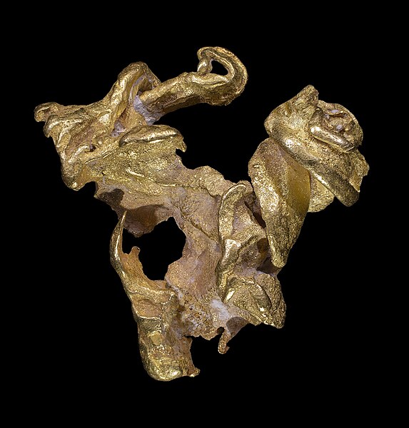
Mining is extraction of valuable minerals or other geological materials from the earth usually from an orebody, lode, vein, seam, reef or placer deposits. These deposits form a mineralized package that is of economic interest to the miner, ores recovered by mining include metals, coal, oil shale, gemstones, limestone, chalk, dimension stone, rock salt, potash, gravel, and clay. Mining is required to obtain any material that cannot be grown through agricultural processes, Mining in a wider sense includes extraction of any non-renewable resource such as petroleum, natural gas, or even water. Mining of stones and metal has been a human activity since pre-historic times, Mining operations usually create a negative environmental impact, both during the mining activity and after the mine has closed. Hence, most of the nations have passed regulations to decrease the impact. Work safety has long been a concern as well, and modern practices have significantly improved safety in mines, levels of metals recycling are generally low. Unless future end-of-life recycling rates are stepped up, some rare metals may become unavailable for use in a variety of consumer products, due to the low recycling rates, some landfills now contain higher concentrations of metal than mines themselves. Since the beginning of civilization, people have used stone, ceramics and, later and these were used to make early tools and weapons, for example, high quality flint found in northern France, southern England and Poland was used to create flint tools. Flint mines have been found in areas where seams of the stone were followed underground by shafts. The mines at Grimes Graves and Krzemionki are especially famous, other hard rocks mined or collected for axes included the greenstone of the Langdale axe industry based in the English Lake District. The oldest-known mine on archaeological record is the Lion Cave in Swaziland, at this site Paleolithic humans mined hematite to make the red pigment ochre. Mines of an age in Hungary are believed to be sites where Neanderthals may have mined flint for weapons. Ancient Egyptians mined malachite at Maadi, at first, Egyptians used the bright green malachite stones for ornamentations and pottery. Later, between 2613 and 2494 BC, large building projects required expeditions abroad to the area of Wadi Maghareh in order to secure minerals and other resources not available in Egypt itself. Quarries for turquoise and copper were found at Wadi Hammamat, Tura, Aswan and various other Nubian sites on the Sinai Peninsula. Mining in Egypt occurred in the earliest dynasties, the gold mines of Nubia were among the largest and most extensive of any in Ancient Egypt. These mines are described by the Greek author Diodorus Siculus, who mentions fire-setting as one used to break down the hard rock holding the gold. One of the complexes is shown in one of the earliest known maps, the miners crushed the ore and ground it to a fine powder before washing the powder for the gold dust
25.
Petroleum geology
–
Petroleum geology is the study of origin, occurrence, movement, accumulation, and exploration of hydrocarbon fuels. It refers to the set of geological disciplines that are applied to the search for hydrocarbons. These wells present only a 1-dimensional segment through the Earth and the skill of inferring 3-dimensional characteristics from them is one of the most fundamental in petroleum geology. Recently, the availability of inexpensive, high quality 3D seismic data and data from various electromagnetic geophysical techniques has greatly aided the accuracy of such interpretation, the following section discusses these elements in brief. For a more in-depth treatise, see the second half of this article below, the reservoir is a porous and permeable lithological unit or set of units that holds the hydrocarbon reserves. Analysis of reservoirs at the simplest level requires an assessment of their porosity, some of the key disciplines used in reservoir analysis are the fields of structural analysis, stratigraphy, sedimentology, and reservoir engineering. The seal, or cap rock, is a unit with low permeability that impedes the escape of hydrocarbons from the reservoir rock, common seals include evaporites, chalks and shales. Analysis of seals involves assessment of their thickness and extent, such that their effectiveness can be quantified, the trap is the stratigraphic or structural feature that ensures the juxtaposition of reservoir and seal such that hydrocarbons remain trapped in the subsurface, rather than escaping and being lost. Analysis of maturation involves assessing the history of the source rock in order to make predictions of the amount. Finally, careful studies of migration reveal information on how hydrocarbons move from source to reservoir, several major subdisciplines exist in petroleum geology specifically to study the seven key elements discussed above. In terms of source analysis, several facts need to be established. Firstly, the question of there actually is any source rock in the area must be answered. If the likelihood of there being a rock is thought to be high, the next matter to address is the state of thermal maturity of the source. Maturation of source rocks depends strongly on temperature, such that the majority of oil occurs in the 60° to 120°C range. Gas generation starts at similar temperatures, but may continue up beyond this range, in order to determine the likelihood of oil/gas generation, therefore, the thermal history of the source rock must be calculated. This is performed with a combination of analysis of the source rock and basin modelling methods, such as back-stripping. A full scale basin analysis is carried out prior to defining leads. This study tackles the petroleum system and studies source rock, burial history, maturation, migration and focus, all these elements are used to investigate where potential hydrocarbons might migrate towards
26.
Water resources
–
Water resources are sources of water that are potentially useful. Uses of water include agricultural, industrial, household, recreational and environmental activities, the majority of human uses require fresh water. 97% of the water on the Earth is salt water and only three percent is water, slightly over two thirds of this is frozen in glaciers and polar ice caps. The remaining unfrozen freshwater is mainly as groundwater, with only a small fraction present above ground or in the air. The framework for allocating resources to water users is known as water rights. Surface water is water in a river, lake or fresh water wetland, surface water is naturally replenished by precipitation and naturally lost through discharge to the oceans, evaporation, evapotranspiration and groundwater recharge. All of these factors affect the proportions of water loss. Human activities can have a large and sometimes devastating impact on these factors, humans often increase storage capacity by constructing reservoirs and decrease it by draining wetlands. Humans often increase runoff quantities and velocities by paving areas and channelizing the stream flow, the total quantity of water available at any given time is an important consideration. Some human water users have an intermittent need for water, for example, many farms require large quantities of water in the spring, and no water at all in the winter. To supply such a farm with water, a water system may require a large storage capacity to collect water throughout the year. Other users have a continuous need for water, such as a plant that requires water for cooling. To supply such a plant with water, a surface water system only needs enough storage capacity to fill in when average stream flow is below the power plants need. Nevertheless, over the term the average rate of precipitation within a watershed is the upper bound for average consumption of natural surface water from that watershed. Natural surface water can be augmented by importing water from another watershed through a canal or pipeline. It can also be artificially augmented from any of the sources listed here. Humans can also cause water to be lost through pollution. Brazil is the estimated to have the largest supply of fresh water in the world, followed by Russia
27.
Natural hazard
–
A natural hazard is a natural phenomenon that might have a negative effect on people or the environment. Natural hazard events can be grouped into two broad categories, geophysical hazards encompass geological and meteorological phenomena such as earthquakes, volcanic eruption, wildfire, cyclonic storms, flood, drought, and coastal erosion. Biological hazards can refer to an array of disease and infestation. Many geophysical hazards are related, for example, submarine earthquakes can cause tsunamis, floods and wildfires can result from a combination of geological, hydrological, and climatic factors. It is possible that some natural hazards are intertemporally correlated as well, an example of the division between a natural hazard and a natural disaster is that the 1906 San Francisco earthquake was a disaster, whereas living on a fault line is a hazard. An avalanche occurs when a large snow mass slides down a mountainside, an avalanche is an example of a gravity current consisting of granular material. In an avalanche, lots of material or mixtures of different types of fall or slide rapidly under the force of gravity. Avalanches are often classified by the size or severity of consequences resulting from the event, an earthquake is the sudden release of energy stored as lithospheric stress that radiates seismic waves. Many earthquakes happen each day, few of which are enough to cause significant damage. Coastal erosion can result from long-term processes as well as from events such as tropical cyclones or other severe storm events. These flows can destroy entire towns in seconds and kill thousands of people and this is based on natural events. A landslide is a displacement of sediment, usually down a slope. A sinkhole is a depression in the surface topography, usually caused by the collapse of a subterranean structure such as a cave. Although rare, large sinkholes that develop suddenly in populated areas can lead to the collapse of buildings, a volcanic eruption is the point in which a volcano is active and releases its power, and the eruptions come in many forms. They range from daily small eruptions occur in places like Kilauea in Hawaii, to megacolossal eruptions from supervolcanoes like Lake Taupo. Some eruptions form pyroclastic flows, which are high-temperature clouds of ash, a blizzard is a severe winter stormer icy and windy conditions characterized by low temperature, strong wind and heavy snow. Scientists warn that global warming and climate change may result in more extensive droughts in coming years and these extensive droughts are likely to occur within the African continent due to its very low precipitation levels and high climate. A hailstorm is a hazard where a thunderstorm produces numerous hailstones which damage the location in which they fall
28.
Climate change
–
Climate change is a change in the statistical distribution of weather patterns when that change lasts for an extended period of time. Climate change may refer to a change in weather conditions. Climate change is caused by such as biotic processes, variations in solar radiation received by Earth, plate tectonics. Certain human activities have also identified as significant causes of recent climate change. Scientists actively work to understand past and future climate by using observations, more recent data are provided by the instrumental record. The most general definition of change is a change in the statistical properties of the climate system when considered over long periods of time. Accordingly, fluctuations over periods shorter than a few decades, such as El Niño, the term climate change is often used to refer specifically to anthropogenic climate change. Anthropogenic climate change is caused by activity, as opposed to changes in climate that may have resulted as part of Earths natural processes. In this sense, especially in the context of environmental policy, within scientific journals, global warming refers to surface temperature increases while climate change includes global warming and everything else that increasing greenhouse gas levels affect. A related term is climatic change, in 1966, the World Meteorological Organization proposed the term climatic change to encompass all forms of climatic variability on time-scales longer than 10 years, regardless of cause. Change was a given and climatic was used as an adjective to describe this kind of change, when it was realized that human activities had a potential to drastically alter the climate, the term climate change replaced climatic change as the dominant term to reflect an anthropogenic cause. Climate change was incorporated in the title of the Intergovernmental Panel on Climate Change, Climate change, used as a noun, became an issue rather than the technical description of changing weather. On the broadest scale, the rate at which energy is received from the Sun and this energy is distributed around the globe by winds, ocean currents, and other mechanisms to affect the climates of different regions. Factors that can shape climate are called climate forcings or forcing mechanisms, there are a variety of climate change feedbacks that can either amplify or diminish the initial forcing. Some parts of the system, such as the oceans and ice caps, respond more slowly in reaction to climate forcings. There are also key factors which when exceeded can produce rapid change. Forcing mechanisms can be internal or external. Internal forcing mechanisms are natural processes within the system itself
29.
Geotechnical engineering
–
Geotechnical engineering is the branch of civil engineering concerned with the engineering behavior of earth materials. A typical geotechnical engineering project begins with a review of project needs to define the material properties. Site investigations are needed to gain an understanding of the area in or on which the engineering will take place, a geotechnical engineer then determines and designs the type of foundations, earthworks, and/or pavement subgrades required for the intended man-made structures to be built. Foundations built for above-ground structures include shallow and deep foundations, retaining structures include earth-filled dams and retaining walls. Earthworks include embankments, tunnels, dikes and levees, channels, reservoirs, deposition of hazardous waste, Geotechnical engineering is also related to coastal and ocean engineering. Coastal engineering can involve the design and construction of wharves, marinas, ocean engineering can involve foundation and anchor systems for offshore structures such as oil platforms. The fields of engineering and engineering geology are closely related. However, the field of engineering is a specialty of engineering. Humans have historically used soil as a material for flood control, irrigation purposes, burial sites, building foundations, as the cities expanded, structures were erected supported by formalized foundations, Ancient Greeks notably constructed pad footings and strip-and-raft foundations. Until the 18th century, however, no basis for soil design had been developed. Several foundation-related engineering problems, such as the Leaning Tower of Pisa, the earliest advances occurred in the development of earth pressure theories for the construction of retaining walls. Henri Gautier, a French Royal Engineer, recognized the natural slope of different soils in 1717, a rudimentary soil classification system was also developed based on a materials unit weight, which is no longer considered a good indication of soil type. The application of the principles of mechanics to soils was documented as early as 1773 when Charles Coulomb developed improved methods to determine the pressures against military ramparts. By combining Coulombs theory with Christian Otto Mohrs 2D stress state, although it is now recognized that precise determination of cohesion is impossible because c is not a fundamental soil property, the Mohr-Coulomb theory is still used in practice today. In the 19th century Henry Darcy developed what is now known as Darcys Law describing the flow of fluids in porous media, albert Atterberg developed the clay consistency indices that are still used today for soil classification. Osborne Reynolds recognized in 1885 that shearing causes volumetric dilation of dense, modern geotechnical engineering is said to have begun in 1925 with the publication of Erdbaumechanik by Karl Terzaghi. Terzaghi also developed the framework for theories of bearing capacity of foundations, in his 1948 book, Donald Taylor recognized that interlocking and dilation of densely packed particles contributed to the peak strength of a soil. Critical state soil mechanics is the basis for many contemporary advanced constitutive models describing the behavior of soil, Geotechnical centrifuge modeling is a method of testing physical scale models of geotechnical problems
30.
Rock cycle
–
The rock cycle is a basic concept in geology that describes the time-consuming transitions through geologic time among the three main rock types, sedimentary, metamorphic, and igneous. As the adjacent diagram illustrates, each of the types of rocks is altered or destroyed when it is forced out of its equilibrium conditions. An igneous rock such as basalt may break down and dissolve when exposed to the atmosphere, due to the driving forces of the rock cycle, plate tectonics and the water cycle, rocks do not remain in equilibrium and are forced to change as they encounter new environments. The rock cycle is an illustration that explains how the three types are related to each other, and how processes change from one type to another over time. This cyclical aspect makes rock change a geologic cycle and, on planets containing life, the original concept of the rock cycle is usually attributed to James Hutton, from the eighteenth century Father of Geology. This concept of a repetitive non-evolutionary rock cycle remained dominant until the plate tectonics revolution of the 1960s, with the developing understanding of the driving engine of plate tectonics, the rock cycle changed from endlessly repetitive to a gradually evolving process. The Wilson cycle was developed by J. Tuzo Wilson during the 1950s and 1960s, the world is made out of rocks. When rocks are pushed deep under the Earths surface, they may melt into magma, if the conditions no longer exist for the magma to stay in its liquid state, it cools and solidifies into an igneous rock. A rock that cools within the Earth is called intrusive or plutonic and cools very slowly, as a result of volcanic activity, magma may cool very rapidly while being on the Earths surface exposed to the atmosphere and are called extrusive or volcanic rocks. Any of the three types of rocks can melt into magma and cool into igneous rocks. Silicification, the replacement of the minerals by crystalline or crypto-crystalline silica, is most common in rocks, such as rhyolite. Kaolinization is the decomposition of the feldspars, which are the most common minerals in rocks, into kaolin. Serpentinization is the alteration of olivine to serpentine, it is typical of peridotites, in uralitization, secondary hornblende replaces augite, chloritization is the alteration of augite to chlorite, and is seen in many diabases, diorites and greenstones. Epidotization occurs also in rocks of this group, and consists in the development of epidote from biotite, hornblende, rocks exposed to high temperatures and pressures can be changed physically or chemically to form a different rock, called metamorphic. Regional metamorphism refers to the effects on large masses of rocks over a wide area and these rocks commonly exhibit distinct bands of differing mineralogy and colors, called foliation. Another main type of metamorphism is caused when a body of rock comes into contact with an intrusion that heats up this surrounding country rock. Any pre-existing type of rock can be modified by the processes of metamorphism, rocks exposed to the atmosphere are variably unstable and subject to the processes of weathering and erosion. Weathering and erosion break the rock down into smaller fragments
31.
Igneous rock
–
Igneous rock, or magmatic rock, is one of the three main rock types, the others being sedimentary and metamorphic. Igneous rock is formed through the cooling and solidification of magma or lava, the magma can be derived from partial melts of existing rocks in either a planets mantle or crust. Typically, the melting is caused by one or more of three processes, an increase in temperature, a decrease in pressure, or a change in composition, solidification into rock occurs either below the surface as intrusive rocks or on the surface as extrusive rocks. Igneous rock may form with crystallization to form granular, crystalline rocks, Igneous and metamorphic rocks make up 90–95% of the top 16 km of the Earths crust by volume. Igneous rocks form about 15% of the Earths current land surface, most of the Earths oceanic crust is made of igneous rock. In terms of modes of occurrence, igneous rocks can be either intrusive or extrusive, the mineral grains in such rocks can generally be identified with the naked eye. Intrusive rocks can also be classified according to the shape and size of the intrusive body, typical intrusive formations are batholiths, stocks, laccoliths, sills and dikes. When the magma solidifies within the earths crust, it cools slowly forming coarse textured rocks, such as granite, gabbro, the central cores of major mountain ranges consist of intrusive igneous rocks, usually granite. When exposed by erosion, these cores may occupy huge areas of the Earths surface, intrusive igneous rocks that form at depth within the crust are termed plutonic rocks and are usually coarse-grained. Intrusive igneous rocks that form near the surface are termed subvolcanic or hypabyssal rocks, hypabyssal rocks are less common than plutonic or volcanic rocks and often form dikes, sills, laccoliths, lopoliths, or phacoliths. Extrusive igneous rocks, also known as rocks, are formed at the crusts surface as a result of the partial melting of rocks within the mantle. Extrusive igneous rocks cool and solidify quicker than intrusive igneous rocks and they are formed by the cooling of molten magma on the earths surface. The magma, which is brought to the surface through fissures or volcanic eruptions, hence such rocks are smooth, crystalline and fine-grained. Basalt is an extrusive igneous rock and forms lava flows, lava sheets. Some kinds of basalt solidify to form long polygonal columns, the Giants Causeway in Antrim, Northern Ireland is an example. The molten rock, with or without suspended crystals and gas bubbles, is called magma and it rises because it is less dense than the rock from which it was created. When magma reaches the surface from beneath water or air, it is called lava, eruptions of volcanoes into air are termed subaerial, whereas those occurring underneath the ocean are termed submarine. Black smokers and mid-ocean ridge basalt are examples of volcanic activity
32.
Sedimentary
–
Sedimentary rocks are types of rock that are formed by the deposition and subsequent cementation of that material at the Earths surface and within bodies of water. Sedimentation is the name for processes that cause mineral and/or organic particles to settle in place. The particles that form a rock by accumulating are called sediment. Sedimentation may also occur as minerals precipitate from solution or shells of aquatic creatures settle out of suspension. The sedimentary rock cover of the continents of the Earths crust is extensive, sedimentary rocks are only a thin veneer over a crust consisting mainly of igneous and metamorphic rocks. Sedimentary rocks are deposited in layers as strata, forming a structure called bedding, sedimentary rocks are also important sources of natural resources like coal, fossil fuels, drinking water or ores. The study of the sequence of rock strata is the main source for an understanding of the Earths history, including palaeogeography, paleoclimatology. The scientific discipline that studies the properties and origin of rocks is called sedimentology. Sedimentology is part of both geology and physical geography and overlaps partly with other disciplines in the Earth sciences, such as pedology, geomorphology, geochemistry, sedimentary rocks have also been found on Mars. Clastic sedimentary rocks are composed of rock fragments that were cemented by silicate minerals. Clastic rocks are composed largely of quartz, feldspar, rock fragments, clay minerals, and mica, any type of mineral may be present, clastic sedimentary rocks, are subdivided according to the dominant particle size. Most geologists use the Udden-Wentworth grain size scale and divide unconsolidated sediment into three fractions, gravel, sand, and mud and this tripartite subdivision is mirrored by the broad categories of rudites, arenites, and lutites, respectively, in older literature. The subdivision of these three categories is based on differences in clast shape, conglomerates and breccias), composition. Conglomerates are dominantly composed of rounded gravel, while breccias are composed of dominantly angular gravel, composition of framework grains The relative abundance of sand-sized framework grains determines the first word in a sandstone name. Naming depends on the dominance of the three most abundant components quartz, feldspar, or the lithic fragments that originated from other rocks, all other minerals are considered accessories and not used in the naming of the rock, regardless of abundance. Clean sandstones with open space are called arenites. Muddy sandstones with abundant muddy matrix are called wackes, six sandstone names are possible using the descriptors for grain composition and the amount of matrix. Mudrocks are sedimentary rocks composed of at least 50% silt- and clay-sized particles and these relatively fine-grained particles are commonly transported by turbulent flow in water or air, and deposited as the flow calms and the particles settle out of suspension
33.
Metamorphic rock
–
Metamorphic rocks arise from the transformation of existing rock types, in a process called metamorphism, which means change in form. The original rock is subjected to heat and pressure, causing profound physical and/or chemical change, the protolith may be a sedimentary, an igneous, or even an existing type of metamorphic rock. Metamorphic rocks make up a part of the Earths crust. They are classified by texture and by chemical and mineral assemblage and they may be formed simply by being deep beneath the Earths surface, subjected to high temperatures and the great pressure of the rock layers above it. They can form from tectonic processes such as continental collisions, which cause horizontal pressure and they are also formed when rock is heated up by the intrusion of hot molten rock called magma from the Earths interior. The study of rocks provides information about the temperatures and pressures that occur at great depths within the Earths crust. Some examples of rocks are gneiss, slate, marble, schist. Metamorphic minerals are those that only at the high temperatures and pressures associated with the process of metamorphism. These minerals, known as index minerals, include sillimanite, kyanite, staurolite, andalusite, and some garnet. Other minerals, such as olivines, pyroxenes, amphiboles, micas, feldspars, and quartz, may be found in metamorphic rocks and these minerals formed during the crystallization of igneous rocks. They are stable at temperatures and pressures and may remain chemically unchanged during the metamorphic process. However, all minerals are only within certain limits. The change in the size of the rock during the process of metamorphism is called recrystallization. Both high temperatures and pressures contribute to recrystallization, high temperatures allow the atoms and ions in solid crystals to migrate, thus reorganizing the crystals, while high pressures cause solution of the crystals within the rock at their point of contact. The layering within metamorphic rocks is called foliation, and it occurs when a rock is being shortened along one axis during recrystallization. This causes the platy or elongated crystals of minerals, such as mica and chlorite and this results in a banded, or foliated rock, with the bands showing the colors of the minerals that formed them. Textures are separated into foliated and non-foliated categories, foliated rock is a product of differential stress that deforms the rock in one plane, sometimes creating a plane of cleavage. For example, slate is a metamorphic rock, originating from shale
34.
Crystallization
–
Crystallization is the process where a solid forms where the atoms or molecules are highly organized in a structure known as a crystal. Some of the ways which crystals form are through precipitating from a solution, crystallization is also a chemical solid–liquid separation technique, in which mass transfer of a solute from the liquid solution to a pure solid crystalline phase occurs. In chemical engineering crystallization occurs in a crystallizer, crystallization is therefore related to precipitation, although the result is not amorphous or disordered, but a crystal. The crystallization process consists of two events, nucleation and crystal growth which are driven by thermodynamic properties as well as chemical properties. These stable clusters constitute the nuclei, therefore, the clusters need to reach a critical size in order to become stable nuclei. Such critical size is dictated by different factors. The crystal growth is the subsequent size increase of the nuclei that succeed in achieving the critical cluster size, crystal growth is a dynamic process occurring in equilibrium where solute molecules or atoms precipitate out of solution, and dissolve back into solution. Supersaturation is one of the forces of crystallization, as the solubility of a species is an equilibrium process quantified by Ksp. Depending upon the conditions, either nucleation or growth may be predominant over the other, many compounds have the ability to crystallize with some having different crystal structures, a phenomenon called polymorphism. Each polymorph is in fact a different thermodynamic solid state and crystal polymorphs of the compound exhibit different physical properties, such as dissolution rate, shape, melting point. For this reason, polymorphism is of importance in industrial manufacture of crystalline products. Additionally, crystal phases can sometimes be interconverted by varying factors such as temperature, there are many examples of natural process that involve crystallization. Geological time scale process examples include, Natural crystal formation, Stalactite/stalagmite, usual time scale process examples include, Snow flakes formation, Honey crystallization. Crystal formation can be divided into two types, where the first type of crystals are composed of a cation and anion, also known as a salt, the second type of crystals are composed of uncharged species, for example menthol. The formation of a solution does not guarantee crystal formation. A typical laboratory technique for crystal formation is to dissolve the solid in a solution in which it is partially soluble, the hot mixture is then filtered to remove any insoluble impurities. The filtrate is allowed to slowly cool, crystals that form are then filtered and washed with a solvent in which they are not soluble, but is miscible with the mother liquor. The process is repeated to increase the purity in a technique known as recrystallization
35.
Magma
–
Besides molten rock, magma may also contain suspended crystals, dissolved gas and sometimes gas bubbles. Magma often collects in magma chambers that may feed a volcano or solidify underground to form an intrusion, magma is capable of intruding into adjacent rocks, extrusion onto the surface as lava, and explosive ejection as tephra to form pyroclastic rock. Magma is a complex high-temperature fluid substance, temperatures of most magmas are in the range 700 °C to 1300 °C, but very rare carbonatite magmas may be as cool as 600 °C, and komatiite magmas may have been as hot as 1600 °C. Environments of magma formation and compositions are commonly correlated, environments include subduction zones, continental rift zones, mid-ocean ridges and hotspots. Despite being found in such locales, the bulk of the Earths crust. Except for the outer core, most of the Earth takes the form of a rheid. Magma, as liquid, preferentially forms in high temperature, low pressure environments within several kilometers of the Earths surface, magma compositions may evolve after formation by fractional crystallization, contamination, and magma mixing. By definition rock formed of solidified magma is called igneous rock, melting of solid rocks to form magma is controlled by three physical parameters, temperature, pressure, and composition. Mechanisms are discussed in the entry for igneous rock, as a rock melts, its volume changes. When enough rock is melted, the small globules of melt link up, under pressure within the earth, as little as a fraction of a percent partial melting may be sufficient to cause melt to be squeezed from its source. The degree of melting is critical for determining what type of magma is produced. The degree of partial melting required to form a melt can be estimated by considering the relative enrichment of incompatible elements versus compatible elements, incompatible elements commonly include potassium, barium, cesium, and rubidium. Rock types produced by small degrees of melting in the Earths mantle are typically alkaline. Typically, primitive melts of this composition form lamprophyre, lamproite, kimberlite and sometimes nepheline-bearing mafic rocks such as alkali basalts, pegmatite may be produced by low degrees of partial melting of the crust. Some granite-composition magmas are eutectic melts, and they may be produced by low to high degrees of melting of the crust. At high degrees of melting of the crust, granitoids such as tonalite, granodiorite and monzonite can be produced. Being only the time in recorded history that magma had been reached, IDDP decided to invest in the hole. A cemented steel case was constructed in the hole with a perforation at the close to the magma
36.
Lava
–
Lava is the molten rock expelled by a volcano during an eruption. The resulting rock after solidification and cooling is called lava. The molten rock is formed in the interior of planets, including Earth. The source of the heat melts the rock within the earth is geothermal energy. When first erupted from a vent, lava is a liquid usually at temperatures from 700 to 1,200 °C. A lava flow is an outpouring of lava, which is created during a non-explosive effusive eruption. When it has stopped moving, lava solidifies to form igneous rock, the term lava flow is commonly shortened to lava. Although lava can be up to 100,000 times more viscous than water, lava can flow great distances before cooling and solidifying because of its thixotropic, explosive eruptions produce a mixture of volcanic ash and other fragments called tephra, rather than lava flows. The word lava comes from Italian, and is derived from the Latin word labes which means a fall or slide. The first use in connection with extruded magma was apparently in an account written by Francesco Serao on the eruption of Vesuvius between May 14 and June 4,1737. Serao described a flow of lava as an analogy to the flow of water. The composition of almost all lava of the Earths crust is dominated by silicate minerals, mostly feldspars, olivine, pyroxenes, amphiboles, micas, igneous rocks, which form lava flows when erupted, can be classified into three chemical types, felsic, intermediate, and mafic. These classes are primarily chemical, however, the chemistry of lava also tends to correlate with the temperature, its viscosity. Felsic or silicic lavas such as rhyolite and dacite typically form lava spines, most silicic lava flows are extremely viscous, and typically fragment as they extrude, producing blocky autobreccias. Felsic magmas can erupt at temperatures as low as 650 to 750 °C, unusually hot rhyolite lavas, however, may flow for distances of many tens of kilometres, such as in the Snake River Plain of the northwestern United States. Intermediate or andesitic lavas are lower in aluminium and silica, and usually somewhat richer in magnesium, intermediate lavas form andesite domes and block lavas, and may occur on steep composite volcanoes, such as in the Andes. Poorer in aluminium and silica than felsic lavas, and also commonly hotter, greater temperatures tend to destroy polymerized bonds within the magma, promoting more fluid behaviour and also a greater tendency to form phenocrysts. Higher iron and magnesium tends to manifest as a darker groundmass, mafic or basaltic lavas are typified by their high ferromagnesian content, and generally erupt at temperatures in excess of 950 °C
37.
Weathering
–
Weathering is the breaking down of rocks, soil, and minerals as well as wood and artificial materials through contact with the Earths atmosphere, waters, and biological organisms. Two important classifications of weathering processes exist – physical and chemical weathering, mechanical or physical weathering involves the breakdown of rocks and soils through direct contact with atmospheric conditions, such as heat, water, ice and pressure. While physical weathering is accentuated in very cold or very dry environments, chemical reactions are most intense where the climate is wet, however, both types of weathering occur together, and each tends to accelerate the other. For example, physical abrasion decreases the size of particles and therefore increases their surface area, the various agents act in concert to convert primary minerals to secondary minerals and release plant nutrient elements in soluble forms. The materials left over after the rock breaks down combined with organic material creates soil, in addition, many of Earths landforms and landscapes are the result of weathering processes combined with erosion and re-deposition. Physical weathering, also recognized as mechanical weathering, is the class of processes that causes the disintegration of rocks without chemical change, the primary process in physical weathering is abrasion. However, chemical and physical weathering often go hand in hand, physical weathering can occur due to temperature, pressure, frost etc. For example, cracks exploited by physical weathering will increase the area exposed to chemical action. Abrasion by water, ice, and wind loaded with sediment can have tremendous cutting power, as is amply demonstrated by the gorges, ravines. In glacial areas, huge moving ice masses embedded with soil and rock fragments grind down rocks in their path, plant roots sometimes enter cracks in rocks and pry them apart, resulting in some disintegration, Burrowing animals may help disintegrate rock through their physical action. However, such influences are usually of importance in producing parent material when compared to the drastic physical effects of water, ice, wind. Physical weathering is called mechanical weathering or disaggregation. Thermal stress weathering results from the expansion and contraction of rock, for example, heating of rocks by sunlight or fires can cause expansion of their constituent minerals. As some minerals expand more than others, temperature changes set up differential stresses that cause the rock to crack apart. Because the outer surface of a rock is often warmer or colder than the more protected inner portions and this process may be sharply accelerated if ice forms in the surface cracks. When water freezes, it expands with a force of about 1465 Mg/m^2, disintegrating huge rock masses, thermal stress weathering comprises two main types, thermal shock and thermal fatigue. Thermal stress weathering is an important mechanism in deserts, where there is a diurnal temperature range, hot in the day. The repeated heating and cooling exerts stress on the layers of rocks
38.
Erosion
–
In earth science, erosion is the action of surface processes that remove soil, rock, or dissolved material from one location on the Earths crust, then transport it away to another location. Eroded sediment or solutes may be transported just a few millimetres, the rates at which such processes act control how fast a surface is eroded. Feedbacks are also possible between rates of erosion and the amount of eroded material that is carried by, for example. Processes of erosion that produce sediment or solutes from a place contrast with those of deposition, while erosion is a natural process, human activities have increased by 10-40 times the rate at which erosion is occurring globally. At well-known agriculture sites such as the Appalachian Mountains, intensive farming practices have caused erosion up to 100x the speed of the rate of erosion in the region. Excessive erosion causes both on-site and off-site problems, on-site impacts include decreases in agricultural productivity and ecological collapse, both because of loss of the nutrient-rich upper soil layers. In some cases, the end result is desertification. Off-site effects include sedimentation of waterways and eutrophication of bodies, as well as sediment-related damage to roads. Intensive agriculture, deforestation, roads, anthropogenic climate change and urban sprawl are amongst the most significant human activities in regard to their effect on stimulating erosion, however, there are many prevention and remediation practices that can curtail or limit erosion of vulnerable soils. Rainfall, and the surface runoff which may result from rainfall, produces four types of soil erosion, splash erosion, sheet erosion, rill erosion. Splash erosion is generally seen as the first and least severe stage in the erosion process. In splash erosion, the impact of a falling raindrop creates a crater in the soil. The distance these soil particles travel can be as much as 0.6 m vertically and 1.5 m horizontally on level ground. If the soil is saturated, or if the rate is greater than the rate at which water can infiltrate into the soil. If the runoff has sufficient flow energy, it will transport loosened soil particles down the slope, sheet erosion is the transport of loosened soil particles by overland flow. Rill erosion refers to the development of small, ephemeral concentrated flow paths which function as both sediment source and sediment delivery systems for erosion on hillslopes, generally, where water erosion rates on disturbed upland areas are greatest, rills are active. Flow depths in rills are typically of the order of a few centimetres or less and this means that rills exhibit hydraulic physics very different from water flowing through the deeper, wider channels of streams and rivers. Gully erosion occurs when water accumulates and rapidly flows in narrow channels during or immediately after heavy rains or melting snow
39.
Deposition (geology)
–
Deposition is the geological process in which sediments, soil and rocks are added to a landform or land mass. Deposition can also refer to the buildup of sediment from organically derived matter or chemical processes, for example, chalk is made up partly of the microscopic calcium carbonate skeletons of marine plankton, the deposition of which has induced chemical processes to deposit further calcium carbonate. Similarly, the formation of coal begins with deposition of material, mainly from plants. The null-point hypothesis explains how sediment is deposited throughout a shore profile according to its grain size and this is due to the influence of hydraulic energy, resulting in a seaward-fining of sediment particle size, or where fluid forcing equals gravity for each grain size. The concept can also be explained as sediment of a particular size may move across the profile to a position where it is in equilibrium with the wave, figure 1 illustrates this relationship between sediment grain size and the depth of the marine environment. The relatively strong onshore stroke of the forms a eddy or vortex on the lee side of the ripple, provided the onshore flow persists. Where there is symmetry in ripple shape the vortex is neutralised and this creates a cloudy water column which travels under tidal influence as the wave orbital motion is in equilibrium. R is the radius of the object, ρ is the mass density of the fluid, g is the gravitational acceleration, Cd is the drag coefficient. When the fluid becomes more viscous due to grain sizes or larger settling velocities, prediction is less straight forward. Cohesion of sediment occurs with the grain sizes associated with silts and clays. Akaroa Harbour is located on Banks Peninsula, Canterbury, New Zealand and this research shows conclusive evidence for the null point theory existing on tidal flats with differing hydrodynamic energy levels and also on flats that are both erosional and accretional. Kirby R. Cheniers can be found at any level on the foreshore and this is because sediment grain size analysis throughout a profile allows inference into the erosion or accretion rates possible if shore dynamics are modified. Planners and managers should also be aware that the environment is dynamic. Cementation Cross-bedding Drift Flocculation Longshore drift Overbank Sedimentary rock Sedimentary structures Settling Shields parameter Stokes law Superficial deposits
40.
Mineral
–
A mineral is a naturally occurring chemical compound, usually of crystalline form and abiogenic in origin. A mineral has one specific chemical composition, whereas a rock can be an aggregate of different minerals or mineraloids, the study of minerals is called mineralogy. There are over 5,300 known mineral species, over 5,070 of these have been approved by the International Mineralogical Association, the silicate minerals compose over 90% of the Earths crust. The diversity and abundance of species is controlled by the Earths chemistry. Silicon and oxygen constitute approximately 75% of the Earths crust, which translates directly into the predominance of silicate minerals, minerals are distinguished by various chemical and physical properties. Differences in chemical composition and crystal structure distinguish the various species, changes in the temperature, pressure, or bulk composition of a rock mass cause changes in its minerals. Minerals can be described by their various properties, which are related to their chemical structure. Common distinguishing characteristics include crystal structure and habit, hardness, lustre, diaphaneity, colour, streak, tenacity, cleavage, fracture, parting, more specific tests for describing minerals include magnetism, taste or smell, radioactivity and reaction to acid. Minerals are classified by key chemical constituents, the two dominant systems are the Dana classification and the Strunz classification, the silicate class of minerals is subdivided into six subclasses by the degree of polymerization in the chemical structure. All silicate minerals have a unit of a 4− silica tetrahedron—that is, a silicon cation coordinated by four oxygen anions. These tetrahedra can be polymerized to give the subclasses, orthosilicates, disilicates, cyclosilicates, inosilicates, phyllosilicates, other important mineral groups include the native elements, sulfides, oxides, halides, carbonates, sulfates, and phosphates. The first criterion means that a mineral has to form by a natural process, stability at room temperature, in the simplest sense, is synonymous to the mineral being solid. More specifically, a compound has to be stable or metastable at 25 °C, modern advances have included extensive study of liquid crystals, which also extensively involve mineralogy. Minerals are chemical compounds, and as such they can be described by fixed or a variable formula, many mineral groups and species are composed of a solid solution, pure substances are not usually found because of contamination or chemical substitution. Finally, the requirement of an ordered atomic arrangement is usually synonymous with crystallinity, however, crystals are also periodic, an ordered atomic arrangement gives rise to a variety of macroscopic physical properties, such as crystal form, hardness, and cleavage. There have been recent proposals to amend the definition to consider biogenic or amorphous substances as minerals. The formal definition of an approved by the IMA in 1995, A mineral is an element or chemical compound that is normally crystalline. However, if geological processes were involved in the genesis of the compound, Mineral classification schemes and their definitions are evolving to match recent advances in mineral science
41.
Fabric (geology)
–
In geology, a rocks fabric describes the spatial and geometric configuration of all the elements that make it up. In sedimentary rocks, the fabric developed depends on the depositional environment, in structural geology, fabrics may provide information on both the orientation and magnitude of the strains that have affected a particular piece of deformed rock. Shape fabric — a fabric that is defined by the orientation of inequant elements within the rock. It may also be formed by the deformation of originally equant elements such as mineral grains, crystallographic preferred orientation — in plastically deformed rocks, the constituent minerals commonly display a preferred orientation of their crystal axes as a result of dislocation processes. S-fabric — a planar fabric such as cleavage or foliation, when it forms the dominant fabric in a rock, it may be called an S-tectonite. Penetrative fabric — a fabric that is present throughout the rock, generally down to the grain scale, although this does also depend on the scale at which the observations take place
42.
Hydrochloric acid
–
Hydrochloric acid is a corrosive, strong mineral acid with many industrial uses. A colorless, highly pungent solution of chloride in water. Free hydrochloric acid was first formally described in the 16th century by Libavius, later, it was used by chemists such as Glauber, Priestley, and Davy in their scientific research. It has numerous applications, including household cleaning, production of gelatin and other food additives, descaling. About 20 million tonnes of acid are produced worldwide annually. It is also found naturally in gastric acid, Hydrochloric acid was known to European alchemists as spirits of salt or acidum salis. Both names are used, especially in other languages, such as German, Salzsäure, Dutch, Zoutzuur, Swedish, Saltsyra, Turkish, Tuz Ruhu, Polish, kwas solny and Chinese. Gaseous HCl was called marine acid air, the old name muriatic acid has the same origin, and this name is still sometimes used. The name hydrochloric acid was coined by the French chemist Joseph Louis Gay-Lussac in 1814, aqua regia, a mixture consisting of hydrochloric and nitric acids, prepared by dissolving sal ammoniac in nitric acid, was described in the works of Pseudo-Geber, a 13th-century European alchemist. Other references suggest that the first mention of aqua regia is in Byzantine manuscripts dating to the end of the 13th century, free hydrochloric acid was first formally described in the 16th century by Libavius, who prepared it by heating salt in clay crucibles. Joseph Priestley of Leeds, England prepared pure hydrogen chloride in 1772, during the Industrial Revolution in Europe, demand for alkaline substances increased. A new industrial process developed by Nicolas Leblanc of Issoundun, France enabled cheap large-scale production of sodium carbonate, in this Leblanc process, common salt is converted to soda ash, using sulfuric acid, limestone, and coal, releasing hydrogen chloride as a by-product. Until the British Alkali Act 1863 and similar legislation in other countries, after the passage of the act, soda ash producers were obliged to absorb the waste gas in water, producing hydrochloric acid on an industrial scale. In the 20th century, the Leblanc process was replaced by the Solvay process without a hydrochloric acid by-product. Since hydrochloric acid was already settled as an important chemical in numerous applications. After the year 2000, hydrochloric acid is made by absorbing by-product hydrogen chloride from industrial organic compounds production. Hydrochloric acid is the salt of hydronium ion, H3O+ and chloride and it is usually prepared by treating HCl with water. H C l + H2 O ⟶ H3 O + + C l − Hydrochloric acid can therefore be used to prepare salts called chlorides, Hydrochloric acid is a strong acid, since it is completely dissociated in water
43.
Halite
–
Halite, commonly known as rock salt, is a type of salt, the mineral form of sodium chloride. The mineral is colorless or white, but may also be light blue, dark blue, purple, pink, red, orange, yellow or gray depending on the amount. It commonly occurs with other evaporite minerals such as several of the sulfates, halides. Halite occurs in vast beds of sedimentary evaporite minerals that result from the drying up of enclosed lakes, playas, salt beds may be hundreds of meters thick and underlie broad areas. In the United States and Canada extensive underground beds extend from the Appalachian basin of western New York through parts of Ontario, other deposits are in Ohio, Kansas, New Mexico, Nova Scotia and Saskatchewan. The Khewra salt mine is a deposit of halite near Islamabad. In the United Kingdom there are three mines, the largest of these is at Winsford in Cheshire producing on average a million tonnes per year. Salt domes are vertical diapirs or pipe-like masses of salt that have been squeezed up from underlying salt beds by mobilization due to the weight of overlying rock. Salt domes contain anhydrite, gypsum, and native sulfur, in addition to halite and sylvite and they are common along the Gulf coasts of Texas and Louisiana and are often associated with petroleum deposits. Germany, Spain, the Netherlands, Romania and Iran also have salt domes, salt glaciers exist in arid Iran where the salt has broken through the surface at high elevation and flows downhill. In all of these cases, halite is said to be behaving in the manner of a rheid, unusual, purple, fibrous vein filling halite is found in France and a few other localities. Halite crystals termed hopper crystals appear to be skeletons of the cubes, with the edges present and stairstep depressions on, or rather in. In a rapidly crystallizing environment, the edges of the cubes simply grow faster than the centers, halite crystals form very quickly in some rapidly evaporating lakes resulting in modern artifacts with a coating or encrustation of halite crystals. Halite flowers are rare stalactites of curling fibers of halite that are found in certain arid caves of Australias Nullarbor Plain, halite stalactites and encrustations are also reported in the Quincy native copper mine of Hancock, Michigan. Halite is often used both residentially and municipally for managing ice, because brine has a lower freezing point than pure water, putting salt or saltwater on ice that is near 0 °C will cause it to melt. It is common for homeowners in cold climates to spread salt on their sidewalks and driveways after a snow storm to melt the ice. It is not necessary to use so much salt that the ice is melted, rather. Also, many cities will spread a mixture of sand and salt on roads during, in addition to de-icing, rock salt is occasionally used in agriculture