Geology of Minnesota
Videos
The geology of Minnesota comprises the rock, minerals, and soils of the U.S. state of Minnesota, including their formation, development, distribution, and condition.
Shaded relief image: Superior Upland in the northeast, the flat Red River Valley in the northwest, Central Minnesota's irregular landscape, the Coteau des Prairies and Minnesota River in the southwest, and the southeast's dissected Driftless Area along the Mississippi River below its confluences with the Minnesota and St. Croix in East Central Minnesota


Limestone bluffs cut by the Root River in Olmsted County

Limestone over sandstone in the gorge of Minnehaha Creek
Driftless Area
Videos
The Driftless Area, also known as Bluff Country and the Paleozoic Plateau, is a topographic and cultural region in the Midwestern United States that comprises southwestern Wisconsin, southeastern Minn

Autumn in the Driftless Area of Cross Plains, Wisconsin
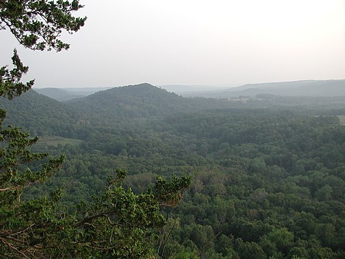
Typical terrain of the Driftless Area as viewed from Wildcat Mountain State Park in Vernon County, Wisconsin

Typical Driftless Area scenery near Mazomanie, Wisconsin

Tablet Rock Overlook in Wisconsin's Devils Lake State Park, located in the Baraboo Range