Gettysburg Battlefield
Videos
The Gettysburg Battlefield is the area of the July 1–3, 1863, military engagements of the Battle of Gettysburg in and around Gettysburg, Pennsylvania. Locations of military engagements extend from the
The Pennsylvania Memorial, the battlefield's largest and one of over 12 state monuments


Southwest view of the Sherfy farm (right background) from the Pennsylvania Monument observation deck, one of six on the battlefield: three on towers (Warfield Ridge), Oak Ridge, Culp's Hill), one on Little Round Top, and one on the closed Cyclorama Building

The Lincoln Address Memorial (top left) at Gettysburg National Cemetery, where Abraham Lincoln delivered the Gettysburg Address on November 19, 1863

View From Little Round Top in 2020
Gettysburg, Pennsylvania
Videos
Gettysburg is a borough in Adams County, Pennsylvania, United States, and its county seat. As of the 2020 census, the borough had a population of 7,106 people.
Gettysburg Battlefield
…The Gettysburg Battlefield is the area of the July 1–3, 1863, military engagements of the Battle of Gettysburg in and around Gettysburg, Pennsylvania. Locations of military engagements extend from the 4-acre (1.6 ha) site of the first shot at Knoxlyn Ridge on the west of the borough, to East Cavalry…
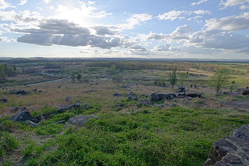
Gettysburg National Military Park in April 2019

On November 19, 1863, U.S. President Abraham Lincoln (center, facing camera) delivered the Gettysburg Address, considered one of the most famous speeches in American history.

Downtown Gettysburg in 1930

Gettysburg in 1935