The Grande Ronde River is a 210-mile (340 km) long tributary of the Snake River, flowing through northeast Oregon and southeast Washington in the United States. Its watershed is situated in the eastern Columbia Plateau, bounded by the Blue Mountains and Wallowa Mountains to the west of Hells Canyon. The river flows generally northeast from its forested headwaters west of La Grande, Oregon, through the agricultural Grande Ronde Valley in its middle course, and through rugged canyons cut from ancient basalt lava flows in its lower course. While it joins the Snake River upstream of Asotin, Washington, more than 90 percent of the river's watershed is in Oregon.
The Grande Ronde River just above Wildcat Creek, near Troy, Oregon
The Grande Ronde at Red Bridge State Park, upstream of La Grande
The Grande Ronde River at Elgin, Oregon
Horizontal basalt layers form cliffs above the Grande Ronde River in Oregon
The Snake River is a major river in the interior Pacific Northwest region of the United States. About 1,080 miles (1,740 km) long, it is the largest tributary of the Columbia River, which is the largest North American river that empties into the Pacific Ocean. Beginning in Yellowstone National Park, western Wyoming, it flows across the arid Snake River Plain of southern Idaho, the rugged Hells Canyon on the borders of Idaho, Oregon and Washington, and finally the rolling Palouse Hills of southeast Washington. It joins the Columbia River just downstream from the Tri-Cities, Washington, in the southern Columbia Basin.
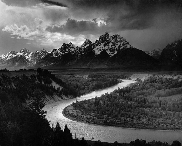
The Tetons and the Snake River (photographed by Ansel Adams, 1942), shows the Snake River in Jackson Hole, Wyoming
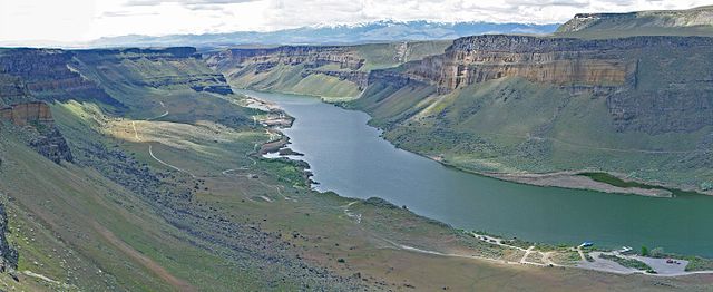
The Snake River flows through canyons in the Morley Nelson Snake River Birds of Prey National Conservation Area, south of Boise
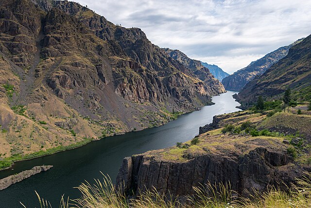
The Snake River in Hells Canyon
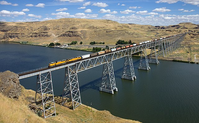
The Union Pacific Railroad crosses the lower Snake River via the Joso Bridge near Starbuck, Washington.