Hāwera
Videos
Photos
Hāwera is the second-largest centre in the Taranaki region of New Zealand's North Island, with a population of 10,350. It is near the coast of the South Taranaki Bight. The origins of the town lie in a government military base that was established in 1866, and the town of Hāwera grew up around a blockhouse in the early 1870s.

Hāwera from the Water Tower

The water tower at Hāwera

Aerial view of Hāwera, including the surrounding agricultural landscape and the Whareroa Dairy Factory.
Taranaki
Videos
Photos
Taranaki is a region in the west of New Zealand's North Island. It is named after its main geographical feature, the stratovolcano Mount Taranaki, also known as Mount Egmont.
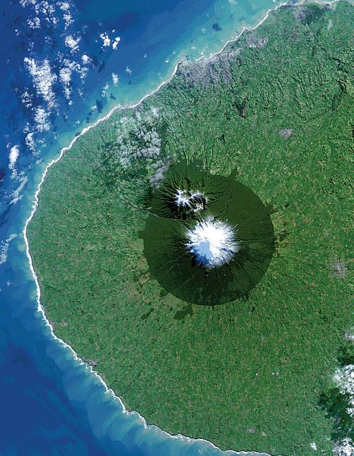
Picture of Taranaki acquired from the Landsat 8 satellite, showing the near-circular Egmont National Park surrounding Mount Taranaki. New Plymouth is the grey area on the northern coastline.

View of Mount Taranaki from SLUGS , facing west. Fanthams Peak is to the left of the main peak. The cow in the foreground is emblematic of Taranaki as a major dairying region.