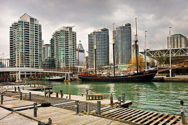
Harbourfront is a neighbourhood on the northern shore of Lake Ontario within the downtown core of the city of Toronto, Ontario, Canada. Part of the Toronto waterfront, Harbourfront extends from Bathurst Street in the west, along Queens Quay, with its ill-defined eastern boundary being either Yonge Street or York Street. Its northern boundary is the Gardiner Expressway. Much of the district was former water lots filled in during the early 1900s to create a larger harbour district. After shipping patterns changed and the use of the Toronto harbour declined, the area was converted from industrial uses to a mixed-use district that is mostly residential and leisure.
Harbourfront consists of the northern shoreline of Downtown Toronto
View of the Harbourfront in 1841. The area surrounding the Toronto Harbour has been used for shipping and industrial purposes since the settlement of York.
Harbourfront Centre was formed in 1991 in an effort to create a waterfront park in Toronto.
Skating outside Harbourfront Centre. The centre is a cultural organization established by the federal government, at Harbourfront.
The Toronto waterfront is the lakeshore of Lake Ontario in the city of Toronto, Ontario, Canada. It spans 46 kilometres between the mouth of Etobicoke Creek in the west and the Rouge River in the east.
View of Toronto's waterfront and Downtown Toronto from the Toronto Islands.
Elevated portions of Toronto's waterfront, like the Scarborough Bluffs, made up the shorelines of Lake Iroquois, a glacial lake that preceded Lake Ontario.
Cannon emplacement at Fort York, located close to where Toronto's original shoreline was. Due to land reclamation projects in the late-19th to early-20th century, the original shoreline is now located inland.
Construction of the Gardiner Expressway in the 1963. The highway substantially changed the western portion of the waterfront.


