Hydrology
Videos
Hydrology is the scientific study of the movement, distribution, and management of water on Earth and other planets, including the water cycle, water resources, and drainage basin sustainability. A practitioner of hydrology is called a hydrologist. Hydrologists are scientists studying earth or environmental science, civil or environmental engineering, and physical geography. Using various analytical methods and scientific techniques, they collect and analyze data to help solve water related problems such as environmental preservation, natural disasters, and water management.

Rain over a Scottish catchment. Understanding the cycling of water into, through, and out of catchments is a key element of hydrology.
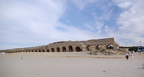
The Roman aqueduct at Caesarea Maritima, bringing water from the wetter Carmel mountains to the settlement.

A standard NOAA rain gauge

Estimates of changes in water storage around the Tigris and Euphrates Rivers, measured by NASA's GRACE satellites. The satellites measure tiny changes in gravitational acceleration, which can then be processed to reveal movement of water due to changes in its total mass.
Water resources
Videos
Water resources are natural resources of water that are potentially useful for humans, for example as a source of drinking water supply or irrigation water. 97% of the water on Earth is salt water and only three percent is fresh water; slightly over two-thirds of this is frozen in glaciers and polar ice caps. The remaining unfrozen freshwater is found mainly as groundwater, with only a small fraction present above ground or in the air. Natural sources of fresh water include surface water, under river flow, groundwater and frozen water. Non-natural or human-made sources of fresh water can include wastewater that has been treated for reuse options, and desalinated seawater. People use water resources for agricultural, industrial and household activities.

Lake Chungará and Parinacota volcano in northern Chile
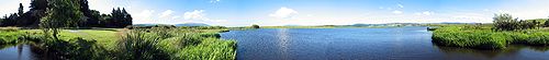
Panorama of a natural wetland (Sinclair Wetlands, New Zealand)

Total renewable freshwater resources of the world, in mm/year (1 mm is equivalent to 1 L of water per m2) (long-term average for the years 1961–1990). Resolution is 0.5° longitude x 0.5° latitude (equivalent to 55 km x 55 km at the equator). Computed by the global freshwater model WaterGAP.

Irrigation of agricultural fields in Andalusia, Spain. Irrigation canal on the left.