The Iowa flood of 2008 was a hydrological event involving most of the rivers in eastern Iowa which began June 8 and continued until July 1. Flooding continued on the Upper Mississippi River in the southeastern area of the state for many more days. The phrase "Iowa's Katrina" was often heard.
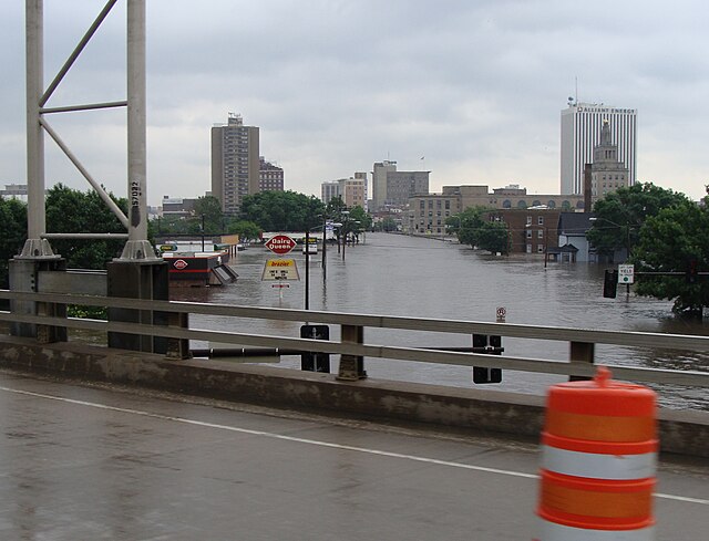
Looking towards downtown Cedar Rapids, Iowa, on June 12
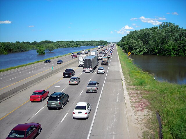
Floodwaters fill the ditches surrounding Interstate 80 in Des Moines
The Des Moines River threatened downtown businesses and prompted officials to call for a voluntary evacuation
Coralville Dam and Lake, Sunday June 15, 2008, with the spillway fully opened, with water about 5 feet (1.5 m) deep.
Cedar Rapids is the second-most populous city in the U.S. state of Iowa and the county seat of Linn County. The city lies on both banks of the Cedar River, 20 miles (32 km) north of Iowa City and 128 miles (206 km) northeast of Des Moines, the state's capital. It is a part of the Cedar Rapids/Iowa City region of Eastern Iowa, which includes Linn, Benton, Cedar, Iowa, Jones, Johnson, and Washington counties.
Image: Cedar Rapids Skyline (2022)
Image: National Czech & Slovak Museum & Library
Image: Cedar Rapids City Hall
Image: Czech Village (Cedar Rapids, Iowa)