Mona is the third-largest island of the Puerto Rican archipelago, after the main island of Puerto Rico and Vieques. It is the largest of three islands in the Mona Passage, a strait between the Dominican Republic and Puerto Rico, the others being Monito Island and Desecheo Island. It measures about 7 miles by 4 miles, and lies 41 mi (66 km) west of Puerto Rico, of which it is administratively a part. It is one of two islands that make up the Isla de Mona e Islote Monito barrio in the municipality of Mayagüez.
Picture of Mona Island between the Dominican Republic and the Puerto Rico mainland
Taíno cave art in caves of Mona island
Mona Island Lighthouse and Mona Island Tramway, 1913
Mona is a mainly flat plateau surrounded by sea cliffs.
Puerto Rico, officially the Commonwealth of Puerto Rico, is a Caribbean island, Commonwealth, and unincorporated territory of the United States. It is located in the northeast Caribbean Sea, approximately 1,000 miles (1,600 km) southeast of Miami, Florida, between the Dominican Republic and the U.S. Virgin Islands, and includes the eponymous main island and several smaller islands, such as Mona, Culebra, and Vieques. With roughly 3.2 million residents, it is divided into 78 municipalities, of which the most populous is the capital municipality of San Juan. Spanish and English are the official languages of the executive branch of government, though Spanish predominates.
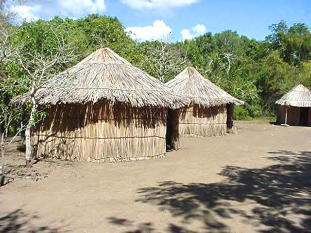
A 20th-century reconstruction of an 8th-century Taíno village, located at the spot in which their ballpark and remains were discovered in 1975, in the aftermath of Hurricane Eloise
Artist's depiction of Juan Ponce de León, Puerto Rico's first governor
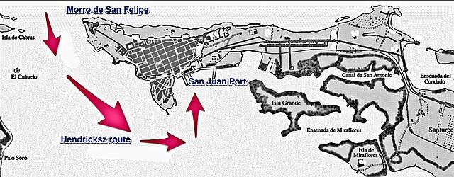
1625 attack on San Juan by Boudewijn Hendricksz
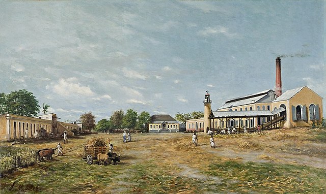
Sugar haciendas, like the one depicted above, ran a significant portion of the Puerto Rican economy in the late 19th century.


