The Islands of the Firth of Clyde are the fifth largest of the major Scottish island groups after the Inner and Outer Hebrides, Orkney and Shetland. They are situated in the Firth of Clyde between Ayrshire and Argyll and Bute. There are about forty islands and skerries. Only four are inhabited, and only nine are larger than 40 hectares. The largest and most populous are Arran and Bute. They are served by dedicated ferry routes, as are Great Cumbrae and Holy Island. Unlike the isles in the four larger Scottish archipelagos, none of the isles in this group are connected to one another or to the mainland by bridges.
Holy Isle seen from Bute
The PS Waverley lying in Brodick Bay in front of Brodick Castle. Paddle steamers like this were formerly extremely common on the Clyde.
Castle Island from Little Cumbrae
Machrie Moor standing stones, Arran
The Firth of Clyde is the mouth of the River Clyde. It is located on the west coast of Scotland and constitutes the deepest coastal waters in the British Isles. The firth is sheltered from the Atlantic Ocean by the Kintyre peninsula, which encloses the outer firth in Argyll and Ayrshire. The Kilbrannan Sound is a large arm of the Firth of Clyde, separating the Kintyre Peninsula from the Isle of Arran. Within the Firth of Clyde is another major island – the Isle of Bute. Given its strategic location at the entrance to the middle and upper Clyde, Bute played a vital naval military role during World War II.
The Seamill beach looks south down the outer firth towards southern Arran and Ailsa Craig
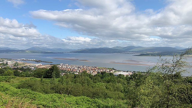
River Clyde navigable channel and sandbanks leading to the Tail of the Bank, seen from above redevelopments on the Lithgows shipyard site, and Greenock's Great Harbour.
The Holy Loch seen across the upper Firth of Clyde from Gourock, with Hunter's Quay to the left and Strone to the right, with the Caledonian MacBrayne ferry MV Saturn arriving from Dunoon.
Firth of Clyde, from Dunoon


