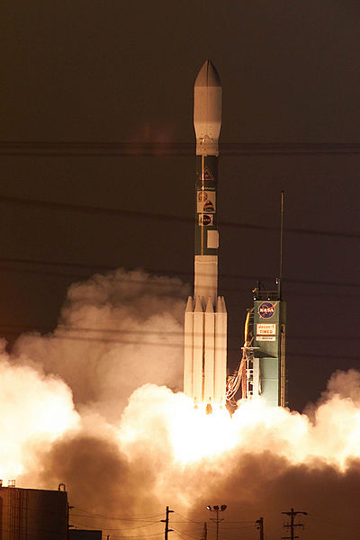
Jason-1 was a satellite altimeter oceanography mission. It sought to monitor global ocean circulation, study the ties between the ocean and the atmosphere, improve global climate forecasts and predictions, and monitor events such as El Niño and ocean eddies. Jason-1 was launched in 2001 and it was followed by OSTM/Jason-2 in 2008, and Jason-3 in 2016 – the Jason satellite series. Jason-1 was launched alongside the TIMED spacecraft.
Artist's interpretation of the Jason-1 satellite
A Boeing Delta II rocket carrying the Jason 1 and Timed satellites from Space Launch Complex-2 on Dec. 7.
Poseidon radar altimeter
Laser retroreflector
Satellite geodesy is geodesy by means of artificial satellites—the measurement of the form and dimensions of Earth, the location of objects on its surface and the figure of the Earth's gravity field by means of artificial satellite techniques. It belongs to the broader field of space geodesy. Traditional astronomical geodesy is not commonly considered a part of satellite geodesy, although there is considerable overlap between the techniques.
Wettzell Laser Ranging System, a satellite laser ranging station
Artist's conception of GRACE
This graph shows the rise in global sea level (in millimeters) measured by the NASA/CNES ocean altimeter mission TOPEX/Poseidon (on the left) and its follow-on mission Jason-1. Image credit: University of Colorado


