John Day Dam
Videos
The John Day Dam is a concrete gravity dam spanning the Columbia River in the northwestern United States. The dam features a navigation lock plus fish ladders on both sides. The John Day Lock has the

The dam in 2013

Depth of John Day Dam pool showing the new UPRR bridge, with old bridges at sites to be submerged below, 1967

The dam and vicinity, taken from the International Space Station in 2022

Cropped view of the dam in 2022
Columbia River
Videos
The Columbia River is the largest river in the Pacific Northwest region of North America. The river forms in the Rocky Mountains of British Columbia, Canada. It flows northwest and then south into the
John Day Dam
…The John Day Dam is a concrete gravity dam spanning the Columbia River in the northwestern United States. The dam features a navigation lock plus fish ladders on both sides. The John Day Lock has the highest lift (at 110…

Columbia River from Rowena Crest with Interstate 84 on the right

The Columbia River Gorge facing east toward Beacon Rock
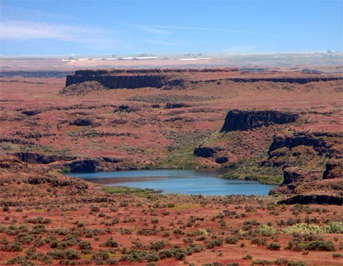
Drumheller Channels, part of the Channeled Scablands formed by the Missoula Floods

Panoramic view of Columbia River Gorge from Dog Mountain in Washington