Kalaupapa is a small unincorporated community and Hawaiian home land on the island of Molokaʻi, within Kalawao County in the U.S. state of Hawaii. In 1866, during the reign of Kamehameha V, the Hawaii legislature passed a law that resulted in the designation of Molokaʻi as the site for a leper colony, where patients who were seriously affected by leprosy could be quarantined, to prevent them from infecting others. At the time, the disease was little understood: it was believed to be highly contagious and was incurable until the advent of antibiotics. The communities where people with leprosy lived were under the administration of the Board of Health, which appointed superintendents on the island.
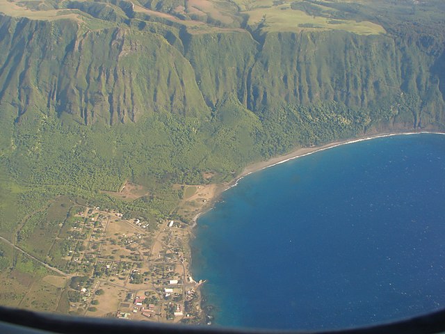
Most of the village of Kalaupapa as seen from an airplane. This photo also includes a section of the sea cliffs that form a natural barrier between the Kalaupapa Peninsula and "Topside" Molokaʻi.
Kalaupapa postmark
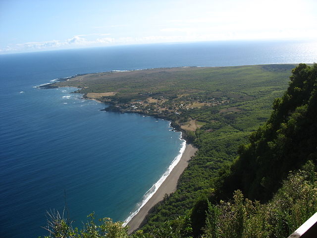
Kalaupapa Peninsula as seen from a descent down the sea cliffs
The Kalaupapa Leper Settlement
Molokai is the fifth most populated of the eight major islands that make up the Hawaiian Islands archipelago in the middle of the Pacific Ocean. It is 38 by 10 miles at its greatest length and width with a usable land area of 260 sq mi (673.40 km2), making it the fifth-largest in size of the main Hawaiian Islands and the 27th largest island in the United States. It lies southeast of Oʻahu across the 25 mi (40 km) wide Kaʻiwi Channel and north of Lānaʻi, separated from it by the Kalohi Channel.
Satellite image of Molokai
Eastern Molokai with a portion of Kamakou and Molokaʻi Forest Reserve
Halawa Bay Beach Park, located at the extreme east end of Molokai
U.S. Coast Guard Molokai Light, Kalaupapa Peninsula, northern shore of Molokai. It is listed on the National Register of Historic Places.