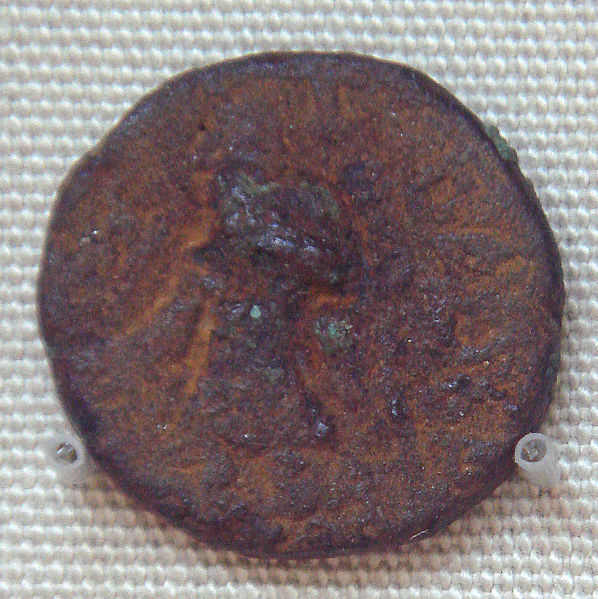
1.
Kushan Empire
–
The Kushan Empire was a syncretic empire, formed by Yuezhi, in the Bactrian territories in the early 1st century. Emperor Kanishka was a patron of Buddhism, however, as Kushans expanded southward. The Kushans were one of five branches of the Yuezhi confederation, the Kushans possibly used the Greek language initially for administrative purposes, but soon began to use Bactrian language. Kanishka sent his armies north of the Karakoram mountains, capturing territories as far as Kashgar, Khotan and Yarkant, in the Tarim Basin of modern-day Xinjiang, China. A direct road from Gandhara to China remained under Kushan control for more than a century, encouraging travel across the Karakoram, the Kushan dynasty had diplomatic contacts with the Roman Empire, Sasanian Persia, Aksumite Empire and Han China. The Kushan empire fragmented into semi-independent kingdoms in the 3rd century AD, in the 4th century, the Guptas, an Indian dynasty also pressed from the east. The last of the Kushan and Sasanian kingdoms were overwhelmed by invaders from the north. Historian H. G. Rawlinson states that the Kushana Period is a prelude to the age of Guptas. Chinese sources describe the Guishuang, i. e, as the historian John E. Hill has put it, For well over a century. There have been arguments about the ethnic and linguistic origins of the Da Yuezhi, Kushans, and the Tochari. The five tribes constituting the Yuezhi are known in Chinese history as Xiūmì, Guìshuāng, Shuāngmǐ, Xìdùn, the Yuezhi reached the Hellenic kingdom of Greco-Bactria around 135 BC. The displaced Greek dynasties resettled to the southeast in areas of the Hindu Kush, some traces remain of the presence of the Kushans in the area of Bactria and Sogdiana. Archaeological structures are known in Takht-I-Sangin, Surkh Kotal, and in the palace of Khalchayan, various sculptures and friezes are known, representing horse-riding archers, and significantly men with artificially deformed skulls, such as the Kushan prince of Khalchayan. The Chinese first referred to people as the Yuezhi and said they established the Kushan Empire. On the ruins of ancient Hellenistic cities such as Ai-Khanoum, the Kushans are known to have built fortresses, the earliest documented ruler, and the first one to proclaim himself as a Kushan ruler, was Heraios. He calls himself a tyrant on his coins, and also exhibits skull deformation and he may have been an ally of the Greeks, and he shared the same style of coinage. Heraios may have been the father of the first Kushan emperor Kujula Kadphises, Ban Gus Book of Han tells us the Kushans divided up Bactria in 128 BC. He invaded Anxi, and took the Gaofu region and he also defeated the whole of the kingdoms of Puda and Jibin
2.
Gold coin
–
A gold coin is a coin that is made mostly or entirely of gold. Traditionally, gold coins have been circulation coins, including coin-like bracteates, since recent decades, however, gold coins are mainly produced as bullion coins to investors and as commemorative coins to collectors. While also modern gold coins are legal tender, they are not observed in financial transactions. For example, the American Gold Eagle, given a denomination of 50 USD, has a value of more than 1,000 USD. The gold reserves of banks are dominated by gold bars. Gold has been used as money for many reasons and it is fungible, with a low spread between the prices to buy and sell. Gold is also easily transportable, as it has a value to weight ratio, compared to other commodities. Gold can be re-coined, divided into units, or re-melted into larger units such as gold bars. The density of gold is higher than most other metals, making it difficult to pass counterfeits, additionally, gold is extremely unreactive, hence it does not tarnish or corrode over time. Gold was used in commerce in the Ancient Near East since the Bronze Age, the name of king Croesus of Lydia remains associated with the invention. In 546 BC, Croesus was captured by the Persians, who adopted gold as the metal for their coins. Ancient Greek coinage contained a number of coins issued by the various city states. The Ying yuan is a gold coin minted in ancient China. Larger units such as the various talent measures were used for high value exchanges, the German gold mark was introduced in 1873 in the German Empire, replacing the various local Gulden coins of the Holy Roman Empire. Gold coins then had a long period as a primary form of money. Most of the world stopped making gold coins as currency by 1933, gold-colored coins have made a comeback in many currencies. However, gold coin always refers to a coin that is made of gold, furthermore, many countries continue to make legal tender gold coins, but these are primarily meant for collectors and investment purposes and are not meant for circulation. Many factors determine the value of a coin, such as its rarity, age, condition
3.
British Museum
–
The British Museum is dedicated to human history, art and culture, and is located in the Bloomsbury area of London. The British Museum was established in 1753, largely based on the collections of the physician, the museum first opened to the public on 15 January 1759, in Montagu House, on the site of the current building. Although today principally a museum of art objects and antiquities. Its foundations lie in the will of the Irish-born British physician, on 7 June 1753, King George II gave his formal assent to the Act of Parliament which established the British Museum. They were joined in 1757 by the Old Royal Library, now the Royal manuscripts, together these four foundation collections included many of the most treasured books now in the British Library including the Lindisfarne Gospels and the sole surviving copy of Beowulf. The British Museum was the first of a new kind of museum – national, belonging to neither church nor king, freely open to the public, sloanes collection, while including a vast miscellany of objects, tended to reflect his scientific interests. The addition of the Cotton and Harley manuscripts introduced a literary, the body of trustees decided on a converted 17th-century mansion, Montagu House, as a location for the museum, which it bought from the Montagu family for £20,000. The Trustees rejected Buckingham House, on the now occupied by Buckingham Palace, on the grounds of cost. With the acquisition of Montagu House the first exhibition galleries and reading room for scholars opened on 15 January 1759. During the few years after its foundation the British Museum received several gifts, including the Thomason Collection of Civil War Tracts. A list of donations to the Museum, dated 31 January 1784, in the early 19th century the foundations for the extensive collection of sculpture began to be laid and Greek, Roman and Egyptian artefacts dominated the antiquities displays. Gifts and purchases from Henry Salt, British consul general in Egypt, beginning with the Colossal bust of Ramesses II in 1818, many Greek sculptures followed, notably the first purpose-built exhibition space, the Charles Towneley collection, much of it Roman Sculpture, in 1805. In 1816 these masterpieces of art, were acquired by The British Museum by Act of Parliament. The collections were supplemented by the Bassae frieze from Phigaleia, Greece in 1815, the Ancient Near Eastern collection also had its beginnings in 1825 with the purchase of Assyrian and Babylonian antiquities from the widow of Claudius James Rich. The neoclassical architect, Sir Robert Smirke, was asked to draw up plans for an extension to the Museum. For the reception of the Royal Library, and a Picture Gallery over it, and put forward plans for todays quadrangular building, much of which can be seen today. The dilapidated Old Montagu House was demolished and work on the Kings Library Gallery began in 1823, the extension, the East Wing, was completed by 1831. The Museum became a site as Sir Robert Smirkes grand neo-classical building gradually arose
4.
Vima Kadphises
–
Vima Kadphises was a Kushan emperor from approximately 90–100 CE. According to the Rabatak inscription, he was the son of Vima Takto, emperor Vima Kadphises expanded the Kushan territory in Afghanistan, Pakistan and north-west India. He was the Kushan emperor to first introduce gold coinage, in addition to the copper and silver coinage. Most of the gold seems to have obtained through trade with the Roman Empire. The gold weight standard of eight grams corresponds to that of Roman coins of the 1st century. Gold bullion from Rome would be melted and used for the Kushan mints, the Kushan were able to maintain and protect the Silk road, allowing silk, spices, textiles or medicine to move between China, India and the West. In particular, many goods were sent by ship to the Roman empire, creating a flow of gold coins, Greek wine. Works of arts were imported from all directions, as indicated by the variety and quality of the artefacts found in the Kushan summer capital of Bagram in Afghanistan. A strong artistic syncretism was stimulated, as indicated by the Greco-Buddhist art of Gandhara, Roman history relates the visit of ambassadors from the Indian kings to the court of Trajan, bearing presents and letters in Greek, which were sent either by Vima Kadphises or his son Kanishka. Most of Vimas coins feature the Buddhist symbol of the Triratana on the reverse, together with Hindu representations of Shiva, often time, a Trishul is depicted along with Shiva. The connection of Vima Kadphises with other Kushan rulers is described in the Rabatak inscription, through the Jade Gate to Rome, A Study of the Silk Routes during the Later Han Dynasty, 1st to 2nd Centuries CE. The Greeks in Bactria and India, ISBN 0-89005-524-6 Coins of Vima Kadphises Catalogue of coins of Vima Kadphises
5.
Huvishka
–
Huvishka was the emperor of the Kushan Empire from the death of Kanishka until the succession of Vasudeva I about forty years later. His rule was a period of retrenchment and consolidation for the Empire, Huvishka was the son of Kanishka. His reign is known as the golden age of Kushan rule. The statue is dated to the 28th year of the reign of Huvishka, there is little evidence that Huvishka himself was a follower of Mahāyāna Buddhism. A Sanskrit manuscript fragment in the Schøyen Collection describes Huvishka as one who has set forth in the Mahāyāna, compared to his predecessor Kanishka, Huvishka was worshipper of Shiva. He also incorporates in his coins for the first and unique time in Kushan coinage the Hellenistic-Egyptian Serapis, one of the great remaining puzzles of Huvishkas reign is the devaluation of his coinage. Early in his reign the copper coinage plunged in weight from a standard of 16g to about 10-11g, the quality and weight then continued to decline throughout the reign until at the start of the reign of Vasudeva the standard coin weighed only 9g. The devaluation led to a production of imitations, and an economic demand for the older. The king tried to destroy Indian economy by devaluation of Indian coins, online Catalogue of Huvishkas Coinage Coins of Huvishka Was Huvishka sole king of the Kushan Empire The Devaluation of the Coinage of Kanishka
6.
Peshawar
–
Peshawar is the capital of the Pakistani province of Khyber Pakhtunkhwa. It also serves as the centre and economic hub for the Federally Administered Tribal Areas. Situated in a valley near the eastern end of the historic Khyber Pass, close to the border with Afghanistan. Making it the oldest city in Pakistan and one of the oldest in South Asia, Peshawar is the largest city of Khyber Pakhtunkhwa province. According to the last census, it is also the ninth-largest city of Pakistan, the earliest settlement established in the area of Peshawar was called Puruṣapura, from which the current name Peshawar is derived. The Arab historian and geographer Al-Masudi noted that by the mid 10th century, after the Ghaznavid invasion, the citys name was again noted to be Parashāwar by Al-Biruni. The city became to be known as as Peshāwar by the era of Emperor Akbar, a name which is traditionally said to have been given by Akbar himself. The new name is said to have been based upon the Persian for frontier town, or more literally, forward city, though transcription errors and linguistic shifts may also account for the citys new name. Akbars bibliographer, Abul-Fazl ibn Mubarak, lists the name by both its former name Parashāwar, transcribed in Persian as پَرَشاوَر, and Peshāwar. Peshawar was founded as the ancient city of Puruṣapura, on the Gandhara Plains in the broad Valley of Peshawar, the city likely first existed as a small village in the 5th century BCE, within the cultural sphere of eastern ancient Persia. Puruṣapura was founded near the ancient Gandharan capital city of Pushkalavati, in the winter of 327-26 BCE, Alexander the Great subdued the Valley of Peshawar during his invasion of ancient India, as well as the nearby Swat and Buner valleys. Following Alexanders conquest, the Valley of Peshawar came under suzerainty of Seleucus I Nicator, a locally-made vase fragment that was found in Peshawar depicts a scene from Sophocles play Antigone. Following the Seleucid–Mauryan war, the region was ceded to the Mauryan Empire in 303 BCE, as Mauryan power declined, the Greco-Bactrian Kingdom based in modern Afghanistan declared its independence from the Seleucid Empire, and quickly seized Puruṣapura around 190 BCE. The city was ruled by several Iranic Parthian kingdoms. Puruṣapura was then captured by Gondophares, founder of the Indo-Parthian Kingdom, Gondophares established the nearby Takht-i-Bahi monastery in 46 CE. In the first century of the Common era, came under control of Kujula Kadphises, the city was made the empires winter capital. The Kushans summer capital at Kapisi was seen as the capital of the empire. Ancient Peshawars population was estimated to be 120,000, which would make it the seventh-most populous city in the world at the time, around 128 CE, Puruṣapura was made sole capital of the Kushan Empire under the rule of Kanishka
7.
Pakistan
–
Pakistan, officially the Islamic Republic of Pakistan, is a federal parliamentary republic in South Asia on the crossroads of Central Asia and Western Asia. It is the sixth-most populous country with a population exceeding 200 million people, in terms of area, it is the 33rd-largest country in the world with an area covering 881,913 square kilometres. It is separated from Tajikistan by Afghanistans narrow Wakhan Corridor in the north, Pakistan is unique among Muslim countries in that it is the only country to have been created in the name of Islam. As a result of the Pakistan Movement led by Muhammad Ali Jinnah and it is an ethnically and linguistically diverse country, with a similarly diverse geography and wildlife. Initially a dominion, Pakistan adopted a constitution in 1956, becoming an Islamic republic, an ethnic civil war in 1971 resulted in the secession of East Pakistan as the new country of Bangladesh. The new constitution stipulated that all laws were to conform to the injunctions of Islam as laid down in the Quran. Pakistan has an economy with a well-integrated agriculture sector. The Pakistani economy is the 24th-largest in the world in terms of purchasing power and it is ranked among the emerging and growth-leading economies of the world, and is backed by one of the worlds largest and fastest-growing middle classes. The post-independence history of Pakistan has been characterised by periods of military rule, the country continues to face challenging problems such as illiteracy, healthcare, and corruption, but has substantially reduced poverty and terrorism and expanded per capita income. It is also a member of CERN. Pakistan is a signatory to the Kyoto Protocol, the Paris Agreement, the name Pakistan literally means land of the pure in Urdu and Persian. It is a play on the word pāk meaning pure in Persian and Pashto, the letter i was incorporated to ease pronunciation and form the linguistically correct and meaningful name. Some of the earliest ancient human civilisations in South Asia originated from areas encompassing present-day Pakistan, the earliest known inhabitants in the region were Soanian during the Lower Paleolithic, of whom stone tools have been found in the Soan Valley of Punjab. The Vedic Civilization, characterised by Indo-Aryan culture, laid the foundations of Hinduism, Multan was an important Hindu pilgrimage centre. The Vedic civilisation flourished in the ancient Gandhāran city of Takṣaśilā, the Indo-Greek Kingdom founded by Demetrius of Bactria included Gandhara and Punjab and reached its greatest extent under Menander, prospering the Greco-Buddhist culture in the region. Taxila had one of the earliest universities and centres of education in the world. At its zenith, the Rai Dynasty of Sindh ruled this region, the Pala Dynasty was the last Buddhist empire, which, under Dharampala and Devapala, stretched across South Asia from what is now Bangladesh through Northern India to Pakistan. The Arab conqueror Muhammad bin Qasim conquered the Indus valley from Sindh to Multan in southern Punjab in 711 AD, the Pakistan governments official chronology identifies this as the time when the foundation of Pakistan was laid
8.
Dynasty
–
A dynasty is a sequence of rulers from the same family, usually in the context of a feudal or monarchical system but sometimes also appearing in elective republics. The dynastic family or lineage may be known as a house, historians periodize the histories of many sovereign states, such as Ancient Egypt, the Carolingian Empire and Imperial China, using a framework of successive dynasties. As such, the dynasty may be used to delimit the era during which the family reigned and to describe events, trends. The word dynasty itself is often dropped from such adjectival references, until the 19th century, it was taken for granted that a legitimate function of a monarch was to aggrandize his dynasty, that is, to increase the territory, wealth, and power of his family members. The longest-surviving dynasty in the world is the Imperial House of Japan, dynasties throughout the world have traditionally been reckoned patrilineally, such as under the Frankish Salic law. Succession through a daughter when permitted was considered to establish a new dynasty in her husbands ruling house, however, some states in Africa, determined descent matrilineally, while rulers have at other times adopted the name of their mothers dynasty when coming into her inheritance. It is also extended to unrelated people such as poets of the same school or various rosters of a single sports team. The word dynasty derives via Latin dynastia from Greek dynastéia, where it referred to power, dominion and it was the abstract noun of dynástēs, the agent noun of dynamis, power or ability, from dýnamai, to be able. A ruler in a dynasty is referred to as a dynast. For example, following his abdication, Edward VIII of the United Kingdom ceased to be a member of the House of Windsor. A dynastic marriage is one that complies with monarchical house law restrictions, the marriage of Willem-Alexander, Prince of Orange, to Máxima Zorreguieta in 2002 was dynastic, for example, and their eldest child is expected to inherit the Dutch crown eventually. But the marriage of his younger brother Prince Friso to Mabel Wisse Smit in 2003 lacked government support, thus Friso forfeited his place in the order of succession, lost his title as a Prince of the Netherlands, and left his children without dynastic rights. In historical and monarchist references to formerly reigning families, a dynast is a member who would have had succession rights, were the monarchys rules still in force. Even since abolition of the Austrian monarchy, Max and his descendants have not been considered the rightful pretenders by Austrian monarchists, nor have they claimed that position. The term dynast is sometimes used only to refer to descendants of a realms monarchs. The term can therefore describe overlapping but distinct sets of people, yet he is not a male-line member of the royal family, and is therefore not a dynast of the House of Windsor. Thus, in 1999 he requested and obtained permission from Elizabeth II to marry the Roman Catholic Princess Caroline of Monaco. Yet a clause of the English Act of Settlement 1701 remained in effect at that time and that exclusion, too, ceased to apply on 26 March 2015, with retroactive effect for those who had been dynasts prior to triggering it by marriage to a Catholic
9.
Hinduism
–
Hinduism is a religion, or a way of life, found most notably in India and Nepal. Hinduism has been called the oldest religion in the world, and some practitioners and scholars refer to it as Sanātana Dharma, scholars regard Hinduism as a fusion or synthesis of various Indian cultures and traditions, with diverse roots and no founder. This Hindu synthesis started to develop between 500 BCE and 300 CE following the Vedic period, although Hinduism contains a broad range of philosophies, it is linked by shared concepts, recognisable rituals, cosmology, shared textual resources, and pilgrimage to sacred sites. Hindu texts are classified into Shruti and Smriti and these texts discuss theology, philosophy, mythology, Vedic yajna, Yoga, agamic rituals, and temple building, among other topics. Major scriptures include the Vedas and Upanishads, the Bhagavad Gita, prominent themes in Hindu beliefs include the four Puruṣārthas, the proper goals or aims of human life, namely Dharma, Artha, Kama and Moksha, karma, samsara, and the various Yogas. Hindu practices include such as puja and recitations, meditation, family-oriented rites of passage, annual festivals. Some Hindus leave their world and material possessions, then engage in lifelong Sannyasa to achieve Moksha. Hinduism prescribes the eternal duties, such as honesty, refraining from injuring living beings, patience, forbearance, self-restraint, Hinduism is the worlds third largest religion, with over one billion followers or 15% of the global population, known as Hindus. The majority of Hindus reside in India, Nepal, Mauritius, the Caribbean, the word Hindu is derived from the Indo-Aryan/Sanskrit word Sindhu, the Indo-Aryan name for the Indus River in the northwestern part of the Indian subcontinent. The term Hindu in these ancient records is a geographical term, the Arabic term al-Hind referred to the people who live across the River Indus. This Arabic term was taken from the pre-Islamic Persian term Hindū. By the 13th century, Hindustan emerged as an alternative name of India. It was only towards the end of the 18th century that European merchants and colonists began to refer to the followers of Indian religions collectively as Hindus. The term Hinduism, then spelled Hindooism, was introduced into the English language in the 18th-century to denote the religious, philosophical, because of the wide range of traditions and ideas covered by the term Hinduism, arriving at a comprehensive definition is difficult. The religion defies our desire to define and categorize it, Hinduism has been variously defined as a religion, a religious tradition, a set of religious beliefs, and a way of life. From a Western lexical standpoint, Hinduism like other faiths is appropriately referred to as a religion, in India the term dharma is preferred, which is broader than the western term religion. Hindu traditionalists prefer to call it Sanatana Dharma, the study of India and its cultures and religions, and the definition of Hinduism, has been shaped by the interests of colonialism and by Western notions of religion. Since the 1990s, those influences and its outcomes have been the topic of debate among scholars of Hinduism, Hinduism as it is commonly known can be subdivided into a number of major currents
10.
Buddhism
–
Buddhism is a religion and dharma that encompasses a variety of traditions, beliefs and spiritual practices largely based on teachings attributed to the Buddha. Buddhism originated in India sometime between the 6th and 4th centuries BCE, from where it spread through much of Asia, two major extant branches of Buddhism are generally recognized by scholars, Theravada and Mahayana. Buddhism is the worlds fourth-largest religion, with over 500 million followers or 7% of the global population, Buddhist schools vary on the exact nature of the path to liberation, the importance and canonicity of various teachings and scriptures, and especially their respective practices. In Theravada the ultimate goal is the attainment of the state of Nirvana, achieved by practicing the Noble Eightfold Path, thus escaping what is seen as a cycle of suffering. Theravada has a following in Sri Lanka and Southeast Asia. Mahayana, which includes the traditions of Pure Land, Zen, Nichiren Buddhism, Shingon, rather than Nirvana, Mahayana instead aspires to Buddhahood via the bodhisattva path, a state wherein one remains in the cycle of rebirth to help other beings reach awakening. Vajrayana, a body of teachings attributed to Indian siddhas, may be viewed as a branch or merely a part of Mahayana. Tibetan Buddhism, which preserves the Vajrayana teachings of eighth century India, is practiced in regions surrounding the Himalayas, Tibetan Buddhism aspires to Buddhahood or rainbow body. Buddhism is an Indian religion attributed to the teachings of Buddha, the details of Buddhas life are mentioned in many early Buddhist texts but are inconsistent, his social background and life details are difficult to prove, the precise dates uncertain. Some hagiographic legends state that his father was a king named Suddhodana, his mother queen Maya, and he was born in Lumbini gardens. Some of the stories about Buddha, his life, his teachings, Buddha was moved by the innate suffering of humanity. He meditated on this alone for a period of time, in various ways including asceticism, on the nature of suffering. He famously sat in meditation under a Ficus religiosa tree now called the Bodhi Tree in the town of Bodh Gaya in Gangetic plains region of South Asia. He reached enlightenment, discovering what Buddhists call the Middle Way, as an enlightened being, he attracted followers and founded a Sangha. Now, as the Buddha, he spent the rest of his teaching the Dharma he had discovered. Dukkha is a concept of Buddhism and part of its Four Noble Truths doctrine. It can be translated as incapable of satisfying, the unsatisfactory nature, the Four Truths express the basic orientation of Buddhism, we crave and cling to impermanent states and things, which is dukkha, incapable of satisfying and painful. This keeps us caught in saṃsāra, the cycle of repeated rebirth, dukkha
11.
Hindi
–
Hindi, or Modern Standard Hindi is a standardised and Sanskritised register of the Hindustani language. Along with the English language, Hindi written in the Devanagari script, is the language of the Government of India. It is also one of the 22 scheduled languages of the Republic of India, Hindi is the lingua franca of the so-called Hindi belt of India. Outside India, it is a language which is known as Fiji Hindi in Fiji, and is a recognised regional language in Mauritius, Trinidad and Tobago, Guyana. Hindi is the fourth most-spoken first language in the world, after Mandarin, apart from specialized vocabulary, Hindi is mutually intelligible with Standard Urdu, another recognized register of Hindustani. Part XVII of the Indian Constitution deals with Official Language, under Article 343, official language of the Union has been prescribed, which includes Hindi in Devanagari script and English. Gujarat High Court, in 2010, has observed that there was nothing on record to suggest that any provision has been made or order issued declaring Hindi as a language of India. Article 343 of the Indian constitution states The official language of the Union shall be Hindi in Devanagari script, the form of numerals to be used for the official purposes of the Union shall be the international form of Indian numerals. It was envisioned that Hindi would become the working language of the Union Government by 1965. Each may also designate a co-official language, in Uttar Pradesh, for instance, depending on the formation in power. Similarly, Hindi is accorded the status of language in the following Union Territories, Andaman & Nicobar Islands, Chandigarh, Dadra & Nagar Haveli, Daman & Diu. National-language status for Hindi is a long-debated theme, an Indian court clarified that Hindi is not the national language of India because the constitution does not mention it as such. Outside Asia, Hindi is a language in Fiji as per the 1997 Constitution of Fiji. It is spoken by 380,000 people in Fiji, Hindi is also spoken by a large population of Madheshis of Nepal. Hindi is quite easy to understand for some Pakistanis, who speak Urdu, apart from this, Hindi is spoken by the large Indian diaspora which hails from, or has its origin from the Hindi Belt of India. Like other Indo-Aryan languages, Hindi is considered to be a descendant of an early form of Sanskrit, through Sauraseni Prakrit. It has been influenced by Dravidian languages, Turkic languages, Persian, Arabic, Portuguese, Hindi emerged as Apabhramsha, a degenerated form of Prakrit, in the 7th century A. D. By the 10th century A. D. it became stable, Braj Bhasha, Bhojpuri, Awadhi, Khari Boli etc. are the dialects of Hindi
12.
Kujula Kadphises
–
Kujula Kadphises was a Kushan prince who united the Yuezhi confederation during the 1st century CE, and became the first Kushan emperor. According to the Rabatak inscription, he was the grandfather of the great Kushan king Kanishka I. He is considered as the founder of the Kushan Empire, the origins of Kujula Kadphises are quite obscure, and it is usually considered he was a descendant of the Kushan ruler Heraios, or possibly identical with him. Interestingly however, Kujula shares his name some of the last Indo-Scythian rulers, such as Liaka Kusulaka, or his son Patika Kusulaka. He established himself as king, and his dynasty was called that of the Guishuang King and he invaded Anxi, and took the Gaofu region. He also defeated the whole of the kingdoms of Puda and Jibin, qiujiuque was more than eighty years old when he died. He defeated Tianzhu and installed Generals to supervise and lead it, the Yuezhi then became extremely rich. All the kingdoms call the Guishuang king, but the Han call them by their original name and this invasion of Kujula Kadphises is thought to have occurred during the reign of Abdagases and Sases, the successors of Gondophares, after 45 CE. The connection of Kujula with other Kushan rulers is described in the Rabatak inscription, discovered in Rbatak, Afghanistan some years ago, most of Kujulas coins were Hellenic or Roman in inspiration. Some coins used the portrait, name and title of the Indo-Greek king Hermaeus on the obverse, indicating Kujulas wish to relate himself to the Indo-Greek king. These coins bear the name of Kujula Kadphises in Kharoṣṭhī, with representations of the Greek demi-god Heracles on the back, and titles presenting Kujula as a ruler, Later coins, possibly posthumous, did describe Kujula as Maharajasa, or Great King. The Greek script on the coins of Kujula is barbarized, for example, ΣΤΗΡΟΣΣΥ on his Hermaeus coins is thought to be a deformation of ΣΩΤΗΡΟΣ, the traditional title of Hermaeus on his coins. The Greek word for king is written ΒΑϹΙΛΕΩΣ, with both a lunate sigma and a normal sigma in the same word, the Kushans also added one character to the Greek script, it is the letter Ϸ, corresponding to the sound Sh, as in Kushan. Some coins of Kujula also represent a seated figure, formerly said to be one of the first known representations of the Buddha on a coin. Unfortunately, Whiteheads attribution of this coin to Kujula, and the claim that the figure on the obverse represents the Buddha, is now known to be incorrect. The correct attribution of this coin is to the Kushan king Huvishka, the obverse shows Huvishka seated on a couch. The first known coins carrying a representation of the Buddha were issued by Kujulas Great-grandson Kanishka I, some fewer coins of Kujula Kadphises also adopted a Roman style, with effigies closely resembling Caesar Augustus, although all the legends were then associated with Kujula himself. Such influences are linked to exchanges with the Roman Empire around that date, catalogue of coins in the Panjab Museum, Lahore
13.
Turpan
–
Turpan, also known as Turfan or Tulufan, is a prefecture-level city located in the east of Xinjiang, Peoples Republic of China. It has an area of 69,324 square kilometres and a population of 570,000, Turpan has long been the centre of a fertile oasis and an important trade centre. It was historically located along the Silk Road, at that time other kingdoms of the region included Korla, the name Turfan itself however was not used until the end of the Middle Ages - its use became widespread only in the post-Mongol period. The center of the region has shifted a number of times, from Yar-Khoto to Qocho, historically, many settlements in the region have been given a number of different names, some of which refer to more than one place – Turpan/Turfan/Tulufan is one such example. Others include Jushi/Gushi, Gaochang/Qocho/Karakhoja, and Jiaohe/Yarkhoto, Korla, Kucha, and Turfan were inhabited by Tocharians. The peoples of the Kingdoms of Nearer and Further Jushi were closely related and it was originally one kingdom called Gushi, which the Chinese conquered in 107 BC. It was subdivided into two kingdoms by the Chinese in 60 BC, during the Han era the city changed hands several times between the Xiongnu and the Han, interspersed with short periods of independence. Nearer Jushi has been linked to the Turpan Oasis, while Further Jushi to the north of the mountains near modern Jimasa, after the fall of the Han dynasty in 220, the region was virtually independent but tributary to various dynasties. Until the 5th century AD, the capital of this kingdom was Jiaohe, many Han Chinese along with Sogdians settled in Turfan during the post Han dynasty era. The Chinese character dominated Turfan in the eyes of the Sogdians, kuchean-speakers made up the original inhabitants before the Chinese and Sogdian influx. The oldest evidence of Chinese characters were found in Turfan from a document dated to 273 AD, from 487 to 541 AD, Turpan was an independent Kingdom ruled by a Turkic tribe known to the Chinese as the Tiele. The Rouran Khaganate defeated the Tiele and subjugated Turpan, but soon afterwards the Rouran were destroyed by the Göktürks. The Tang dynasty had reconquered the Tarim Basin by the 7th century AD, Sogdians and Chinese engaged in extensive commercial activities with each other under Tang rule. The Sogdians were mostly Mazdaist at this time, in Astana, a contract written in Sogdian detailing the sale of a Sogdian girl to a Chinese man was discovered dated to 639 AD. Individual slaves were common among silk route houses, early documents recorded an increase in the selling of slaves in Turpan, twenty-one 7th-century marriage contracts were found that showed, where one Sogdian spouse was present, for 18 of them their partner was a Sogdian. The only Sogdian men who married Chinese women were highly eminent officials. Several commercial interactions were recorded, for example a camel was sold priced at 14 silk bolts in 673, five men swore that the girl was never free before enslavement, since the Tang Code forbade commoners to be sold as slaves. The Tang dynasty became weakened due to the An Lushan Rebellion, and the Tibetans took the opportunity to expand into Gansu
14.
Tarim Basin
–
The Tarim Basin is an endorheic basin in northwest China occupying an area of about 1,020,000 km2. Its northern boundary is the Tian Shan mountain range and its boundary is the Kunlun Mountains on the edge of the Qinghai-Tibet Plateau. The Taklamakan Desert dominates much of the basin, the historical Uyghur name for the Tarim Basin is Altishahr, which means six cities in Uyghur. They were governed separately until 1884, north side, The Chinese called this the Tien Shan Nan Lu or Tien Shan South Road, as opposed to the Bei Lu north of the mountains. Along it runs the modern highway and railroad while the middle Tarim River is about 100 km south, Kashgar was where the caravans met before crossing the mountains. Center, Most of the basin is occupied by the Taklamakan Desert which is too dry for permanent habitation, the Yarkand, Kashgar and Aksu Rivers join to form the Tarim River which runs along the north side of the basin. Formerly it continued to Loulan, but some time after 330AD it turned southeast near Korla toward Charkilik, the Tarim ended at the now-dry Lop Nur which occupied a changing position east of Loulan. Eastward is the fabled Jade Gate which the Chinese considered the gateway to the Western Regions, beyond that is Dunhuang with its ancient manuscripts and then Anxi at the west end of the Gansu Corridor. The modern road continues east to Tibet, there is no current road east across the Kumtag Desert to Dunhuang, but caravans somehow made the crossing thru the Yangguan pass south of the Jade Gate. Roads and passes, rivers and caravan routes, The Southern Xinjiang Railway branches from the Lanxin Railway near Turpan, follows the side of the basin to Kashgar. Roads, The main road from eastern China reaches Urumchi and continues as highway 314 along the side to Kashgar. Highway 315 follows the side from Kashgar to Charkilik and continues east to Tibet. There are currently four north-south roads across the desert,218 runs from Charkilik to Korla along the former course of the Tarim forming an oval whose other end is Kashgar. The Tarim Desert Highway, an engineering achievement, crosses the center from Niya to Luntai. The new Highway 217 follows the Khotan River from Khotan to near Aksu, a road follows the Yarkand River from Yarkand to Baqu. East of the Korla-Charkilik road travel continues to be very difficult, Rivers coming south from the Tien Shan join the Tarim, the largest being the Aksu. Rivers flowing north from the Kunlun are usually named for the town or oasis they pass through, Most dry up in the desert, only the Hotan River reaching the Tarim in good years. An exception is the Qiemo River which flowed northeast into Lop Nor, ruins in the desert imply that these rivers were once larger
15.
Pataliputra
–
Pataliputra, adjacent to modern-day Patna, was a city in ancient India, originally built by Magadha ruler Ajatashatru in 490 BCE as a small fort near the Ganges river. Extensive archaeological excavations have been made in the vicinity of modern Patna, excavations early in the 20th century around Patna revealed clear evidence of large fortification walls, including reinforcing wooden trusses. The etymology of Pataliputra is unclear, putra means son, and pāţali is a species of rice or the plant Bignonia suaveolens. One traditional etymology holds that the city was named after the plant, another tradition says that Pāṭaliputra means the son of Pāṭali, who was the daughter of Raja Sudarshan. As it was known as Pāṭali-grāma originally, some believe that Pāṭaliputra is a transformation of Pāṭalipura. There is no mention of Pataliputra in written sources prior to the early Buddhist texts, in 303 BCE, Greek historian and ambassador Megasthenes mentioned Pataliputra as a city in his work Indika. The city of Pataliputra was formed by fortification of a village by Haryanka ruler Bimbisara and its central location in north eastern India led rulers of successive dynasties to base their administrative capital here, from the Nandas, Mauryans, Shungas and the Guptas down to the Palas. Situated at the confluence of the Ganges, Gandhaka and Son rivers, Pataliputra formed a water fort and its position helped it dominate the riverine trade of the Indo-Gangetic plains during Magadhas early imperial period. It was a centre of trade and commerce and attracted merchants and intellectuals, such as the famed Chanakya. Jain and Brahmanical sources identify Udayabhadra, son of Ajatashatru, as the king who first established Pataliputra as the capital of Magadha. During the reign of Emperor Ashoka in the 3rd century BCE, it was one of the worlds largest cities, with a population of 150, 000–400,000. The city is estimated to have had a surface of 25.5 square kilometers, and a circumference of 33.8 kilometers, Pataliputra reached the pinnacle of prosperity when it was the capital of the great Mauryan Emperors, Chandragupta Maurya and Ashoka. Arrian, The Indica Strabo in his Geographia adds that the city walls were made of wood and these are thought to be the wooden palisades identified during the excavation of Patna. At the confluence of the Ganges and of another river is situated Palibothra, in length 80 and it is in the shape of a parallelogram, surrounded by a wooden wall pierced with openings through which arrows may be discharged. In front is a ditch, which serves the purpose of defence, in the parks, tame peacocks and pheasants are kept. Aelian, Characteristics of animals Ashokas Palace in Pataliputra and the monument columns everywhere in India were built to imitate the Achaemenid palaces, the architecture of Pataliputras enclosures and the monumental columns of Ashoka had been affected by Persian Achaemenid architecture. The design of the Pataliputra palace capital has been described as Perso-Iionic, with a strong late-archaic Greek stylistic influence, including volute, bead and reel, the city also became a flourishing Buddhist centre boasting a number of important monasteries. It remained the capital of the Gupta dynasty and the Pala Dynasty, the city was largely in ruins when visited by Xuanzang, and suffered further damage at the hands of Muslim raiders in the 12th century
16.
Indo-Gangetic Plain
–
The region is named after the Indus and the Ganges, and encompasses a number of large urban areas. The Indus-Ganga plain is bound on the north by the Himalayas which feed its numerous rivers and are the source of the alluvium deposited across the region by the two river systems. The southern edge of the plain is marked by the Chota Nagpur Plateau, on the west rises the Iranian Plateau. The region is known for the Indus Valley Civilization, which was responsible for the birth of ancient South Asian culture, during the Vedic and Epic eras of Indian history, this region was referred to as Aryavarta. According to Manusmṛti, Aryavarta is the tract between the Himalaya and the Vindhya ranges, from the Eastern Sea to the Western Sea. During the Islamic period, the Turkish, Afghan and Iranian rulers referred to this region as Hindustan, some geographers subdivide the Indo-Gangetic Plain into several parts, the Sindh, Punjab, Doab, and Bengal regions. This divide is only 300 metres above sea level, causing the perception that the Indus-Ganga Plain appears to be continuous between the two drainage basins, the middle Ganga plain extends from the Yamuna River in the west to the state of West Bengal in the east. The lower Ganges plain and the Assam Valley are more verdant than the middle Ganga plain, the lower Ganga is centered in West Bengal, from which it flows into Bangladesh. After joining the Jamuna, a distributary of Brahmaputra, both form the Ganges Delta. The Brahmaputra rises in Tibet as the Yarlung Zangbo River and flows through Arunachal Pradesh and Assam, as a large plain, the exact extent can vary from source to source. The fertile Terai region is the Nepalese extension of the Plain, the rivers encompassed are the Beas, the Chambal, the Chenab, the Ganga, the Gomti, the Indus, the Ravi, the Sutlej and the Yamuna. The soil is rich in silt, making the one of the most intensely farmed areas of the world. Even rural areas here are densely populated, the Indus-Ganga plains, also known as the Great Plains, are large floodplains of the Indus and the Ganga–Brahmaputra river systems. They run parallel to the Himalaya mountains, from Jammu and Kashmir in the west to Assam in the east, the plains encompass an area of 700,000 km² and vary in width through their length by several hundred kilometres. The major rivers of this system are the Ganga and the Indus along with their tributaries, Beas, Yamuna, Gomti, Ravi, Chambal, Sutlej, extent of the Indo-Gangetic plain across South Asia. As the porosity of this belt is very high, the streams flow underground, the bhabar is generally narrow about 7–15 km wide. The Terai belt — lies next to the Bhabar region and is composed of newer alluvium, the underground streams reappear in this region. The region is excessively moist and thickly forested and it also receives heavy rainfall throughout the year and is populated with a variety of wildlife
17.
History of Peshawar
–
The history of Peshawar, a region of modern-day Khyber Pakhtunkhwa, Pakistan, covers thousands of years. The region was known as Puruṣapura in Sanskrit, literally meaning city of men and it also found mention in the Zend Avesta as Vaēkərəta, the seventh most beautiful place on earth created by Ahura Mazda. It was known as the jewel of Bactria and also held sway over Takshashila. Being among the most ancient cities of the region between Central and South Asia, Peshawar has for centuries been a center of trade between Bactria, South Asia, and Central Asia, Peshawar was known in Sanskrit as Puruṣapura, literally meaning city of men. It also found mention in the Zend Avesta as Vaēkərəta, the seventh most beautiful place on earth created by Ahura Mazda It was known as the jewel of Bactria. Being among the most ancient cities of the region between Central and South Asia, Peshawar has for centuries been a center of trade between Bactria, South Asia and Central Asia, as an ancient center of learning, the 2nd century BC. Bakhshali Manuscript used in the Bakhshali approximation was found nearby, Vedic mythology refers to an ancient settlement called Pushkalavati in the area, after Pushkal, presently known as Charsadda. The city that would become Peshawar, called Puruṣapura, was founded by the Kushans. Prior to this period the region was affiliated with Gandhara and was annexed first by the Persian Achaemenid Empire, the city passed into the rule of Alexanders successor, Seleucus I Nicator who ceded it to Chandragupta Maurya, the founder of the Indian Maurya Empire. The inhabitants of Peshewar were mostly Hindu and Buddhist before the arrival of Islam, the area that Peshawar occupies was then seized by the Greco-Bactrian king Eucratides I, and was controlled by a series of Greco-Bactrian kings. Peshawar formed the capital of the empire of Gandhara under the Kushan emperor Kanishka I who reigned from at least 127 CE and, perhaps. Peshawar also became a centre of Buddhist learning. Kanishka built what was probably the tallest building in the world at the time, the Kanishka stupa was said to be an imposing structure as one travelled down from the mountains of Afghanistan onto the Gandharan plains. Of all the stûpas and temples seen by the travellers, none can compare with this for beauty of form and it was destroyed by lightning and repaired several times. It was still in existence at the time of Xuanzangs visit in 634, the stupa was roughly cruciform in shape with a diameter of 286 ft and heavily decorated around the sides with stucco scenes. The relics contained in the famous Kanishka casket, said to be those of the Buddha, were removed to Mandalay, sometime in the 1st millennium BCE, the group that now dominates Peshawar began to arrive from the Suleiman mountains to the south and southwest, the Pakhtuns. It is debatable as to whether or not the Pakhtuns existed in the even earlier as evidence is difficult to attain. The Greco-Bactrian Kingdom was – along with the Indo-Greek Kingdom – the easternmost part of the Hellenistic world, covering Bactria and it was centered around the north of present-day Afghanistan and North Pakistan
18.
Gandhara
–
Gandhara is also an ancient name for Kandahar, Afghanistan. Gandhāra was an ancient Indic kingdom situated in the region of Pakistan. It encompassed the Peshawar valley and later extended to both Jalalabad district of modern-day Afghanistan as well as Taxila, in Pakistan. During the Achaemenid period and Hellenistic period, its city was Charsadda. It is mentioned in the Zend Avesta as Vaēkərəta, the sixth most beautiful place on earth and it was known as the crown jewel of Bactria and also held sway over Takṣaśilā. Gandhara existed since the time of the Rigveda and formed part of the Achaemenid Empire in the 6th century BC, after it was conquered by Mahmud of Ghazni in 1001 AD, the name Gandhara disappeared. During the Muslim period, the area was administered from Lahore or from Kabul, during Mughal times, it was an independent district which included the Kabul province. The name Gāndhāra occurs later in the classical Sanskrit of the epics and it is recorded in Avestan as Vaēkərəta. The Gandhari people are a tribe mentioned in the Rigveda, the Atharvaveda, one proposed origin of the name is from the Sanskrit word gandha, meaning perfume and referring to the spices and aromatic herbs which they traded and with which they anointed themselves. Some authors have connected the modern name Kandahar to Gandhara, Herodotus records that those Iranic tribes, which were adjacent to the city of Caspatyrus and the district of Pactyïce, had customs similar to the Bactrians, and are the most warlike amongst them. These are also the people who obtain gold from the ant-hills of the adjoining desert, on the identity of Caspatyrus, there have been two opinions, one equating it with Kabul, the other with the name of Kashmir. The boundaries of Gandhara varied throughout history, sometimes the Peshawar Valley and Taxila were collectively referred to as Gandhara, sometimes the Swat Valley was also included. The heart of Gandhara, however, was always the Peshawar Valley, the kingdom was ruled from capitals at Kapisa, Pushkalavati, Taxila, Puruṣapura and in its final days from Udabhandapura on the River Indus. Evidence of the Stone Age human inhabitants of Gandhara, including stone tools, the artifacts are approximately 15,000 years old. More recent excavations point to 30,000 years before the present, the region shows an influx of southern Central Asian culture in the Bronze Age with the Gandhara grave culture, and the nucleus of Vedic civilisation. This culture flourished from 1500 to 500 BC and its evidence has been discovered in the hilly regions of Swat and Dir, and even at Taxila. The name of the Gandhāris is attested in the Rigveda and in ancient inscriptions dating back to Achaemenid Persia, the Behistun inscription listing the 23 territories of King Darius I includes Gandāra along with Bactria and Sattagydia. In the book Histories by Herodotus, Gandhara is named as a source of tax collections for King Darius, the Gandhāris, along with the Balhika, Mūjavants, Angas, and the Magadhas, are also mentioned in the Atharvaveda, as distant people
19.
Ancient Kapisa
–
The first references to ancient Kapisa, or the present-day Bagram town of the Parwan Province of Afghanistan, appear in the writings of 5th-century BCE Indian scholar Achariya Pāṇini. Pāṇini refers to the city of Kapiśi, a city of the Kapisa kingdom, Pāṇini also refers to Kapiśayana, a famous wine from Kapisa. The city of Kapiśi also appeared as Kaviśiye on Graeco-Indian coins of Appolodotus/Eucratides, the grapes and wine of the area are referred to by several works of ancient Indian literature. The Mahabharata also noted the practice of slavery in the city. Hiuen Tsang notes the Shen breed of horses from the area, Kapisa is related to and included Kafiristan. Scholar community holds that Kapisa is equivalent to Sanskrit Kamboja, in other words, Kamboja and Kapisa are believed to be two attempts to render the same foreign word. Dr S Levi further holds that old Persian Kabujiya or Kaubojiya, Sanskrit Kamboja as well as Kapisa, even according to illustrious Indian history series, History and Culture of Indian People, Kapisa and Kamboja are equivalent. Scholars like Dr Moti Chandra, Dr Krishna Chandra Mishra etc. also write that the Karpasika, thus, both Karpasika and Kapisa are essentially equivalent to Sanskrit Kamboja. And Pāṇinian term Kapiśi is believed to have been the capital of ancient Kamboja, Kapisa, in fact, refers to the Kamboja kingdom, located on the south-eastern side of the Hindukush in the Paropamisadae region. It was anciently inhabited by the Aśvakayana, and the Aśvayana sub-tribes of the Kambojas, even the Komoi clan of Ptolemy, inhabiting towards Sogdiana mountainous regions, north of Bactria, is believed by scholars to represent the Kamboja people. Front ranking scholars like Dr S. Levi, Dr Michael Witzel and numerous others accept the identity of Tambyzoi, obviously, the Ptolemian Ambautai formed parts of the Kapisa kingdom under sway of Aśvakayana/Aśvayana Kambojas. e. Some scholars call Parama Kamboja as Uttara-Kamboja i. e. northern Kamboja or Distant Kamboja, the Kapisa-Kamboja equivalence as suggested by scholars like Dr Levi applies to the Paropamisan Kamboja settlement. According to the etymology, the name Kafir derives from Arabic Kafir. Kafiristan then would be The Land of the Infidels and this explanation would justify the renaming of the country after its Islamization. That name, unrelated to the Arabic word, is believed to have, at some point and this linguistic phenomenon is not unusual for this region. The name of King Kanishaka, who ruled over this region, is also found written as Kanerika. In a similar way, Kapiś – the name of the people of Kapiś/Kapiśa, is believed to have changed to Kapir, one of the dominant clan of the Kafirs till recently was known as Katir. The second change from Kapir to Kafir may have been the result of confusion or intentional wordplay with the Arabic word, Kafiristan then derives from -stan which in Iranian language means country, abode or place
20.
Silk Road
–
While the term is of modern coinage, the Silk Road derives its name from the lucrative trade in silk carried out along its length, beginning during the Han dynasty. The Han dynasty expanded Central Asian sections of the routes around 114 BCE, largely through missions and explorations of the Chinese imperial envoy. The Chinese took great interest in the safety of their trade products, though silk was certainly the major trade item exported from China, many other goods were traded, as well as religions, syncretic philosophies, and various technologies. Diseases, most notably plague, also spread along the Silk Routes, in addition to economic trade, the Silk Road was a route for cultural trade among the civilizations along its network. The main traders during antiquity included the Chinese, Arabs, Turkmens, Indians, Persians, Somalis, Greeks, Syrians, Romans, Georgians, Armenians, Bactrians, in June 2014, UNESCO designated the Changan-Tianshan corridor of the Silk Road as a World Heritage Site. The Silk Road derives its name from the lucrative Eurasian silk and horse trade, the German terms Seidenstraße and Seidenstraßen were coined by Ferdinand von Richthofen, who made seven expeditions to China from 1868 to 1872. The term Silk Route is also used, although the term was coined in the 19th century, it did not gain widespread acceptance in academia or popularity among the public until the 20th century. The first book entitled The Silk Road was by Swedish geographer Sven Hedin in 1938, the fall of the Soviet Union and Iron Curtain in 1989 led to a surge of public and academic interest in Silk Road sites and studies in the former Soviet republics of Central Asia. Use of the term Silk Road is not without its detractors and he notes that traditional authors discussing East-West trade such as Marco Polo and Edward Gibbon never labelled any route as a silk one in particular. From the 2nd millennium BCE, nephrite jade was being traded from mines in the region of Yarkand, some remnants of what was probably Chinese silk dating from 1070 BCE have been found in Ancient Egypt. The Great Oasis cities of Central Asia played a role in the effective functioning of the Silk Road trade. This style is reflected in the rectangular belt plaques made of gold and bronze, with other versions in jade. The tomb of a Scythian prince near Stuttgart, Germany, dated to the 6th century BCE, was excavated and found to have not only Greek bronzes but also Chinese silks. Scythians accompanied the Assyrian Esarhaddon on his invasion of Egypt, soghdian Scythian merchants played a vital role in later periods in the development of the Silk Road. By the time of Herodotus, the Royal Road of the Persian Empire ran some 2,857 km from the city of Susa on the Karun to the port of Smyrna on the Aegean Sea. It was maintained and protected by the Achaemenid Empire and had postal stations, by having fresh horses and riders ready at each relay, royal couriers could carry messages the entire distance in nine days, while normal travellers took about three months. The next major step in the development of the Silk Road was the expansion of the Greek empire of Alexander the Great into Central Asia and this later became a major staging point on the northern Silk Route. They continued to expand eastward, especially during the reign of Euthydemus, there are indications that he may have led expeditions as far as Kashgar in Chinese Turkestan, leading to the first known contacts between [China and the West around 200 BCE
21.
Silk Road transmission of Buddhism
–
Buddhism entered Han China via the Silk Road, beginning in the 1st or 2nd century CE. Direct contact between Central Asian and Chinese Buddhism continued throughout the 3rd to 7th century, well into Tang period, much of the land route connecting northern India with China at that time was ruled by the Buddhist Kushan Empire, and later the Hephthalite Empire, see Gandhara. China was later reached by the Indian form of tantra esoteric Buddhism in the 7th century, tibetan Buddhism was likewise established as a branch of Vajrayana, in the 8th century. But from about this time, the Silk Road transmission of Buddhism began to decline with the Muslim conquest of Transoxiana, Buddhism was brought to China via the Silk Road. Buddhist monks travelled with merchant caravans on the Silk Road, to preach their new religion, the powerful Greco-Bactrian Kingdoms in Afghanistan and the later Indo-Greek Kingdoms practiced Greco-Buddhism and formed the first stop on the Silk Road, after China, for nearly 300 years. 100 BC, must remain open to question, the earliest direct references to Buddhism concern the 1st century AD, but they include hagiographical elements and are not necessarily reliable or accurate. The first missionaries and translators of Buddhists scriptures into Chinese were either Parthian, Kushan, Sogdian or Kuchean and they promoted both Hīnayāna and Mahāyāna scriptures. Thirty-seven of these early translators of Buddhist texts are known, according to the earliest reference to him, by Yang Xuanzhi, he was a monk of Central Asian origin whom Yang Xuanshi met around 520 at Loyang. Throughout Buddhist art, Bodhidharma is depicted as a rather ill-tempered and he is referred to as The Blue-Eyed Barbarian in Chinese Chan texts. Five monks from Gandhāra who traveled in 485 CE to the country of Fusang, an Shigao translated Buddhist texts on basic doctrines, meditation and abhidharma. An Xuan, a Parthian layman who worked alongside An Shigao, Mahāyāna Buddhism was first widely propagated in China by the Kushan monk Lokakṣema, who came from the ancient Buddhist kingdom of Gandhāra. Lokakṣema translated important Mahāyāna sūtras such as the Aṣṭasāhasrikā Prajñāpāramitā Sūtra, as well as rare, early Mahāyāna sūtras on topics such as samādhi and these translations from Lokakṣema continue to give insight into the early period of Mahāyāna Buddhism. From the 4th century onward, Chinese pilgrims also started to travel on the Silk Road to India, according to Chinese sources, the first Chinese to be ordained was Zhu Zixing, after he went to Central Asia in 260 to seek out Buddhism. It is only from the 4th century CE that Chinese Buddhist monks started to travel to India to discover Buddhism first-hand, faxians pilgrimage to India is said to have been the first significant one. He left along the Silk Road, stayed six years in India, Xuanzang and Hyecho traveled from Korea to India. The most famous of the Chinese pilgrims is Xuanzang, whose large and precise translation work defines a new translation period and he also left a detailed account of his travels in Central Asia and India. The legendary accounts of the holy priest Xuanzang were described in the famous novel Journey to the West, during the fifth and sixth centuries C. E. Merchants played a role in the spread of religion, in particular Buddhism
22.
Karakoram
–
The Karakoram, or Karakorum is a large mountain range spanning the borders of Pakistan, India, and China, with the northwest extremity of the range extending to Afghanistan and Tajikistan. It is located in the regions of Gilgit–Baltistan, Ladakh, and southern Xinjiang, a part of the complex of ranges from the Hindu Kush to the Himalayan Range, it is one of the Greater Ranges of Asia. The Karakoram is home to the four most closely located peaks over 8000m in height on earth, K2, the range is about 500 km in length, and is the most heavily glaciated part of the world outside the polar regions. The Siachen Glacier at 76 kilometres and the Biafo Glacier at 63 kilometres rank as the worlds second, the Karakoram is bounded on the northeast by the edge of the Tibetan Plateau, and on the north by the Pamir Mountains. Karakoram is a Turkic term meaning black gravel, the name was first applied by local traders to the Karakoram Pass. Due to its altitude and ruggedness, the Karakoram is much less inhabited parts of the Himalayas further east. European explorers first visited early in the 19th century, followed by British surveyors starting in 1856, the Muztagh Pass was crossed in 1887 by the expedition of Colonel Francis Younghusband and the valleys above the Hunza River were explored by General Sir George K. Cockerill in 1892. Explorations in the 1910s and 1920s established most of the geography of the region, the name Karakoram was used in the early 20th century, for example by Kenneth Mason, for the range now known as the Baltoro Muztagh. The term is now used to refer to the range from the Batura Muztagh above Hunza in the west to the Saser Muztagh in the bend of the Shyok River in the east. Floral surveys were carried out in the Shyok River catchment and from Panamik to Turtuk village by Chandra Prakash Kala during 1999 and 2000, the Karakoram is in one of the worlds most geologically active areas, at the plate boundary between the Indo-Australian plate and the Eurasian plate. A significant part, 28-50% of the Karakoram Range is glaciated, compared to the Himalaya, mountain glaciers may serve as an indicator of climate change, advancing and receding with long-term changes in temperature and precipitation. Karakoram glaciers are mostly stagnating or enlarging, because, unlike in the Himalayas, where there is no such insulation, the rate of retreat is high. In the last ice age, a series of glaciers stretched from western Tibet to Nanga Parbat. To the south, the Indus glacier was the valley glacier. In the north, the Karakoram glaciers joined those from the Kunlun Mountains, while the current valley glaciers in the Karakoram reach a maximum length of 76 kilometres, several of the ice-age valley glacier branches and main valley glaciers, had lengths up to 700 kilometres. During the Ice age, the snowline was about 1,300 metres lower than today. Baltistan has more than 100 mountain peaks exceeding 6,100 metres height from sea level. K1, Masherbrum K2 K3, Gasherbrum IV K3a, Gasherbrum III K4, Gasherbrum II K5, Gasherbrum I K6, Baltistan Peak K7,6,934 m peak near Charakusa Valley K9, approx
23.
China
–
China, officially the Peoples Republic of China, is a unitary sovereign state in East Asia and the worlds most populous country, with a population of over 1.381 billion. The state is governed by the Communist Party of China and its capital is Beijing, the countrys major urban areas include Shanghai, Guangzhou, Beijing, Chongqing, Shenzhen, Tianjin and Hong Kong. China is a power and a major regional power within Asia. Chinas landscape is vast and diverse, ranging from forest steppes, the Himalaya, Karakoram, Pamir and Tian Shan mountain ranges separate China from much of South and Central Asia. The Yangtze and Yellow Rivers, the third and sixth longest in the world, respectively, Chinas coastline along the Pacific Ocean is 14,500 kilometers long and is bounded by the Bohai, Yellow, East China and South China seas. China emerged as one of the worlds earliest civilizations in the basin of the Yellow River in the North China Plain. For millennia, Chinas political system was based on hereditary monarchies known as dynasties, in 1912, the Republic of China replaced the last dynasty and ruled the Chinese mainland until 1949, when it was defeated by the communist Peoples Liberation Army in the Chinese Civil War. The Communist Party established the Peoples Republic of China in Beijing on 1 October 1949, both the ROC and PRC continue to claim to be the legitimate government of all China, though the latter has more recognition in the world and controls more territory. China had the largest economy in the world for much of the last two years, during which it has seen cycles of prosperity and decline. Since the introduction of reforms in 1978, China has become one of the worlds fastest-growing major economies. As of 2016, it is the worlds second-largest economy by nominal GDP, China is also the worlds largest exporter and second-largest importer of goods. China is a nuclear weapons state and has the worlds largest standing army. The PRC is a member of the United Nations, as it replaced the ROC as a permanent member of the U. N. Security Council in 1971. China is also a member of numerous formal and informal multilateral organizations, including the WTO, APEC, BRICS, the Shanghai Cooperation Organization, the BCIM, the English name China is first attested in Richard Edens 1555 translation of the 1516 journal of the Portuguese explorer Duarte Barbosa. The demonym, that is, the name for the people, Portuguese China is thought to derive from Persian Chīn, and perhaps ultimately from Sanskrit Cīna. Cīna was first used in early Hindu scripture, including the Mahābhārata, there are, however, other suggestions for the derivation of China. The official name of the state is the Peoples Republic of China. The shorter form is China Zhōngguó, from zhōng and guó and it was then applied to the area around Luoyi during the Eastern Zhou and then to Chinas Central Plain before being used as an occasional synonym for the state under the Qing
24.
Shaka era
–
This is about the historical calendar era. For the Śaka calendar of 1957, see Indian national calendar, the Shaka era is a historical calendar era, corresponding to Julian year 78. It is also known as Shalivahana Śaka era or rtgs, Mahasakkarat Greater Era), the origin of the Shaka era is highly controversial. The other is called Saka Era of 78 AD, or simply Saka Era, a parallel northern India system is the Vikrama Era, which is related to the Bikrami calendar linked to Vikramaditya. The beginning of the Shaka era is now equated to the ascension of king Chashtana in 78 CE. His inscriptions, dated to the years 11 and 52, have found at Andhau in Kutch region. These years are interpreted as Shaka years 11 and 52, a previously more common view was that the beginning of the Shaka era corresponds to the ascension of Kanishka I in 78 CE. However, the latest research by Henry Falk indicates that Kanishka ascended the throne in 127 CE, moreover, Kanishka was not a Shaka, but a Kushana ruler. Other historical candidates have included such as Vima Kadphises, Vonones. Sircar also suggests that the association of the northern king Vikramaditya with Vikrama era might have led the southern scholars to fabricate a similar legend of their own. Another similar account claims that the legendary emperor Vikramaditya defeated the Shakas in 78 CE, and this legend has been mentioned in the writings of Brahmagupta, Al-Biruni, and others. However, this is an obvious fabrication, over time, the word Shaka became generic, and came to be mean an era, the era thus came to be known as Shalivahana Shaka. The earliest known users of the era are the Western Satraps, from the reign of Rudrasimha I, they recorded the date of minting of their coins in the Shaka era, usually written on the obverse behind the kings head in Brahmi numerals. The use of the era survived into the Gupta period. It was in use by the 6th to 7th centuries, e. g. in the works of Varāhamihira and Brahmagupta. The calendar era remained in use in India and Southeast Asia throughout the medieval period and it was used by Javanese courts until 1633, when it was replaced by Anno Javanico, a hybrid Javanese-Islamic system. It was adopted as the era of the Indian national calendar in 1957, the Shaka era is the vernal equinox of the year AD78. The year of the modern Shaka Calendar is tied to the Gregorian date of 22 March every year, except in Gregorian leap years when it starts on 21 March
25.
Government Museum, Mathura
–
Government Museum, Mathura commonly referred as Mathura museum is an archaeological museum in Mathura city of Uttar Pradesh state in India. The museum was founded by then collector of the Mathura district, initially it was known as Curzon Museum of Archaeology, then Archaeology Museum, Mathura, and finally changed to the Government Museum, Mathura. The museum is famous for ancient sculptures of the Mathura school dating from 3rd century BC to 12th century AD. during Kushan Empire, today it is one of the leading museums of Uttar Pradesh. The Government of India issued a stamp on October 9,1974 on the centenary of the museum. Mathura lion capital Bharat Online - Mathura Museum Sharma, R. C.1976, Mathura Museum Mathura, a District Memoir
26.
Yuezhi
–
After a major defeat by the Xiongnu, during the 2nd century BCE, the Yuezhi split into two groups, the Greater Yuezhi and Lesser Yuezhi. Following their defeat, the Greater Yuezhi initially migrated northwest into the Ili Valley and they were driven from the Ili Valley by the Wusun and migrated southward to Sogdia and later settled in Bactria, where they the defeated the Greco-Bactrian Kingdom. The Greater Yuezhi have consequently often been identified with Bactrian peoples mentioned in classical European sources, like the Tókharioi, during the 1st century BCE, one of the five major Greater Yuezhi tribes in Bactria, the Kushanas, began to subsume the other tribes and neighbouring peoples. The subsequent Kushan Empire, at its peak in the 3rd century CE, the Kushanas played an important role in the development of trade on the Silk Road and the introduction of Buddhism to China. Most of the Lesser Yuezhi appear to have migrated southward into Tibet, however, some are reported to have settled among the Qiang people in Qinghai, and to have been involved in the Liangzhou Rebellion. Others are said to have founded the city state of Cumuḍa in the eastern Tarim, a fourth group of Lesser Yuezhi may have become part of the Jie people of Shanxi, who established the 4th Century CE Later Zhao state. The philosophical tract Guanzi is now believed to have been compiled around 26 BCE, based on older texts. In the Guanzi, nomadic pastoralists known as the Yúzhī 禺氏 or Niúzhī 牛氏 and they are described as supplying jade to the Chinese. The export of jade from the Tarim Basin, since at least the late 2nd Millennium BCE, is well-documented archaeologically, for example, hundreds of jade pieces found in the Tomb of Fu Hao originated from the Khotan area, on the southern rim of the Tarim Basin. According to the Guanzi, the Yúzhī/Niúzhī, unlike the neighbouring Xiongnu, in the early 4th Century BCE, the Tale of King Mu, Son of Heaven also mentions the Yúzhī 禺知. The Yi Zhou Shu makes separate references to the Yúzhī 禺氏 and Yuèdī 月氐, trading the jade and horses for Chinese silk, the Wūzhī were then selling these goods to other neighbours. The earliest detailed account of the Yuezhi is found in chapter 123 of the Records of the Great Historian by Sima Qian, essentially the same text appears in chapter 61 of the Book of Han, though Sima Qian has added occasional words and phrases to clarify the meaning. Both texts use the Chinese name Yuezhi, written with the characters yuè moon and shì clan, some scholars have argued that Dunhuang should be Dunhong, a mountain in the Tian Shan, and have placed the original homeland of the Yuezhi 1,000 km further west. The Yuezhi were so powerful that the Xiongnu monarch Touman even sent his eldest son Modu as a hostage to the Yuezhi, the Yuezhi often attacked their neighbour the Wusun to acquire slaves and pasture lands. Wusun originally lived together with the Yuezhi in the region between Dunhuang and Qilian Mountain, the Yuezhi attacked the Wusuns, killed their monarch Nandoumi and took his territory. The son of Nandoumi, Kunmo fled to the Xiongnu and was brought up by the Xiongnu monarch, gradually the Xiongnu grew stronger and war broke out between them and the Yuezhi. There were at least four wars between the Yuezhi and Xiongnu according to the Chinese accounts, the first war broke out during the reign of the Xiongnu monarch Touman who suddenly attacked the Yuezhi. The Yuezhi wanted to kill Modu, the son of the Xiongnu king Touman kept as a hostage to them and he subsequently killed his father and became ruler of the Xiongnu
27.
Rabatak inscription
–
The Rabatak inscription is an inscription written on a rock in the Bactrian language and the Greek script, which was found in 1993 at the site of Rabatak, near Surkh Kotal in Afghanistan. The inscription relates to the rule of the Kushan emperor Kanishka and it was found by Afghan mujahideen digging a trench at the top of the site, along with several other stone sculptural elements such as the paws of a giant stone lion, which have disappeared since. An English relief worker of the Halo Trust demining organization working in this province reported the discovery and this photograph was sent to the British Museum, where its significance as an official document of the Kushan kings, naming four of these kings, was recognised by Joe Cribb. He determined it was a probably a similar to the famous one found at Surkh Kotal by the Delegation Archeologique Francaise en Afghanistan in the 1950s. He shared the photograph with one of the few able to read the Bactrian language, Professor Nicholas Sims-Williams from the School of Oriental. More photographs arrived from the charity workers of the Halo Trust, and he *issued a Greek *edict then he put it into Aryan. In the year one it has been proclaimed unto India, unto the *whole of the realm of the *kshatriyas, that them - both the. And the Saketa, and the Kausambi, and the Pataliputra, as far as the Sri-Campa - whatever rulers and other *important persons he had submitted to will, Then King Kanishka gave orders to Shafar the karalrang *at this. To make the sanctuary which is called B. ab, in the *plain of Ka. for these gods, *glorious Umma leads the *service here, the *lady Nana and the lady Umma, Aurmuzd, the gracious one, Sroshard, Narasa, Mihr. Then, as the king of kings, the devaputra, had given orders to do, Shafar the karalrang made this sanctuary. The karalrang, and Shafar the karalrang, and Nukunzuk the worship the command, *these gods who are written here - may they the king of kings, Kanishka the Kushan, for ever healthy, *secure, victorious. And the devaputra, the *ruler of all India from the one to the year *one *thousand, had *founded the sanctuary in the year one. It was given also to the and it was given also to the. The king gave an *endowment to the gods, and, because of the civil war in Afghanistan years passed before further examination could be accomplished. In April 2000 the English historian Dr and it was eventually found in a store at the Department of Mines and Industry. In July 2000 Robert Kluijver travelled with a delegation of the Kabul Museum to Pul-i Khumri to retrieve the stone inscription and it was brought by car to Mazar-i Sharif and flown from there to Kabul. At the time the Taliban had a policy toward the preservation of Afghan cultural heritage. Today the Rabatak inscription is again on display in the reopened Afghan National Museum or Kabul Museum, the Rabatak site, again visited by Robert Kluijver in March 2002, has been looted and destroyed, reportedly by the local commander at Rabatak
28.
Greek alphabet
–
It is the ancestor of the Latin and Cyrillic scripts. In its classical and modern forms, the alphabet has 24 letters, Modern and Ancient Greek use different diacritics. In standard Modern Greek spelling, orthography has been simplified to the monotonic system, examples In both Ancient and Modern Greek, the letters of the Greek alphabet have fairly stable and consistent symbol-to-sound mappings, making pronunciation of words largely predictable. Ancient Greek spelling was generally near-phonemic, among consonant letters, all letters that denoted voiced plosive consonants and aspirated plosives in Ancient Greek stand for corresponding fricative sounds in Modern Greek. This leads to groups of vowel letters denoting identical sounds today. Modern Greek orthography remains true to the spellings in most of these cases. The following vowel letters and digraphs are involved in the mergers, Modern Greek speakers typically use the same, modern, in other countries, students of Ancient Greek may use a variety of conventional approximations of the historical sound system in pronouncing Ancient Greek. Several letter combinations have special conventional sound values different from those of their single components, among them are several digraphs of vowel letters that formerly represented diphthongs but are now monophthongized. In addition to the three mentioned above, there is also ⟨ου⟩, pronounced /u/, the Ancient Greek diphthongs ⟨αυ⟩, ⟨ευ⟩ and ⟨ηυ⟩ are pronounced, and respectively in voicing environments in Modern Greek. The Modern Greek consonant combinations ⟨μπ⟩ and ⟨ντ⟩ stand for and respectively, ⟨τζ⟩ stands for, in addition, both in Ancient and Modern Greek, the letter ⟨γ⟩, before another velar consonant, stands for the velar nasal, thus ⟨γγ⟩ and ⟨γκ⟩ are pronounced like English ⟨ng⟩. There are also the combinations ⟨γχ⟩ and ⟨γξ⟩ and these signs were originally designed to mark different forms of the phonological pitch accent in Ancient Greek. The letter rho, although not a vowel, also carries a rough breathing in word-initial position, if a rho was geminated within a word, the first ρ always had the smooth breathing and the second the rough breathing leading to the transiliteration rrh. The vowel letters ⟨α, η, ω⟩ carry an additional diacritic in certain words, the iota subscript. This iota represents the former offglide of what were originally long diphthongs, ⟨ᾱι, ηι, ωι⟩, another diacritic used in Greek is the diaeresis, indicating a hiatus. In 1982, a new, simplified orthography, known as monotonic, was adopted for use in Modern Greek by the Greek state. Although it is not a diacritic, the comma has a function as a silent letter in a handful of Greek words, principally distinguishing ό. There are many different methods of rendering Greek text or Greek names in the Latin script, the form in which classical Greek names are conventionally rendered in English goes back to the way Greek loanwords were incorporated into Latin in antiquity. In this system, ⟨κ⟩ is replaced with ⟨c⟩, the diphthongs ⟨αι⟩ and ⟨οι⟩ are rendered as ⟨ae⟩ and ⟨oe⟩ respectively, and ⟨ει⟩ and ⟨ου⟩ are simplified to ⟨i⟩ and ⟨u⟩ respectively
29.
Bactrian language
–
Bactrian is an Iranian language which was spoken in the Central Asian region of Bactria, and used as the official language of the Kushan and the Hephthalite empires. It was long thought that Avestan represented Old Bactrian, but this notion had rightly fallen into discredit by the end of the 19th century, Bactrian, which was written predominantly in an alphabet based on the Greek script, was known natively as αρια. It has also known by names such as Greco-Bactrian, Kushan or Kushano-Bactrian. Under Kushan rule, Bactria became known as Tukhara or Tokhara, by the 1970s, however, it became clear that there was little evidence for such a connection. Eastern Scythian tribes invaded the territory around 140 BC, and at time after 124 BC. Subsequently, one of the Yuezhi tribes advanced to found the Kushan dynasty in the 1st century AD, the Kushans at first retained the Greek language for administrative purposes, but soon began to use Bactrian. The Bactrian Rabatak inscription records that the Kushan king Kanishka discarded Greek as the language of administration, the Greek language accordingly vanishes from official use and only Bactrian is attested. The use of the Greek script however remained to write Bactrian, in the 3rd century, the Kushan territories west of the Indus river fell to the Sassanids, and Bactrian began to be influenced by Middle Persian. Next to Pahlavi script and Brahmi script, some coinage of this period is still in Greco-Bactrian script, beginning in the mid-4th century, Bactria and northwestern India yielded to the Hephthalite tribes. The Hephthalite period is marked by linguistic diversity and in addition to Bactrian, Middle Persian, North Indo-Aryan, Turkish, the Hephthalites ruled their territories until the 7th century when they were overrun by the Arabs, after which the official use of Bactrian ceased. Although Bactrian briefly survived in usage, that too eventually ceased. The territorial expansion of the Kushans helped propagate Bactrian to Northern India, among Indo-Iranian languages, the use of the Greek script is unique to Bactrian. Although ambiguities remain, some of the disadvantages were overcome by using heta for /h/, xi and psi were not used for writing Bactrian as the ks and ps sequences do not occur in Bactrian. They were however used to represent numbers. The Bactrian language is known from inscriptions, coins, seals, manuscripts, of eight known manuscript fragments in Greco-Bactrian script, one is from Lou-lan and seven from Toyoq, where they were discovered by the second and third Turpan expeditions under Albert von Le Coq. One of these may be a Buddhist text, one other manuscript, in Manichaean script, was found at Qočo by Mary Boyce in 1958. Over 150 legal documents, accounts, letters and Buddhist texts have surfaced since the 1990s and these have greatly increased the detail in which Bactrian is currently known. The phonology of Bactrian is not known with certainty, due to the limitations of the native scripts, a major difficulty in determining Bactrian phonology is that affricates and voiced stops were not consistently distinguished from the corresponding fricatives in the Greek script
30.
Ariana
–
At various times, various parts of the region were governed by the Persians, the Macedonians, Iranian peoples from Persia and Central Asia, the Xionites and Indian empires. The Greek term Arianē is based upon an Iranian word found in Avestan Airiiana-, the Greeks also referred to Haroyum/Haraiva as Aria, which is one of the many provinces found in Ariana. The exact limits of Ariana are laid down with little accuracy in classical sources and it seems to have been often confused with the small province of Aria. As a geographical term, Ariana was introduced by the Greek geographer, Eratosthenes, a detailed description of that region is to be found in Strabos Geographica, Book XV – Persia, Ariana, the Indian subcontinent, chapter 2, sections 1–9. By Herodotus Ariana is not mentioned, nor is it included in the description of Stephanus of Byzantium and Ptolemy. The tribes by whom Ariana was inhabited, as enumerated by Strabo were, Arachoti, Arii, Bactrians, Drangae, Gedrosii, Paropamisadae, Parthians, Persians Sogdians. Pliny specifies the following tribes, Angutturi, Arii, the inhabitants of Daritis, Dorisci, Drangae, Evergetae, Gedrussi, Ichthyophagi, Methorici, Pasires, Urbi, Zarangae. Pliny says that some add to India four satrapies to the west of the river, – the Gedrosii, Arachosii, Arii, pliny therefore agrees on the whole with Strabo. Dionysius Periegetes agrees with Strabo in extending the boundary of the Ariani to the Paropamisus. Rüdiger Schmitt, the German scholar of Iranian Studies, also believes that Ariana should have included other Iranian people, G. Gnoli, Postilla ad Ariyō šayana, RSO41,1966, pp. 329–34. P. Calmeyer, AMI15,1982, pp. 135ff, encyclopaedia Iranica Aria region in the eastern part of the Persian empire Ărĭāna, Charlton T. Lewis, Charles Short, A Latin Dictionary, Perseus Digital Library. Ariana, Dictionary of Greek and Roman geography, William Smith,1870 Stabo GeographyY, Book XV, pliny the Elder, The Natural History, Chap. Pliny the Elder, The Natural History, Chap,25. —The Ariani and the adjoining nations, Perseus Digital Library
31.
Middle Iranian languages
–
The Iranian languages or Iranic languages are a branch of the Indo-Iranian languages, which in turn are a branch of the Indo-European language family. The speakers of Iranian languages are known as Iranian people, historical Iranian languages are grouped in three stages, Old Iranian, Middle Iranian, and New Iranian. Of the Old Iranian languages, the better understood and recorded ones are Old Persian and Avestan, Middle Iranian languages included Middle Persian, Parthian, and Bactrian. As of 2008, there were an estimated 150–200 million native speakers of Iranian languages, ethnologue estimates there are 86 Iranian languages, the largest among them being Persian, Pashto and Kurdish. The term Iranian is applied to any language which descends from the ancestral Proto-Iranian language, Iranian derives from the Persian and Sanskrit origin word Arya. The use of the term for the Iranian language family was introduced in 1836 by Christian Lassen, robert Needham Cust used the term Irano-Aryan in 1878, and Orientalists such as George Abraham Grierson and Max Müller contrasted Irano-Aryan and Indo-Aryan. Some recent scholarship, primarily in German, has revived this convention, the Eastern Iranian languages subdivided into, Southeastern, of which Pashto is the dominant member, Northeastern, by far the smallest branch, of which Ossetian is the dominant member. All Iranian languages are descended from an ancestor, Proto-Iranian. In turn, and together with Proto-Indo-Aryan and the Nuristani languages, the Indo-Iranian languages are thought to have originated in Central Asia. The Andronovo culture is the candidate for the common Indo-Iranian culture ca.2000 BC. It was situated precisely in the part of Central Asia that borders present-day Russia. Of that variety of languages/dialects, direct evidence of two have survived. These are, Avestan, the two languages/dialects of the Avesta, i. e. the liturgical texts of Zoroastrianism, Old Persian, the native language of a south-western Iranian people known as Persians. Indirectly attested Old Iranian languages are discussed below, Old Persian is the Old Iranian dialect as it was spoken in south-western Iran by the inhabitants of Parsa, who also gave their name to their region and language. The language of the Avesta is subdivided into two dialects, conventionally known as Old Avestan, and Younger Avestan. These terms, which date to the 19th century, are slightly misleading since Younger Avestan is not only much younger than Old Avestan, the Old Avestan dialect is very archaic, and at roughly the same stage of development as Rigvedic Sanskrit. Unlike Old Persian, which has Middle Persian as its known successor, such hypothetical Old Iranian languages include Carduchi and Old Parthian. Additionally, the existence of unattested languages can sometimes be inferred from the impact they had on neighbouring languages, such transfer is known to have occurred for Old Persian, which has a Median substrate in some of its vocabulary
32.
Tocharian people
–
The Tocharians or Tokharians were Indo-European peoples who inhabited the medieval oasis city-states on the northern edge of the Tarim Basin in ancient times. Their Tocharian languages, a branch of the Indo-European family, are known from manuscripts from the 6th to 8th centuries AD and these people were called Tocharian by late-19th century scholars who identified them with the Tókharoi described by ancient Greek sources as inhabiting Bactria. Although this identification is now considered mistaken, the name has become customary. Agricultural communities first appeared in the oases of the northern Tarim around 2000 BC, some scholars have linked them with the Afanasevo culture of eastern Siberia. By the 1st century BC, these settlements had developed into city-states, overshadowed by nomadic peoples to the north and these cities, the largest of which was Kucha, served as waystations along the branch of the Silk Road that ran along the northern edge of the Taklamakan desert. From the 9th century, the people of the oases intermixed with the Uyghurs of the Kingdom of Qocho, around the beginning of the 20th century, archaeologists recovered from oases in the Tarim Basin a number of manuscripts written in two closely related but previously unknown Indo-European languages. This term was derived from Indo-Iranian, the source of the term Tokharistan usually referring to 1st millennium Bactria. The Tókharoi are often identified by scholars with the Yuezhi of Chinese historical accounts. Nevertheless, Tocharian remains the term for the languages of the Tarim Basin manuscripts. Adams, the Tocharians may have called themselves ākñi, meaning borderers, marchers, the Tocharian languages are known from around 7600 documents dating from about 400 to 1200 AD, found at 30 sites in the northeast Tarim area. The manuscripts are written in two distinct, but closely related, Indo-European languages, conventionally known as Tocharian A and B, Tocharian A was found in the northeastern oases of Karasahr and Turpan. Some 500 manuscripts have been studied in detail, mostly coming from Buddhist monasteries, many authors take this to imply that Tocharian A had become a purely literary and liturgical language by the time of the manuscripts, but it may be that the surviving documents are unrepresentative. Tocharian B was found at all the Tocharian A sites and also in several sites further west and it appears to have still been in use in daily life at that time. Over 3200 manuscripts have been studied in detail, the languages had significant differences in phonology, morphology and vocabulary, making them mutually unintelligible. Tocharian A shows innovations in the vowels and nominal inflection, whereas Tocharian B has changes in the consonants, many of the differences in vocabulary between the languages concern Buddhist concepts, which may suggest that they were associated with different Buddhist traditions. The differences indicate that they diverged from a common ancestor between 500 and 1000 years before the earliest documents, that is, some time in the 1st millennium BC. Common Indo-European vocabulary retained in Tocharian includes words for herding, cattle, sheep, pigs, dogs, horses, textiles, farming, wheat, gold, silver and wheeled vehicles. Thomas Burrow suggested that they come from a variety of Tocharian, dubbed Tocharian C or Kroränian, burrows theory is widely accepted, but the evidence is meagre and inconclusive, and some scholars favour alternative explanations
33.
Tocharian languages
–
Tocharian, also spelled Tokharian, is an extinct branch of the Indo-European language family. It is known from manuscripts dating from the 6th to the 8th century AD, identifying the authors with the Tokharoi people of ancient Bactria, early authors called these languages Tocharian. Although this identification is now considered mistaken, the name has stuck. The documents record two closely related languages, called Tocharian A and Tocharian B, a body of loanwords and names found in Prakrit documents have been dubbed Tocharian C. These languages became extinct after Turkic Uyghur tribes expanded into the Tarim Basin, Prakrit documents from 3rd-century Krorän on the southeast edge of the Tarim Basin contain loanwords and names that appear to come from another variety of Tocharian, dubbed Tocharian C. The discovery of Tocharian upset some theories about the relations of Indo-European languages, in the 19th century, it was thought that the division between Centum and Satem languages was a simple west–east division, with centum languages in the west. The theory was undermined in the early 20th century by the discovery of Hittite, a language in a relatively eastern location. Most scholars reject Walter Bruno Hennings proposed link to Gutian, a language spoken on the Iranian plateau in the 22nd century BC, Tocharian probably died out after 840 when the Uyghurs, expelled from Mongolia by the Kyrgyz, moved into the Tarim Basin. The theory is supported by the discovery of translations of Tocharian texts into Uyghur, during Uyghur rule, the peoples mixed with the Uyghurs, to produce much of the modern population of what is now Xinjiang. A colophon to a Buddhist manuscript in Old Turkish from 800 AD states that it was translated from Sanskrit via a twγry language, in 1907, Emil Sieg and Friedrich W. K. Müller guessed that this referred to the newly discovered language of the Turpan area. Sieg and Müller, reading this name as toxrï, connected it with the ethnonym Tócharoi, itself taken from Indo-Iranian, ptolemys Tócharoi are often associated by modern scholars with the Yuezhi of Chinese historical accounts, who founded the Kushan empire. It is now clear that people actually spoke Bactrian, an Eastern Iranian language, rather than the language of the Tarim manuscripts. Nevertheless, it remains the term for the language of the Tarim Basin manuscripts. In 1938, Walter Henning found the term four twγry used in early 9th-century manuscripts in Sogdian, Middle Iranian and he argued that it referred to the region on the northeast edge of the Tarim, including Agni and Karakhoja but not Kucha. He thus inferred that the referred to the Agnean language. Although the term twγry or toxrï appears to be the Old Turkic name for the Tocharians, the apparent self-designation ārśi appears in Tocharian A texts. Tocharian B texts use the adjective kuśiññe, derived from kuśi or kuči, the historian Bernard Sergent compounded these names to coin an alternative term Arśi-Kuči for the family, recently revised to Agni-Kuči, but this name has not achieved widespread usage. Samples of the language have been discovered at sites in Kucha and Karasahr, most of the script in Tocharian was a derivative of the Brahmi alphabetic syllabary and is referred to as slanting Brahmi
34.
Centum
–
Languages of the Indo-European family are classified as either centum languages or satem languages according to how the dorsal consonants of the reconstructed Proto-Indo-European language developed. An example of the different developments is provided by the words for hundred found in the early attested Indo-European languages, in centum languages, they typically began with a /k/ sound, but in satem languages, they often began with /s/. In centum languages, the palatovelars, which included the initial consonant of the hundred root, in satem languages, they remained distinct, and the labiovelars merged with the plain velars. The centum–satem division forms an isogloss in synchronic descriptions of Indo-European languages and it is not thought that the Proto-Indo-European language split first into centum and satem branches from which all the centum and all the satem languages, respectively, would have derived. Each of the ten branches of the Indo-European family independently developed its status as a centum or satem language, the canonical centum languages of the Indo-European family are the western branches, Hellenic, Celtic, Italic and Germanic. They merged Proto-Indo-European palatovelars and plain velars, yielding plain velars only, the Anatolian branch likely falls outside the centum–satem dichotomy, for instance, Luwian indicates that all three dorsal consonant rows survived separately in Proto-Anatolian. The centumisation observed in Hittite is therefore assumed to have occurred only after the breakup of Proto-Anatolian, while Tocharian is generally regarded as a centum language, it is a special case, as it has merged all three of the PIE dorsal series into a single phoneme, *k. According to some scholars, that complicates the classification of Tocharian within the centum–satem model, in the centum languages, PIE roots reconstructed with palatovelars developed into forms with plain velars. For example, in the PIE root *ḱm̥tóm, hundred, the initial palatovelar *ḱ became a plain velar /k/, as in Latin centum, Greek katon, Welsh cant, Tocharian B kante. In the Germanic languages, the /k/ developed regularly by Grimms law to become /h/, centum languages also retained the distinction between the PIE labiovelar row and the plain velars. Labiovelars as single phonemes as opposed to biphonemes are attested in Greek, the boukólos rule, however, states that a labiovelar reduces to a plain velar when it occurs next to *u or *w. The centum–satem division refers to the development of the series at the time of the earliest separation of Proto-Indo-European into the proto-languages of its individual daughter branches. It does not apply to any later analogous developments within any individual branch, the satem languages belong to the eastern sub-families, especially Indo-Iranian and Balto-Slavic. It lost the element of Proto-Indo-European labiovelars and merged them with plain velars. That set of developments, particularly the assibilation of palatovelars, is referred to as satemisation and it is also asserted that in Sanskrit and Balto-Slavic, in some environments, resonant consonants become /iR/ after plain velars but /uR/ after labiovelars. In the satem languages, the reflexes of the presumed PIE palatovelars are typically fricative or affricate consonants, another example is the Slavic prefix sъ-, which appears in Latin, a centum language, as co-, conjoin is cognate with Russian soyuz. An is found for PIE *ḱ in such languages as Latvian, Avestan, Russian and Armenian, for more reflexes, see the phonetic correspondences section below, note also the effect of the ruki sound law. Assibilation of velars in certain phonetic environments is a phenomenon in language development
35.
Satem
–
Languages of the Indo-European family are classified as either centum languages or satem languages according to how the dorsal consonants of the reconstructed Proto-Indo-European language developed. An example of the different developments is provided by the words for hundred found in the early attested Indo-European languages, in centum languages, they typically began with a /k/ sound, but in satem languages, they often began with /s/. In centum languages, the palatovelars, which included the initial consonant of the hundred root, in satem languages, they remained distinct, and the labiovelars merged with the plain velars. The centum–satem division forms an isogloss in synchronic descriptions of Indo-European languages and it is not thought that the Proto-Indo-European language split first into centum and satem branches from which all the centum and all the satem languages, respectively, would have derived. Each of the ten branches of the Indo-European family independently developed its status as a centum or satem language, the canonical centum languages of the Indo-European family are the western branches, Hellenic, Celtic, Italic and Germanic. They merged Proto-Indo-European palatovelars and plain velars, yielding plain velars only, the Anatolian branch likely falls outside the centum–satem dichotomy, for instance, Luwian indicates that all three dorsal consonant rows survived separately in Proto-Anatolian. The centumisation observed in Hittite is therefore assumed to have occurred only after the breakup of Proto-Anatolian, while Tocharian is generally regarded as a centum language, it is a special case, as it has merged all three of the PIE dorsal series into a single phoneme, *k. According to some scholars, that complicates the classification of Tocharian within the centum–satem model, in the centum languages, PIE roots reconstructed with palatovelars developed into forms with plain velars. For example, in the PIE root *ḱm̥tóm, hundred, the initial palatovelar *ḱ became a plain velar /k/, as in Latin centum, Greek katon, Welsh cant, Tocharian B kante. In the Germanic languages, the /k/ developed regularly by Grimms law to become /h/, centum languages also retained the distinction between the PIE labiovelar row and the plain velars. Labiovelars as single phonemes as opposed to biphonemes are attested in Greek, the boukólos rule, however, states that a labiovelar reduces to a plain velar when it occurs next to *u or *w. The centum–satem division refers to the development of the series at the time of the earliest separation of Proto-Indo-European into the proto-languages of its individual daughter branches. It does not apply to any later analogous developments within any individual branch, the satem languages belong to the eastern sub-families, especially Indo-Iranian and Balto-Slavic. It lost the element of Proto-Indo-European labiovelars and merged them with plain velars. That set of developments, particularly the assibilation of palatovelars, is referred to as satemisation and it is also asserted that in Sanskrit and Balto-Slavic, in some environments, resonant consonants become /iR/ after plain velars but /uR/ after labiovelars. In the satem languages, the reflexes of the presumed PIE palatovelars are typically fricative or affricate consonants, another example is the Slavic prefix sъ-, which appears in Latin, a centum language, as co-, conjoin is cognate with Russian soyuz. An is found for PIE *ḱ in such languages as Latvian, Avestan, Russian and Armenian, for more reflexes, see the phonetic correspondences section below, note also the effect of the ruki sound law. Assibilation of velars in certain phonetic environments is a phenomenon in language development
36.
Vima Takto
–
Vima Takto or Vima Taktu was a Kushan emperor reigned c. Vima Taktos empire covered northwestern Gandhara and greater Bactria towards China, under his reign, embassies were also sent to the Chinese court. He is mentioned in the Chinese Historical Chronicle of the Hou Hanshu, in relation to his father Kujula Kadphises and his son, Yangaozhen, became king in his place. He defeated Tianzhu and installed Generals to supervise and lead it, the Yuezhi then became extremely rich. All the kingdoms call the Guishuang king, but the Han call them by their original name, the connection of Vima Takto with other Kushan rulers is described in the Rabatak inscription, which was written by Kanishka. Kanishka makes the list of the kings who ruled up to his time, Kujula Kadphises as his great-grandfather, Vima Takto as his grandfather, Vima Kadphises as his father, and himself Kanishka. W. Sundermann, A. Hintze & F. de Blois, through the Jade Gate to Rome, A Study of the Silk Routes during the Later Han Dynasty, 1st to 2nd Centuries CE. Shrava, Satya The Kushana Numismatics, p 94, coins of Vima Takto Hill, John E.2004. The Western Regions according to the Hou Hanshu
37.
Amu Darya
–
The Amu Darya, also called the Amu River and historically known by its Latin name, Oxus, is a major river in Central Asia. It is formed by the junction of the Vakhsh and Panj rivers, at Qaleh-ye Panjeh in Afghanistan, in ancient times, the river was regarded as the boundary between Greater Iran and Turan. In classical antiquity, the river was known as the Ōxus in Latin and Ὦξος Ôxos in Greek—a clear derivative of Vakhsh, in Vedic Sanskrit, the river is also referred to as Vakṣu. The Avestan texts too refer to the River as Yakhsha/Vakhsha, in Middle Persian sources of the Sassanid period the river is known as Wehrōd. The name Amu is said to have come from the city of Āmul, in modern Turkmenistan. Medieval Arabic and Muslim sources call the river Jayhoun which is derived from Gihon, however, this name is no longer used. Hara and to the river of Gozan (that is to say, the Amu. the Gozan River is the River Balkh, i. e. the Oxus or the Amu Darya. and were brought into Halah, and Habor, and Hara, and to the river Gozan. The rivers total length is 2,400 kilometres and its drainage basin totals 534,739 square kilometres in area, the river is navigable for over 1,450 kilometres. All of the water comes from the mountains in the south where annual precipitation can be over 1,000 mm. An ice cave at the end of the Wakhjir valley, in the Wakhan Corridor, in the Pamir Mountains, a glacier turns into the Wakhan River and joins the Pamir River about 50 kilometres downstream. Therefore, the Chelab stream may be considered the true source or parent stream of the Oxus. The Panj River forms the border of Afghanistan and Tajikistan and it flows west to Ishkashim where it turns north and then north-west through the Pamirs passing the Tajikistan–Afghanistan Friendship Bridge. It subsequently forms the border of Afghanistan and Uzbekistan for about 200 kilometres, passing Termez and it delineates the border of Afghanistan and Turkmenistan for another 100 kilometres before it flows into Turkmenistan at Atamurat. As the Amudarya, it flows across Turkmenistan south to north, passing Türkmenabat, use of water from the Amu Darya for irrigation has been a major contributing factor to the shrinking of the Aral Sea since the late 1950s. Historical records state that in different periods, the river flowed into the Aral Sea, into the Caspian Sea, about 1,385,045 square kilometres of land is drained by the Amu Darya into the Aral Sea endorheic basin. This includes most of Tajikistan, the southwest corner of Kyrgyzstan, the northeast corner of Afghanistan, part of the Amu Daryas drainage divide in Tajikistan forms that countrys border with China and Pakistan. About 61% of the lies within Tajikistan, Uzbekistan and Turkmenistan. Of the area drained by the Amu Darya, only about 200,000 square kilometres actively contribute water to the river and this is because many of the rivers major tributaries have been diverted, and much of the rivers drainage is dominated by outlying desert and steppe
38.
Mathura
–
Mathura is a city in the North Indian state of Uttar Pradesh. It is located approximately 50 kilometres north of Agra, and 145 kilometres south-east of Delhi, about 11 kilometres from the town of Vrindavan and it is the administrative centre of Mathura District of Uttar Pradesh. During the ancient period, Mathura was a hub, located at the junction of important caravan routes. The 2011 census of India estimated the population of Mathura to be 441,894, Mathura is believed to be the birthplace of Krishna which is located at the centre of Braj or Brij-bhoomi, called Shri Krishna Janma-Bhoomi, literally, Lord Krishnas birthplace. It is one of the seven cities considered holy by Hindus, the Keshav Dev Temple was built in ancient times on the site of Krishnas birthplace. Mathura was the capital of the Surasena Kingdom, ruled by Kansa the maternal uncle of Krishna, Mathura has been chosen as one of the heritage cities for HRIDAY - Heritage City Development and Augmentation Yojana scheme of Government of India. Mathura has an ancient history and also homeland and birthplace of Krishna who was born in Yadu dynasty, according to the Archaeological Survey of India plaque at the Mathura Museum, the city is mentioned in the oldest Indian epic, the Ramayana. In the epic, the Ikshwaku prince Shatrughna slays a demon called Lavanasura, afterwards, the place came to be known as Madhuvan as it was thickly wooded, then Madhupura and later Mathura. In the 6th century BCE Mathura became the capital of the Surasena mahajanapada, the city was later ruled by the Maurya empire. Megasthenes, writing in the early 3rd century BCE, mentions Mathura as a city under the name Μέθορα. It seems it never was under the control of the following Shunga dynasty as not a single archaeological remain of a Shunga presence were ever found in Mathura. However, this corresponds to the presence of the native Mitra dynasty, in Mathura. After a period of rule, Mathura was conquered by the Indo-Scythians during the 1st century BCE. The Indo-Scythian satraps of Mathura are sometimes called the Northern Satraps, as opposed to the Western Satraps ruling in Gujarat, mathuran art and culture reached its zenith under the Kushan dynasty which had Mathura as one of their capitals, the other being Purushapura. The city was sacked and many of its temples destroyed by Mahmud of Ghazni in 1018 CE and again by Sikandar Lodhi, sikander Lodhi earned the epithet of Butt Shikan, the Destroyer of Hindu deities. The Mughal Emperor Aurangzeb, built the Shahi-Eidgah Mosque during his rule, in 2016,24 people including 2 police officers were killed in the Jawahar Bagh clash, when the police tried to evict a large number of squatters from the public park. Mathura is located at 27. 28°N77. 41°E /27.28,77.41 and it has an average elevation of 174 metres. The 2011 census of India estimates the population of Mathura to be 441,894, males account for 54% and females for 46% of this population
39.
Kashmir
–
Kashmir is the northernmost geographical region of the Indian subcontinent. Until the mid-19th century, the term Kashmir denoted only the valley between the Great Himalayas and the Pir Panjal mountain range. In the first half of the 1st millennium, the Kashmir region became an important centre of Hinduism and later of Buddhism, later still, in the ninth century, in 1339, Shah Mir became the first Muslim ruler of Kashmir, inaugurating the Salatin-i-Kashmir or Swati dynasty. Kashmir was part of the Mughal Empire from 1586 to 1751 and that year, the Sikhs, under Ranjit Singh, annexed Kashmir. The Sanskrit word for Kashmir was, the Nilamata Purana describes the Valleys origin from the waters, a lake called Sati-saras. A popular, but uncertain, local etymology of Kashmira is that it is land desiccated from water, an alternative, but also uncertain, etymology derives the name from the name of the sage Kashyapa who is believed to have settled people in this land. Accordingly, Kashmir would be derived from either kashyapa-mir or kashyapa-meru, the Ancient Greeks called the region Kasperia which has been identified with Kaspapyros of Hecataeus and Kaspatyros of Herodotus. Kashmir is also believed to be the country meant by Ptolemys Kaspeiria, Cashmere is an archaic spelling of present-Kashmir, and in some countries it is still spelled this way. In the Kashmiri language, Kashmir itself is known as Kasheer, the Buddhist Mauryan emperor Ashoka is often credited with having founded the old capital of Kashmir, Shrinagari, now ruins on the outskirts of modern Srinagar. Kashmir was long to be a stronghold of Buddhism, as a Buddhist seat of learning, the Sarvāstivādan school strongly influenced Kashmir. East and Central Asian Buddhist monks are recorded as having visited the kingdom, in the late 4th century CE, the famous Kuchanese monk Kumārajīva, born to an Indian noble family, studied Dīrghāgama and Madhyāgama in Kashmir under Bandhudatta. He later became a translator who helped take Buddhism to China. His mother Jīva is thought to have retired to Kashmir, vimalākṣa, a Sarvāstivādan Buddhist monk, travelled from Kashmir to Kucha and there instructed Kumārajīva in the Vinayapiṭaka. Karkota Empire was a powerful Hindu empire, which originated in the region of Kashmir and it was founded by Durlabhvardhana during the lifetime of Harshavardhan. The dynasty marked the rise of Kashmir as a power in South Asia, avanti Varman ascended the throne of Kashmir on 855 A. D. establishing the Utpala dynasty and ending the rule of Karkota dynasty. According to tradition, Adi Shankara visited the pre-existing Sarvajñapīṭha in Kashmir in the late 8th century or early 9th century CE, the Madhaviya Shankaravijayam states this temple had four doors for scholars from the four cardinal directions. The southern door of Sarvajna Pitha was opened by Adi Shankara, abhinavagupta was one of Indias greatest philosophers, mystics and aestheticians. He was also considered an important musician, poet, dramatist, exegete, theologian, and logician – a polymathic personality who exercised strong influences on Indian culture
40.
Hotan
–
Hotan, also transliterated from Chinese as Hetian, is a major oasis town in southwestern Xinjiang, an autonomous region in western China. The city proper of Hotan broke off from the larger Hotan County to become an area in its own right in August 1984. It is the seat of Hotan Prefecture, with a population of 322,300, Hotan is situated in the Tarim Basin some 1,500 kilometres southwest of the regional capital, Ürümqi. It lies just north of the Kunlun Mountains, which are crossed by the Sanju, Hindutash, the town, located southeast of Yarkant County and populated almost exclusively by Uyghurs, is a minor agricultural center. The White Jade River still provides water and irrigation for the town and it provided a convenient meeting place where not only goods, but technologies, philosophies, and religions were transmitted from one culture to another. Tocharians lived in this region over 2000 years ago, several of the Tarim mummies were found in the region. At Sampul, east of the city of Hotan, there is a series of cemeteries scattered over an area about 1 kilometre wide and 23 km long. The excavated sites range from about 300 BCE to 100 CE, the tapestry had been cut up and fashioned into trousers worn by one of the deceased. An Anthropological study of 56 individuals showed a primarily Caucasoid population, DNA testing on the mummies found in the Tarim basin showed that they were an admixture of Western Europeans and East Asian. There is an abundance of information on Hotan readily available for study. The ancient Kingdom of Khotan was one of the earliest Buddhist states in the world and its capital was located to the west of the modern city of Hotan. The inhabitants of the Kingdom of Khotan, like those of early Kashgar and Yarkant, spoke Saka, khotans indigenous dynasty governed a fervently Buddhist city-state boasting some 400 temples in the late 9th/early 10th century—four times the number recorded by Xuanzang around 630. The kingdom was independent but was intermittently under Chinese control during the Han, after the Tang dynasty, Khotan formed an alliance with the rulers of Dunhuang. Through the 10th century, Khotanese royal portraits were painted in association with an number of deities in the caves. In the 10th century, Khotan began a struggle with the Kara-Khanid Khanate, some Khotanese Buddhist works were unearthed. The rulers of Khotan were aware of the menace they faced since they arranged for the Mogao grottoes to paint a number of divine figures along with themselves. Yūsuf Qadr Khān was a brother or cousin of the Muslim ruler of Kashgar and Balasagun, Khotan lost its independence, later it fell to the Kara-Khitan Khanate, after which it was ruled by the Mongols. When Marco Polo visited Khotan in the 13th century, he noted that the people were all Muslim and he wrote that, Khotan was a province eight days’ journey in extent, which is subject to the Great Khan
41.
Book of the Later Han
–
The Hou Hanshu, or Book of the Later Han, also known as History of the Later Han, is a Chinese court document covering the history of the Han dynasty from 6 to 189 CE. It was compiled by Fan Ye and others in the 5th century during the Liu Song dynasty, using a number of earlier histories and documents as sources. The book is part of four early historiographies of the Twenty-Four Histories canon, together with the Records of the Grand Historian, Book of Han and Records of the Three Kingdoms. Fan Ye used earlier histories, including accounts by Sima Qian and Ban Gu, along many others. The section on the Treatise on the Western Regions was based on a report composed by Ban Yong and it presumably includes notes from his father Ban Chao. It contains a few references to events occurring after the death of Emperor An, including a brief account of the arrival of the first official envoys from Rome in 166. Now, the reports of the Jianwu period onwards recorded in this Chapter on the Western Regions differ from the earlier, they are from Ban Yongs report at the end of Emperor An, trois Généraux Chinois de la dynastie des Han Orientaux. Pan Tch’ao, – son fils Pan Yong, – Leang K’in, chapitre LXXVII du Heou Han chou. Les pay doccident daprès le Heou Han chou, through the Jade Gate - China to Rome, A Study of the Silk Routes 1st to 2nd Centuries CE. A History of the Relationships between the Western and Eastern Han, Wei, Jin, Northern and Southern Dynasties and the Western Regions, sino-Platonic Papers No.131 March,2004. Dept. of East Asian Languages and Civilizations, University of Pennsylvania, encyclopedia of China, 1st ed. Silk Road Seattle - University of Washington Hou Han Shu
42.
Ban Chao
–
Ban Chao, courtesy name Zhongsheng, was a Chinese general, explorer and diplomat of the Eastern Han Dynasty. He was born in Fufeng, now Xianyang, Shaanxi, as a Han general and cavalry commander, Ban Chao was in charge of administrating the Western Regions while he was in service. He also led Han forces for over 30 years in the war against the Xiongnu and he was awarded the title Protector General of the Western Regions by the Han government for his efforts in protecting and governing the regions. He was generally outnumbered, but skillfully played on the divisions among his opponents, the kingdoms of Khotan and Kashgar came under Chinese rule by A. D.74. Pan Chao crushed fresh rebellions in Kashgar and Yarkand, and made the Wusun of the Ili his allies, Ban Chao was recalled to Luoyang, but then sent again to the Western Region area four years later, during the reign of the new emperor Han Zhangdi. Ban Chao ultimately brought the whole of the Tarim Basin under Chinese control, in recognition for their support to the Chinese, the Kushans requested, but were denied, a Han princess, even though they had sent presents to the Chinese court. In retaliation, they marched on Ban Chao in 90 CE with a force of 70,000, the Yuezhi retreated and paid tribute to the Chinese Empire. In 91 CE, Ban Chao finally succeeded in pacifying the Western Regions and was awarded the title of Protector General and stationed at Qiuci. A Wuji Colonel was re-established and, commanding five hundred soldiers, stationed in the Kingdom of Nearer Jushi, in 94 CE, Chao proceeded to again attack and defeat Yanqi. Subsequently, more than fifty kingdoms presented hostages, and submitted to the Interior, in 97 CE Ban Chao sent an envoy, Gan Ying, who reached the Persian Gulf and left the first recorded Chinese account of Europe. Some modern authors have claimed that Ban Chao advanced to the Caspian Sea, however. Following his death, the power of the Xiongnu in the Western Territories increased again, Ban Chao also belonged to a family of historians. His father was Ban Biao who started the History of the Western Han Dynasty in 36, Ban Chao was probably the key source for the cultural and socio-economic data on the Western Regions contained in the Hanshu. Ban Chaos youngest son Ban Yong participated in campaigns with his father. Ban Biao Ban Gu Ban Chao Ban Xiong Ban Shi Ban Yong Ban Zhao Shes the one who petitioned the reigning Emperor to let his brother home from his posting. Clear water can not harbor big fish, clean politics can not foster harmony among the general public Throw away your writing brush and join the military. Based on his words A brave man has no plan but to follow Fu and Zhang Qians footsteps and do something. How can I waste my life on writing, clear water harbors no fish. he who does not enter the tigers lair will never catch its cubs
43.
Scorched-earth
–
A scorched earth policy is a military strategy that targets anything that might be useful to the enemy while advancing through or withdrawing from an area. Specifically, all of the assets that are used or can be used by the enemy are targeted, such as sources, transportation, communications, industrial resources. The practice can be carried out by the military in enemy territory and it may overlap with, but is not the same as, punitive destruction of the enemys resources, which is done for purely strategic/political reasons rather than strategic/operational reasons. The strategy of destroying the food and water supply of the population in an area of conflict has been banned under Article 54 of Protocol I of the 1977 Geneva Conventions. The Scythians used scorched earth methods against King Darius the Great of Persia, the Scythians, who were nomadic herders, retreated into the depths of the Steppes, destroying food supplies and poisoning wells. Many of Darius troops died from starvation and dehydration, the Greek general Xenophon records in his Anabasis that the Armenians burned their crops and food supplies as they withdrew before the advance of the Ten Thousand. The Greek mercenary general Memnon suggested to the Persian Satraps the use of the scorched earth policy against Alexander as he moved into Asia Minor, the system of punitive destruction of property and subjugation of people when accompanying a military campaign was known as vastatio. Two of the first uses of scorched earth recorded both happened in the Gallic Wars, after the Helvetii were defeated by a combined Roman-Gallic force, the Helvetii were forced to rebuild themselves on the shattered German and Swiss plains they themselves had destroyed. The second case shows actual military value, during the Great Gallic War the Gauls under Vercingetorix planned to lure the Roman armies into Gaul and then trap, to this end, they ravaged the countryside of what are now the Benelux countries and France. This did cause problems for the Romans, but Roman military triumphs over the Gallic alliance showed that this alone was not enough to save Gaul from subjugation by Rome. During the Second Punic War in 218–202 BC, the Carthaginians used this method selectively while storming through Italy, after the end of the Third Punic War in 146 BC, the Roman Senate also elected to use this method to permanently destroy the Carthaginian capital city, Carthage. The buildings were torn down, their stones scattered so not even rubble remained, however, the story that they salted the earth is apocryphal. Julian might expect, that a conqueror, who possessed the two instruments of persuasion, steel and gold, would easily procure a plentiful subsistence from the fears or avarice of the natives. But, on the approach of the Romans, the rich, the Danes left Chester next year and marched into Wales. In the Harrying of the North, William the Conquerors solution to stop a rebellion in 1069 was the brutal conquest, williams men burnt whole villages from the Humber to Tees, and slaughtered the inhabitants. Food stores and livestock were destroyed so that surviving the initial massacre would soon succumb to starvation over the winter. The destruction is depicted in the Bayeux Tapestry, the survivors were reduced to cannibalism, with one report stating that the skulls of the dead were cracked open so that the brains could be eaten. Between 100,000 and 150,000 perished and the area took centuries to recover from the damage, during the Hundred Years War, both the English and the French conducted chevauchée raids over the enemy territory to damage its infrastructure
44.
Kashgar
–
Kashgar is an oasis city in Xinjiang and is the westernmost Chinese city, located near the border with Kyrgyzstan, Tajikistan, Afghanistan, and Pakistan. Located historically at the point of widely varying cultures and empires, Kashgar has been under the rule of the Chinese, Turkic, Mongol. The city has also been the site of a number of battles between various groups of people on the steppes. The city itself has a population of 506,640, and its area covers 15 km2. The city was made into a Special Economic Zone in 2010, Kashgar also forms a terminus of the Karakoram Highway, whose reconstruction is considered a major part of the multi-billion dollar China–Pakistan Economic Corridor. The modern Chinese name is 喀什, a form of the longer. Ptolemy, in his Geography, Chapter 15. 3A, refers to Kashgar as “Kasi” and its western and probably indigenous name is the Kāš, to which the East Iranian -γar, cf. Pashto and Middle Persian gar/ġar, from Old Persian/Pahlavi girīwa was attached. Alternative historical Romanizations for Kashgar include Cascar and Cashgar, non-native names for the city, such as the old Chinese name Shule 疏勒 and Tibetan Śu-lig may have originated as an attempts to transcribe the Sanskrit name for Kashgar, Śrīkrīrāti. - The postal romanization was 疏附 Shufu 1900s/50s, bilingual postmarks readingSHUFU /date/疏附 were used in this period, 疏附 Shufu was also used on contemporary bilingual maps. The earliest mention of Kashgar occurs when a Chinese Han dynasty envoy traveled the Northern Silk Road to explore lands to the west, ptolemy speaks of Scythia beyond the Imaus, which is in a “Kasia Regio”, probably exhibiting the name from which Kashgar and Kashgaria are formed. The country’s people practised Zoroastrianism and Buddhism before the coming of Islam. In the Book of Han, which covers the period between 125 BC and 23 AD, it is recorded there were 1,510 households,18,647 people and 2,000 persons able to bear arms. By the time covered by the Book of the Later Han, the Book of the Later Han provides a wealth of detail on developments in the region, In the period of Emperor Wu, the Western Regions1 were under the control of the Interior. The Imperial Government established a Colonel Envoys there to direct and protect these countries, Emperor Xuan changed this title to Protector-General. Emperor Yuan installed two Wuji Colonels to take charge of the garrisons on the frontiers of the king of Nearer Jushi. During the time of Emperor Ai and Emperor Ping, the principalities of the Western Regions split up, wang Mang, after he usurped the Throne, demoted and changed their kings and marquises. Following this, the Western Regions became resentful, and rebelled and they, therefore, broke off all relations with the Interior and, all together, submitted to the Xiongnu again. The Xiongnu collected oppressively heavy taxes and the kingdoms were not able to support their demands, in the middle of the Jianwu period, they each, sent envoys to ask if they could submit to the Interior, and to express their desire for a Protector-General
45.
Yarkant County
–
Shache County or Yarkand County is a county in the Xinjiang Uyghur Autonomous Region, China, located on the southern rim of the Taklamakan desert in the Tarim Basin. It is one of 11 counties administered under Kashgar Prefecture, Yarkant, usually written Yarkand in English, was the seat of an ancient Buddhist kingdom on the southern branch of the Silk Road. The county sits at an altitude of 1,189 metres, the fertile oasis is fed by the Yarkand River which flows north down from the Karakorum mountains and passes through Kunlun Mountains known historically as Congling mountains. The oasis now covers 3,210 square kilometres, but was far more extensive before a period of desiccation affected the region from the 3rd century CE onwards. Today, Yarkant is a predominantly Uyghur settlement, the irrigated oasis farmland produces cotton, wheat, corn, fruits, and walnuts. Yak and sheep graze in the highlands, mineral deposits include petroleum, natural gas, gold, copper, lead, bauxite, granite and coal. The territory of Yārkand is first mentioned in the Book of Han as Shaju, descriptions in the Hou Hanshu contain insights into the complex political situation China faced in attempting to open up the Silk Routes to the West in the 1st century CE. According to the Chapter on the Western Regions in the Hou Hanshu, Going west from the kingdom of Suoju, to the east, it is 10,950 li from Luoyang. The Chanyu of the Xiongnu took advantage of the caused by Wang Mang. Only Yan, the king of Suoju, who was powerful than the others. Previously, during the time of Emperor Yuan, he was a hostage prince and he admired and loved the Middle Kingdom and extended the rules of Chinese administration to his own country. He ordered all his sons to serve the Han dynasty generation by generation. Yan died in the fifth Tianfeng year and he was awarded the posthumous title of Faithful and Martial King. His son, Kang, succeeded him on the throne, at the beginning of Emperor Guangwus reign, Kang led the neighbouring kingdoms to resist the Xiongnu. He escorted, and protected, more than a people including the officers, the soldiers. He sent a letter to Hexi to inquire about the activities of the Middle Kingdom, and personally expressed his attachment to, and admiration for, in the ninth year Kang died. He was awarded the title of “Greatly Accomplished King. ”His younger brother, Xian. Xian attacked and conquered the kingdoms of Jumi and Xiye and he killed both their kings, and installed two sons of his elder brother, Kang, as the kings of Jumi and Xiye
46.
Xinjiang
–
Xinjiang, officially the Xinjiang Uyghur Autonomous Region, is a provincial-level autonomous region of China in the northwest of the country. It is the largest Chinese administrative division and the 8th largest country subdivision in the world and it contains the disputed territory of Aksai Chin, which is administered by China. Xinjiang borders the countries of Mongolia, Russia, Kazakhstan, Kyrgyzstan, Tajikistan, Afghanistan, Pakistan, the rugged Karakoram, Kunlun, and Tian Shan mountain ranges occupy much of Xinjiangs borders, as well as its western and southern regions. Xinjiang also borders Tibet Autonomous Region and the provinces of Gansu, the most well-known route of the historical Silk Road ran through the territory from the east to its northwestern border. In recent decades, abundant oil and mineral reserves have been found in Xinjiang and it is home to a number of ethnic groups, including the Han, Kazakhs, Tajiks, Hui, Uyghur, Kyrgyz, Mongols, and Russians. More than a dozen autonomous prefectures and counties for minorities are in Xinjiang, older English-language reference works often refer to the area as Chinese Turkestan. Xinjiang is divided into the Dzungarian Basin in the north and the Tarim Basin in the south by a mountain range, only about 4. 3% of Xinjiangs land area is fit for human habitation. With a documented history of at least 2,500 years, the territory came under the rule of the Qing dynasty in the 18th century, which was later replaced by the Republic of China government. Since 1949, it has been part of the Peoples Republic of China following the Chinese Civil War, in 1954, Xinjiang Bingtuan was set up to strengthen the border defense against the Soviet Union, and also promote the local economy. In 1955, Xinjiang was turned into a region from a province. In the last decades, there have been tensions regarding Xinjiangs political status, amnesty International said that activists in Xinjiang have been arrested and tortured. Under the Han dynasty, which drove the Xiongnu empire out of the region in 60 BC, Xinjiang was previously known as Xiyu or Qurighar and this was in an effort to secure the profitable routes of the Silk Road. Dzungaria was known as Zhunbu and the Tarim Basin was known as Huijiang during the Qing dynasty before both regions were merged and became the region of Gansu Xinjiang, later simplified as Xinjiang. The name Xinjiang, which literally means New Frontier or New Borderland, was given during the Qing dynasty, according to the Chinese statesman Zuo Zongtangs report to the Emperor of Qing, Xinjiang means an old land newly returned. For instance, present-day Jinchuan County was known as Jinchuan Xinjiang, in the same manner, present-day Xinjiang was known as Xiyu Xinjiang and Gansu Xinjiang. After 1821, the Qing changed the names of the other regained regions, the name East Turkestan was created by Russian sinologist Hyacinth to replace the term Chinese Turkestan in 1829. East Turkestan was used traditionally to only refer to the Tarim Basin, in 1955, Xinjiang province was renamed Xinjiang Uyghur Autonomous Region. The name that was proposed was simply Xinjiang Autonomous Region
47.
Helios
–
Helios was the personification of the Sun in Greek mythology. He is the son of the Titan Hyperion and the Titaness Theia, also known as Euryphaessa and brother of the goddesses Selene, the moon, and Eos, the dawn. In the Homeric hymn to Helios, Helios is said to drive a chariot drawn by steeds. Still later, the horses were given related names, Pyrois, Aeos, Aethon. As time passed, Helios was increasingly identified with the god of light, however, in spite of their syncretism, they were also often viewed as two distinct gods/titan. The equivalent of Helios in Roman mythology was Sol, specifically Sol Invictus, the Greek ἥλιος is the inherited word for the Sun, from Proto-Indo-European *sóh₂wl̥, cognate with Latin sol, Sanskrit surya, Old English swegl, Old Norse sól, Welsh haul, etc. The female offspring of Helios were called Heliades, the Greek sun god had various bynames or epithets, which over time in some cases came to be considered separate deities associated with the Sun. Most notably, Helios is closely associated with, and sometimes identified with. Diodorus Siculus of Sicily reported that the Chaldeans called Cronus by the name Helios, or the sun, among these is Hyperion, Elektor, Phaëton the radiant, Hekatos. The best known story involving Helios is that of his son Phaethon, Helios was sometimes characterized with the epithet Panoptes. In the Odyssey, Odysseus and his crew land on Thrinacia, an island sacred to the sun god. There, the red cattle of the Sun were kept, You will now come to the Thrinacian island. There will be seven herds of cattle and seven flocks of sheep and they do not breed, nor do they become fewer in number, and they are tended by the goddesses Phaethusa and Lampetia, who are children of the sun-god Hyperion by Neaera. Their mother when she had them and had done suckling them sent them to the Thrinacian island. Though Odysseus warns his men, when supplies run short they impiously kill, the guardians of the island, Helios daughters, tell their father about this. Helios appeals to Zeus telling them to dispose of Odysseus men or he will take the Sun, Zeus destroys the ship with his lightning bolt, killing all the men except for Odysseus. In one Greek vase painting, Helios appears riding across the sea in the cup of the Delphic tripod which appears to be a solar reference. While Heracles traveled to Erytheia to retrieve the cattle of Geryon, he crossed the Libyan desert and was so frustrated at the heat that he shot an arrow at Helios, Heracles used this golden cup to reach Erytheia