Kapoho, Hawaii, is a now-uninhabited unincorporated area in Puna district, Hawaii County, Hawaii, US, located near the eastern tip of the island of Hawaii, in the easternmost subaerial end of the graben overlying Kīlauea's east rift zone. Originally destroyed by an eruption of Kīlauea in 1960, it was rebuilt as a community of private homes and vacation rentals. The town was again destroyed by lava during the 2018 lower Puna eruption, this time with the bay largely buried by lava as well.
Cemetery in Kapoho
There were many snorkeling possibilities at the interconnected tidal pools of Kapoho.
On June 4, 2018, the channel of lava from a fissure ten miles (16 km) inland (from upper right) cuts through the homes of Vacationland and Kapoho Beach Lots, and begins to fill in the tide pools and Kapoho Bay.
Puna is one of the 9 districts of Hawaii County on the Island of Hawaiʻi. It is located on the windward side of the island and shares borders with South Hilo district in the north and Kaʻū district in the west. With a size of just under 320,000 acres (1,300 km2) or 500 sq. miles, Puna is slightly smaller than the island of Kauaʻi.
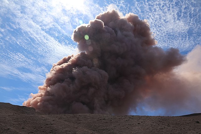
Collapse in the crater of Pu‘u ‘Ō‘ō, creating an ash plume (May 3, 2018)
Eruption in the Leilani Estates subdivision (May 3, 2018)
Lava from a fissure slowly advanced to the northeast on Hoʻokāpu Street in Leilani Estates subdivision (May 5, 2018)
ʻŌhiʻā lehua is the predominant endemic tree found in Puna.